Printed by John Darby, for the Author, and are to be sold at his Shop at the Hermitage in Wapping,
1675 [but c.1685].
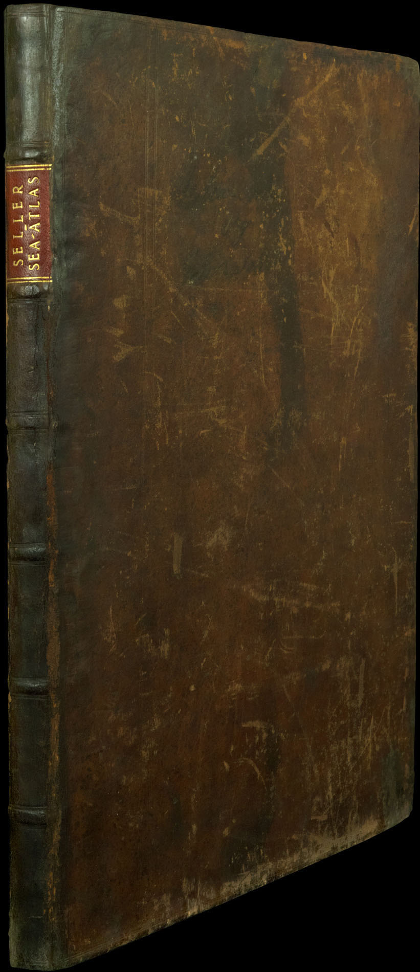
Folio (445 by 280mm), engraved frontispiece incorporating portraits of Sir Francis Drake and Thomas Cavendish, letterpress title, dedication to Charles II, preface leaf, 10pp. text, 20 double-page engraved charts mounted on thick paper, on guards, some light browning, mainly to the margins and at lower centre fold, maps of the world and of Lapland slightly shaved at lower margin, a few small clear tears at folds, contemporary speckled calf, remnants of old label on upper cover worn, upper compartment of spine chipped with loss.
John Seller (1630–1697) was one of the most important individuals in the early history of the atlas trade in England, yet his grand ambition – to rival the great atlas publishing houses of Blaeu, Janssonius, and Goos – would lead to bankruptcy and eventual failure.
Before entering the atlas market, Seller traded in nautical instruments from his shop 'at the Sign of the Mariner's Compass' in Wapping – at the time the heart of the maritime trade. In 1669 he publish...
John Seller (1630–1697) was one of the most important individuals in the early history of the atlas trade in England, yet his grand ambition – to rival the great atlas publishing houses of Blaeu, Janssonius, and Goos – would lead to bankruptcy and eventual failure.
Before entering the atlas market, Seller traded in nautical instruments from his shop 'at the Sign of the Mariner's Compass' in Wapping – at the time the heart of the maritime trade. In 1669 he published 'Paxis Nautica: Practical Navigation', which established his credentials within the maritime community. His place was further strengthened when, in 1671, he was appointed hydrographer to Charles II.
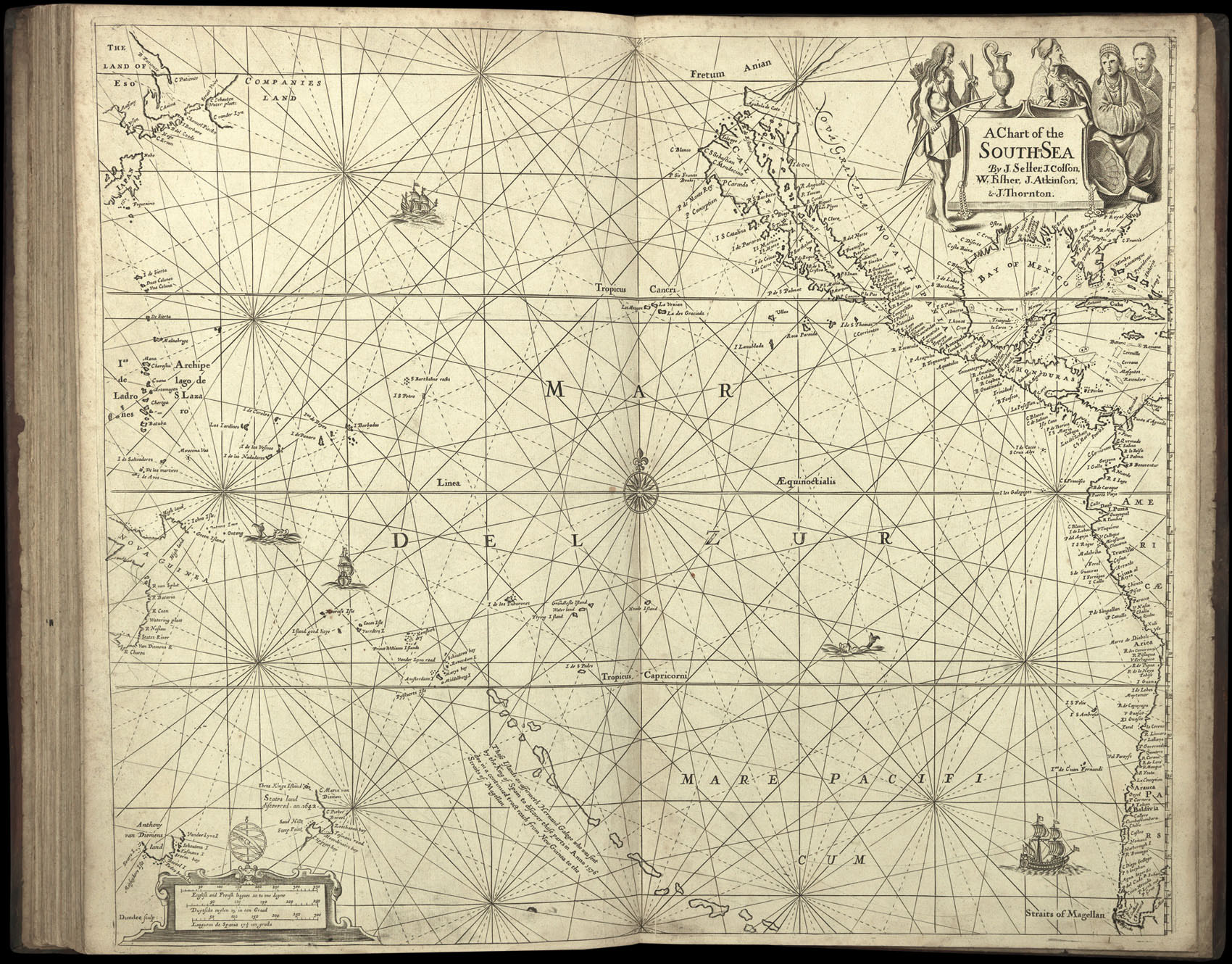
That same year, Seller published his first sea atlas, the 'English Pilot: The First Book', covering the northern navigation. In the following few years, Seller would go on to publish the second, third, and fourth books of the 'English Pilot', covering the Southern, Oriental, and North American navigations; a 'Coasting Pilot' detailing the coasts of Britain the Low Countries; and a sea atlas, the 'Atlas Maritimus'. Although much of their contents were taken from Dutch works by the likes of Goos, Blaeu, and Janssonius, one has to admire Seller's sheer industry. This industry, however, was not allied with enough business acumen, and by 1677 a consortium of map publisher's – most notably William Fisher and John Thornton – had taken over his business. It would seem that the terms of the rescue were quite harsh, as when the consortium broke up in 1679, Fisher kept the publication rights to the 'Atlas Maritimus' and the 'English Pilot the Southern Navigation', and Thornton received some of Seller's plates.
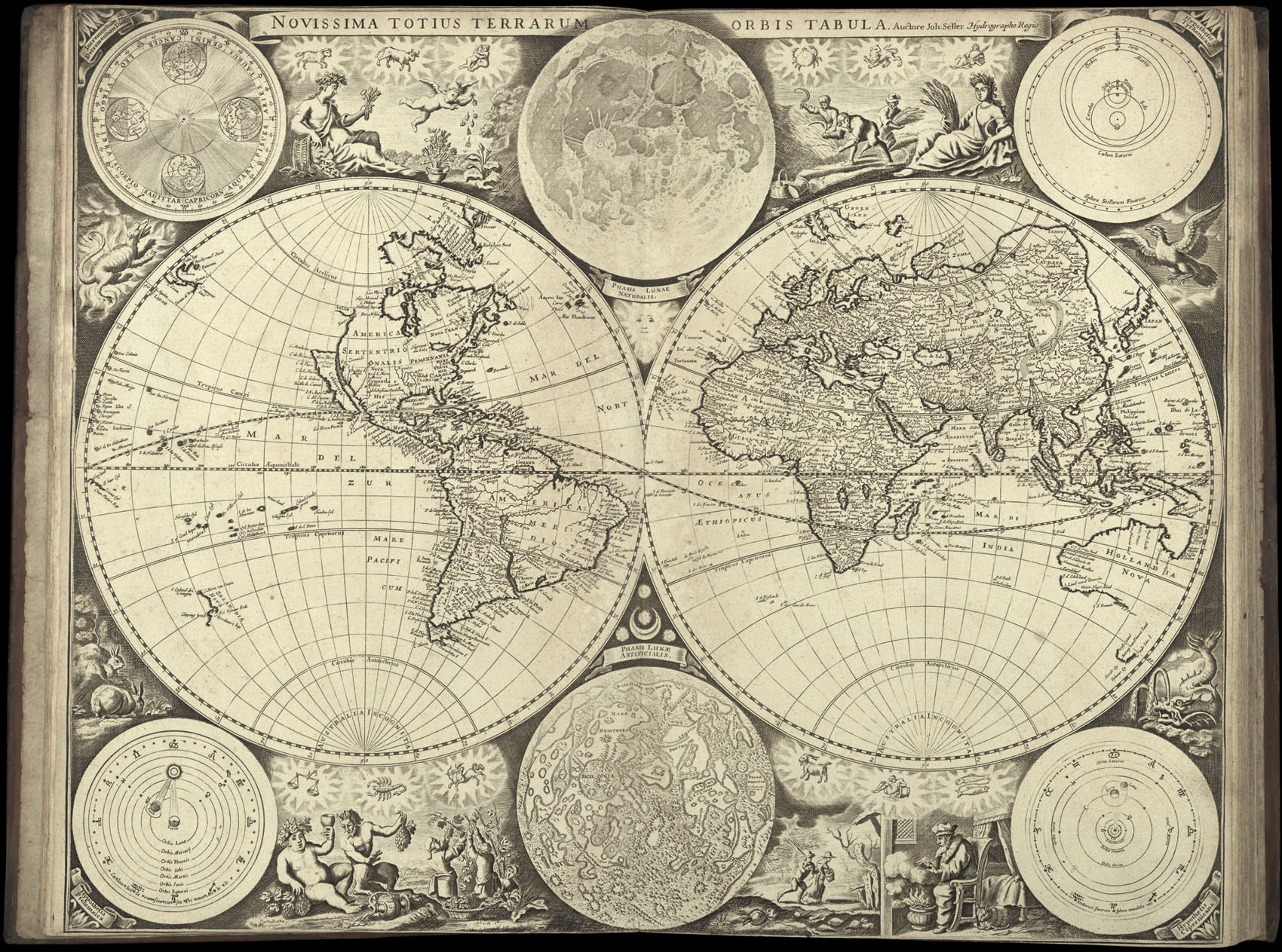
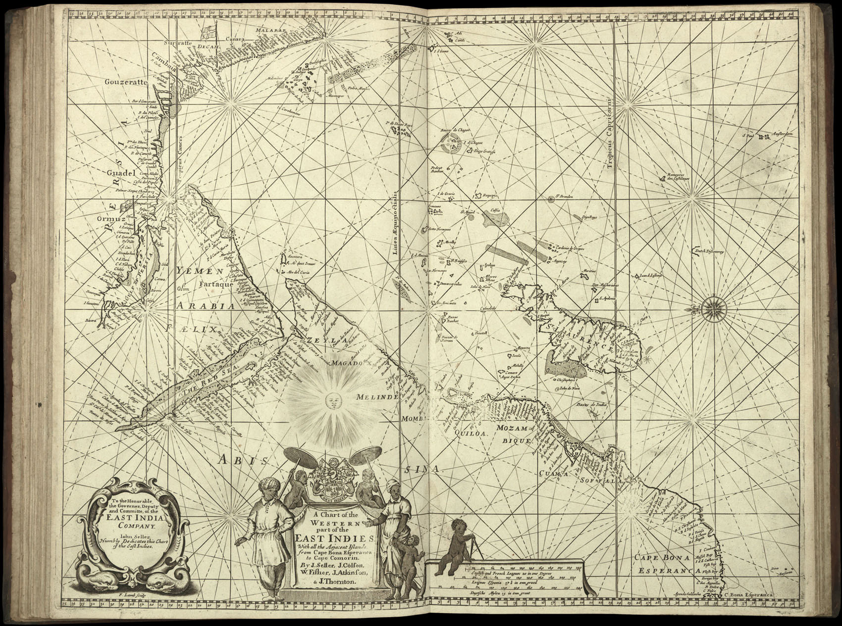
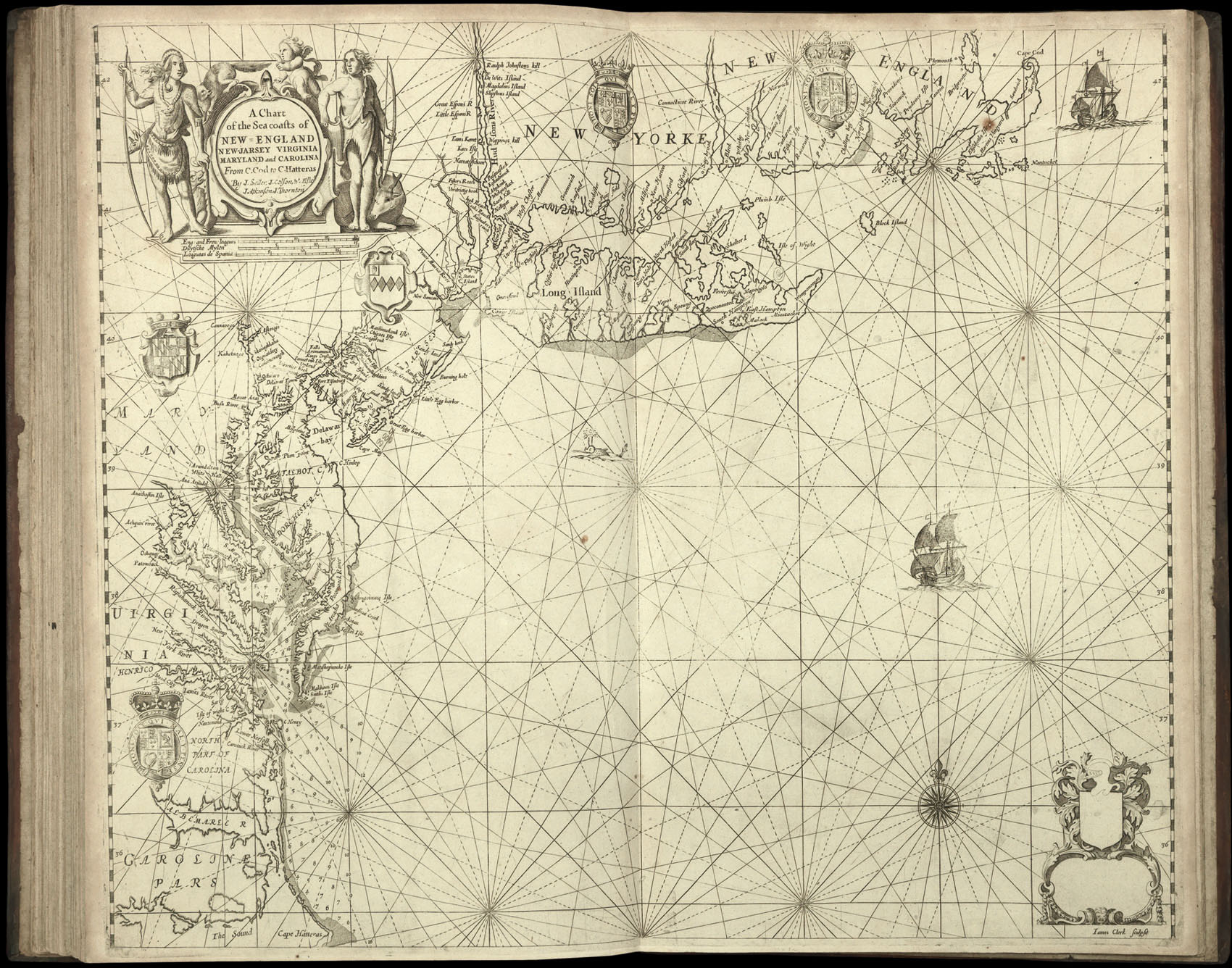
The 'Atlas Maritimus' of 1675 was the first English attempt to challenge the Dutch monopoly in printed sea atlases by the likes of Goos (see item 18), Doncker (see item 15), and Colom (see item 14). Each was made up according to the wishes of the purchaser, and so individual copies can vary considerably. The present atlas contains 20 maps and charts, and can be dated to around 1685, as it would appear to be made up of much of the stock that Seller retained after the breakup of the consortium, supplemented with a few new charts.
Of the five charts that depict North America, two were originally issued separately: the 'Western Ocean According to Mercator's Projection' was based upon Blaeu's seminal 'West Indische Paskaert' (1630), of which Burden records only two other examples; and Seller's beautiful 'Mapp of the Regions & Countreyes under and about the North Pole', a circular chart detailing several voyages of discovery and surrounded by finely wrought depictions of polar bears, Inuits, and whaling.
A full collation is available on request.
bibliography:
bibliography:
Shirley, World, 460; c.f. NMM, 3: 429 for similar atlas containing 20 maps and charts.
provenance:
provenance:
Inscription on front pastedown: "This book of Maritime Charts given to Lieutenant Webb by The Earl of Clarendon 1795".