Published by A. Arrowsmith Hydrographer H.R.H. the Prince of Wales, No. 10 Soho Square,
1815.
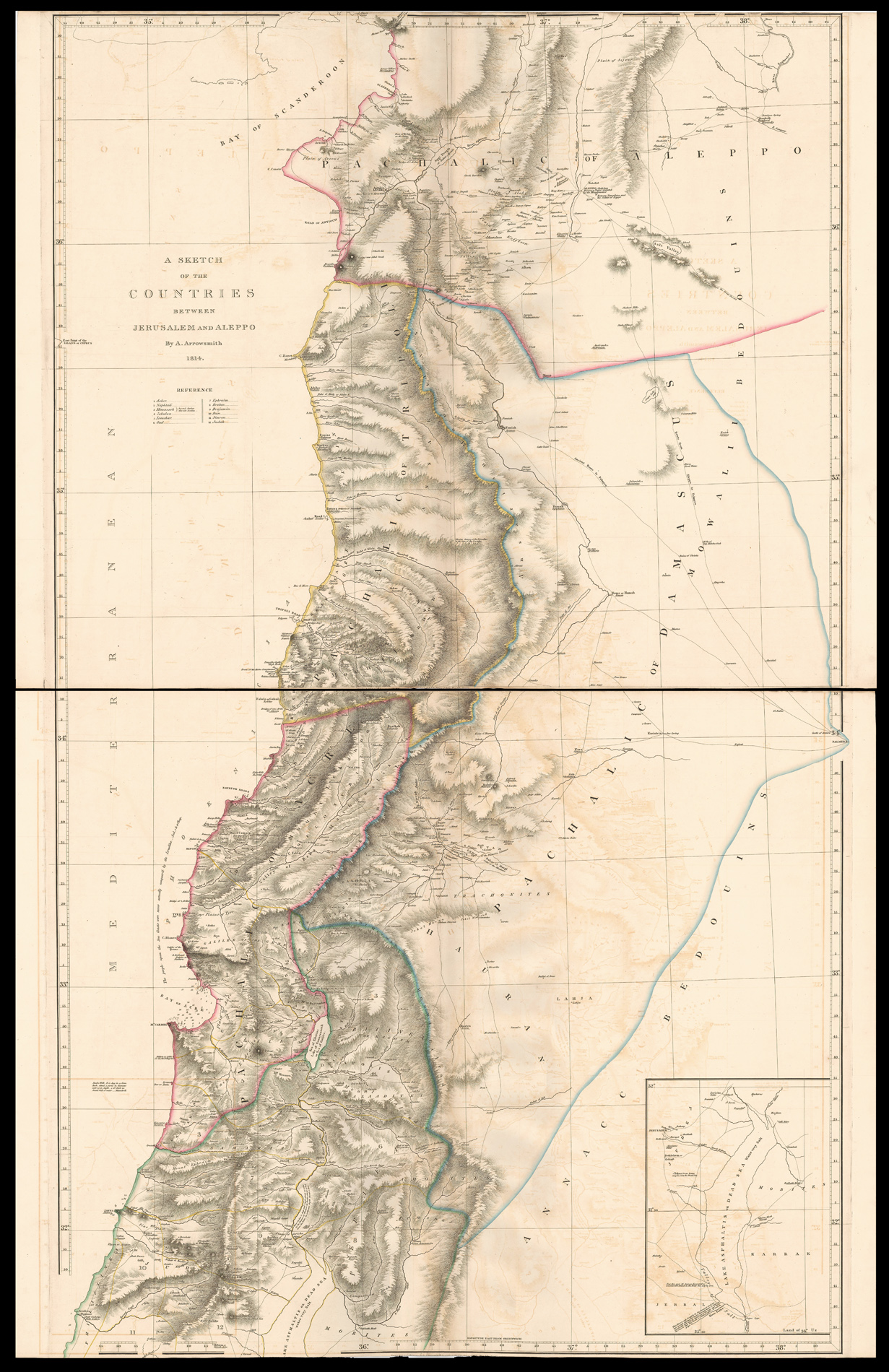
Large engraved map on two sheets, fine outline hand-colour, inset sketch map of the Dead Sea, some minor offsetting, trimmed to upper and lower neatline.
This exceptionally detailed map of the Holy Land not only gives information on the area's Biblical past - the naming of the 12 tribes of Israel, and the location of important sites – but also the contemporary make-up of the area with the demarcation of the Pashalics of Acre, Tripoli, Aleppo, and Damascus.
The title of the map was probably taken from Maundrell's 'A Journey from Aleppo to Jerusalem…'. The wor...
Rare map of the Holy Land, Syria and Lebanon.
This exceptionally detailed map of the Holy Land not only gives information on the area's Biblical past - the naming of the 12 tribes of Israel, and the location of important sites – but also the contemporary make-up of the area with the demarcation of the Pashalics of Acre, Tripoli, Aleppo, and Damascus.
The title of the map was probably taken from Maundrell's 'A Journey from Aleppo to Jerusalem…'. The work was first published in 1703 and would continue to be a hugely popular book well into the nineteenth century. In fact Arrowsmith quotes him: 'Jacob's Well. It is dug in a firm Rock about 3 yards in diameter and 35 in depth, 5 of which we found full of water'. Arrowsmith also draws upon the writings of M. Seetzen whose travels were published in 1809. The most famous passage tells of his journey around the 'Dead Sea', which he under-took alone and dressed as a beggar.
Aaron Arrowsmith (1750-1823) was the finest cartographer of his generation. Although he received little formal education it is believed that he was taught some mathematical instruction by William Emerson, an author of several books on the application of mathematics to the area of cartography. Around 1770, Arrowsmith moved to London to seek employment. It is believed that he worked for William Faden before joining John Cary Sr. in the early 1780s. There he provided the measurements for John Cary's early publication detailing the roads from London to Falmouth, his first signed work. Arrowsmith set up on his own n 1790 and over the next thirty years produced some of the most beautiful and elegant maps of the era.
Rare; we were only able to trace one institutional example, that in the British Library.