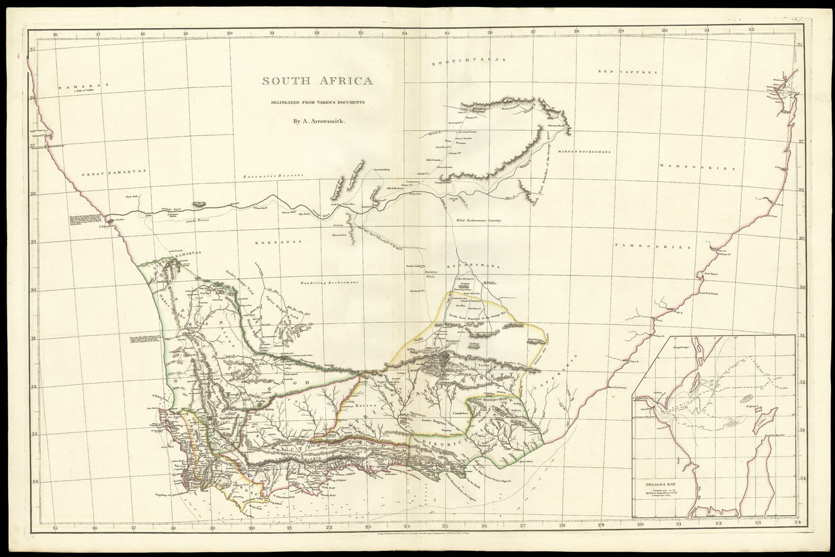
Arrowsmith published the map at around the time that British sovereignty over the Cape Colony was recognized at the Congress of Vienna. The British had been in control of the colony since 1795, when they took over from the Dutch to prevent it from falling into the hands of Napoleonic France; it was briefly relinquished to the Dutch in 1803, before the British regained control in 1806.
The map is based, not surprisingly, up...
Large map of the Cape Colony.
Arrowsmith published the map at around the time that British sovereignty over the Cape Colony was recognized at the Congress of Vienna. The British had been in control of the colony since 1795, when they took over from the Dutch to prevent it from falling into the hands of Napoleonic France; it was briefly relinquished to the Dutch in 1803, before the British regained control in 1806.
The map is based, not surprisingly, upon contemporary Dutch material. Although the British had been in control for the previous 20 years, there had been little interest taken in the colony, beyond its use as an important strategic port from which to base operations during the Napoleonic wars. Wholly British maps of the Cape and South Africa would not be published for another 19 years, most notably by Aaron's son Samuel, with his 'Map of the Cape of Good Hope' in 1834 and S.D.U.K.'s map of South Africa in the same year.
Aaron Arrowsmith (1750-1823), "easily the foremost cartographer of his time" (R.V. Tooley), was the founder of the Arrowsmith dynasty of cartographers. Born in County Durham, he was in London by 1777 when he witnessed the will of Andrew Dury, a mapseller and publisher, and was probably training with him; he may have trained with William Faden, Geographer to the King, but was certainly employed by John Cary in 1782, as he is credited with the survey work for 'Cary's Actual Survey, of the Great Post Roads between London and Falmouth', published in 1784; he is frequently credited with some of the survey work for Cary's county atlas, 'Cary's New and Correct English Atlas: being a set of county maps from actual surveys' (1787), but the sources are silent on this and by this time Arrowsmith had established his own business.
Arrowmsith's maps set a new standard; he was assiduous in analysing and verifying his sources, discarding not only the fictional but also the uncertain, going to printed and manuscript sources for his information, and engraved in a clear and highly legible style. Arrowsmith was also diligent in revising and improving his maps to keep them current, and served as an inspiration for the next generation of (particularly American) surveyors.