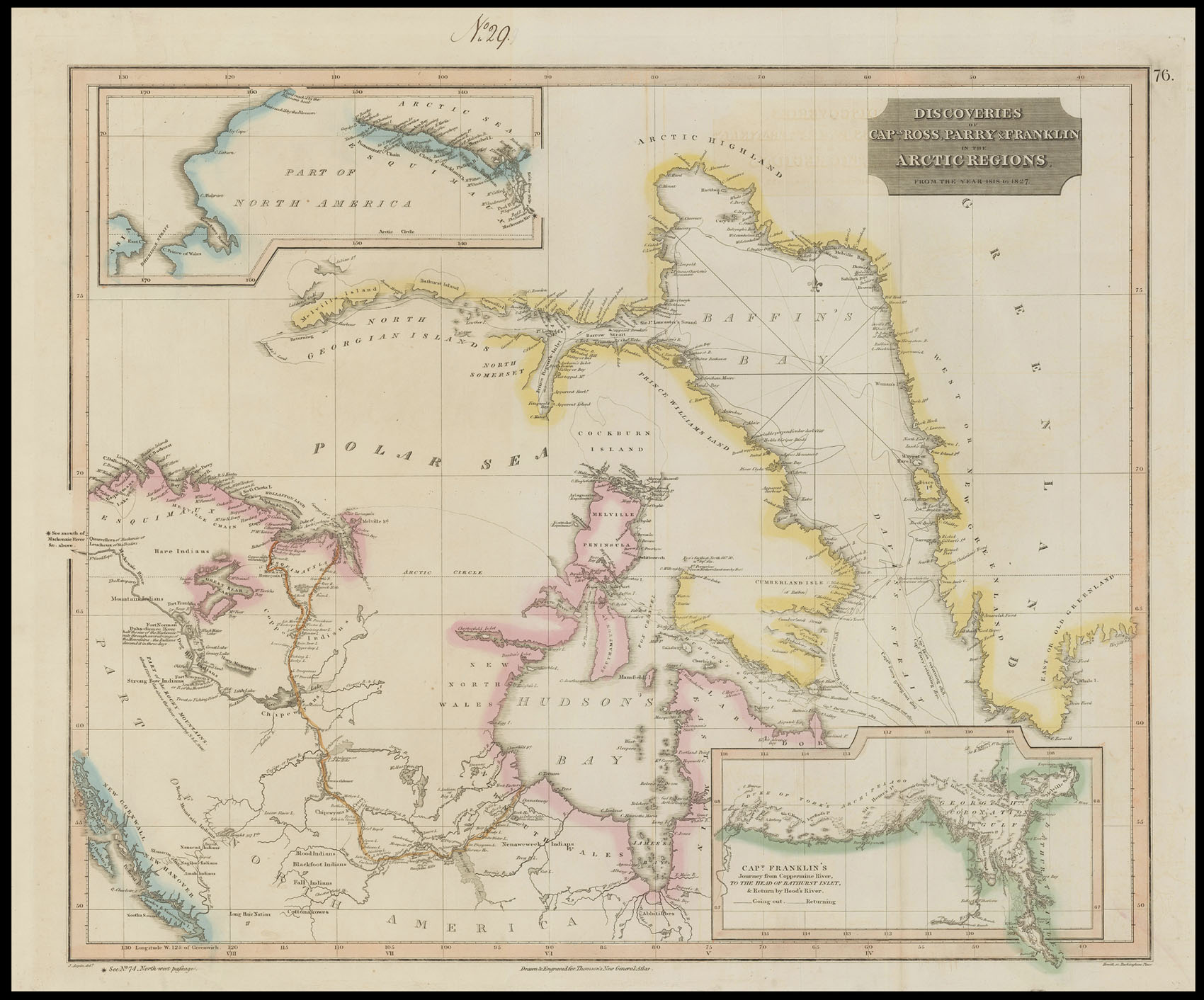
Engraved map, inset map of Alaska and the Bering Straits, and Captain Franklin's Journey from Coppermine River to the head of Bathurst Inlet, fine original outline hand-colour.
Large and detailed map of Hudson's Bay and Baffin's Bay, published by John Thomson for his 'New General Atlas'. John Thomson (1777-1837) was a Scottish cartographer and publisher, active in Edinburgh. He published several editions of the 'New General Atlas' from 1814 to 1821.
...
Large and detailed map of Hudson's Bay and Baffin's Bay, published by John Thomson for his 'New General Atlas'. John Thomson (1777-1837) was a Scottish cartographer and publisher, active in Edinburgh. He published several editions of the 'New General Atlas' from 1814 to 1821.