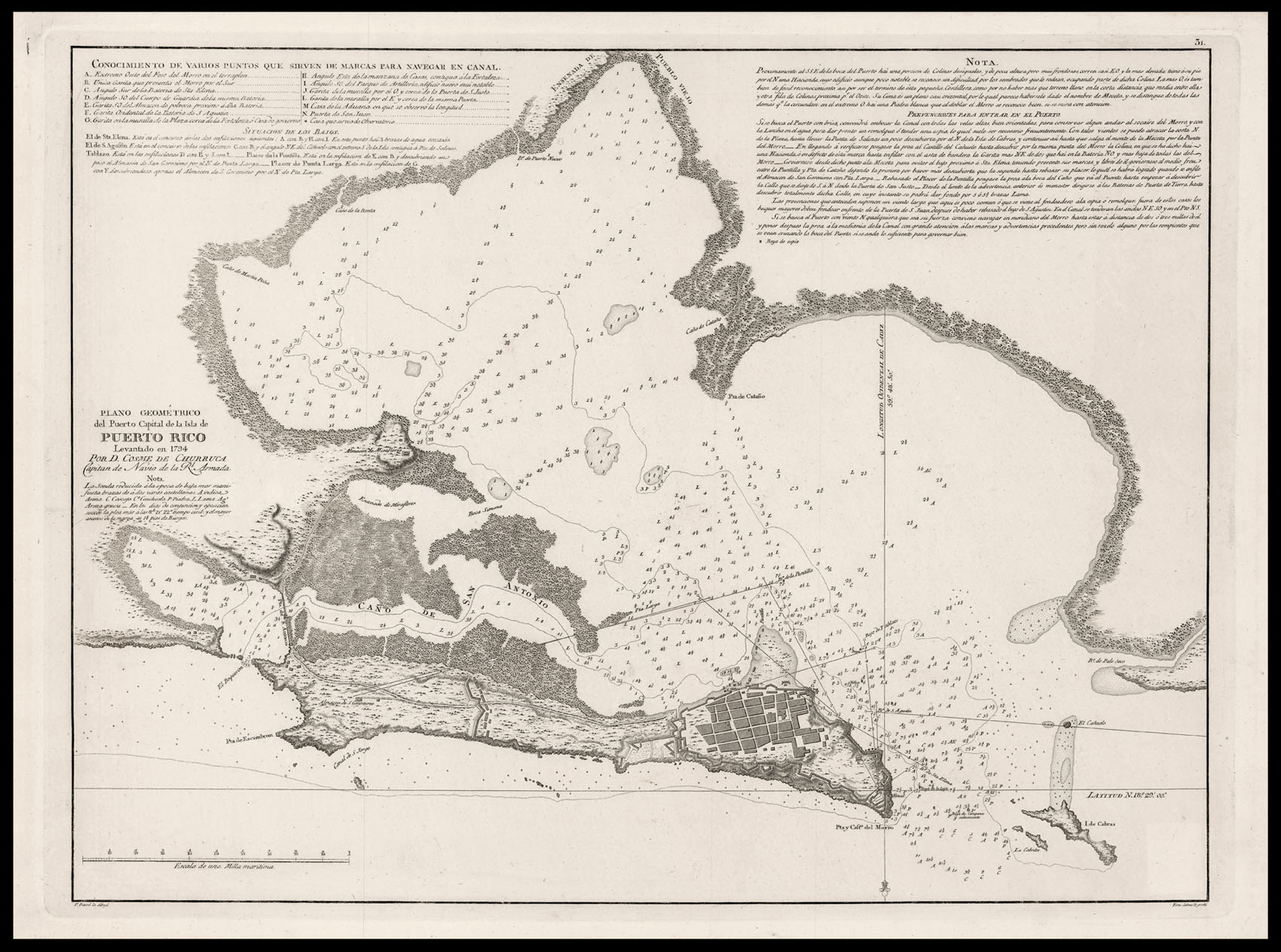
A detailed Spanish sea chart of the Bay of San Juan, orientated with north to the bottom. Care is given to the defences of Fort San Felipe del Morro, at the mouth of the harbour.
...
A detailed Spanish sea chart of the Bay of San Juan, orientated with north to the bottom. Care is given to the defences of Fort San Felipe del Morro, at the mouth of the harbour.