Hand-coloured engraved folding map, 'Drawn and Engraved by H. Martin, 8 Dyers Buildings, Holborn'; a few old tears but generally an attractive map, together with the booklet of 22, [14] with an inserted outline map of "exhibition Chief Objects of Interest in London"; folding into original cloth boards, the upper cover with a green printed label 'The Exhibition Map of London and Visitors Guide. price 1s 6d Colored.'
An attractive map and guide to London produced for visitors during the Great Exhibition.
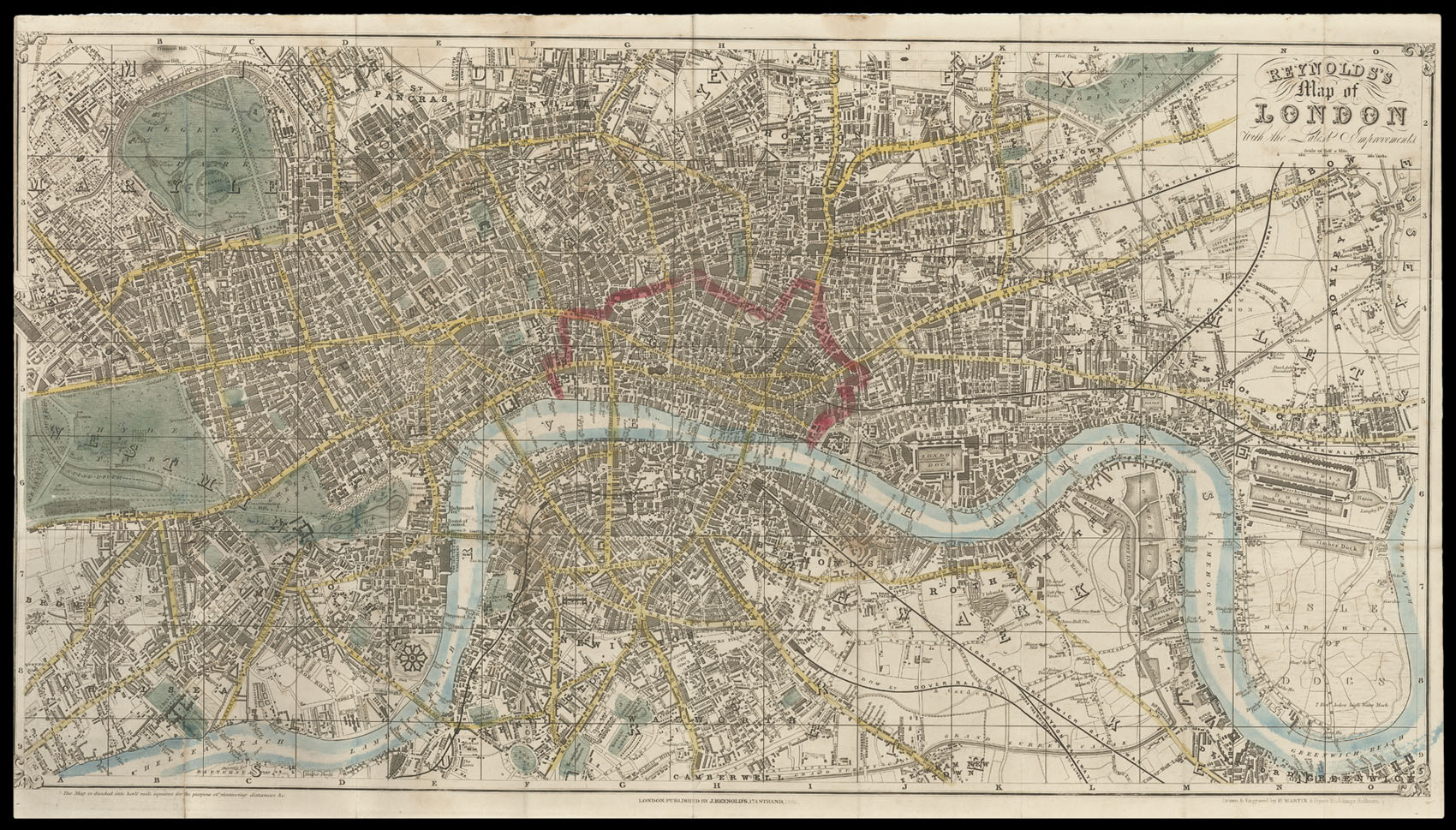
The plan shows the Crystal Palace, which occupies a large part of the southern portion of Hyde Park. Railways and are clearly marked in black with main roads coloured yellow, open spaces in green, and the City of London outlined in red. A booklet accompanies the map, which contains a great deal of information for the 'Stranger' to London. It advises him that he must be "vigil...
An attractive map and guide to London produced for visitors during the Great Exhibition.
The plan shows the Crystal Palace, which occupies a large part of the southern portion of Hyde Park. Railways and are clearly marked in black with main roads coloured yellow, open spaces in green, and the City of London outlined in red. A booklet accompanies the map, which contains a great deal of information for the 'Stranger' to London. It advises him that he must be "vigilant and circumspect... lest he become the prey of some of the swarms of knaves". After frightening the poor tourist half to death, the guide goes on to list the various amusements and sights the city has to offer. Most notable among its attractions is the Great Exhibition, which if one wishes to go to the opening day will cost a gentleman £3 3s and a lady £2 2s.