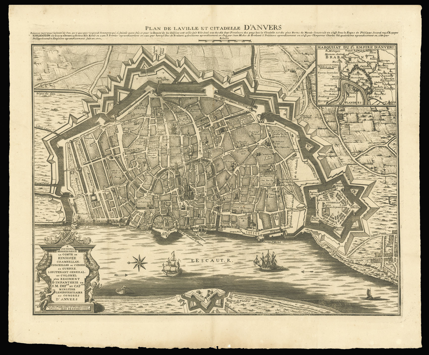
The map shows the city of Antwerp surrounded by its fortifications. On the right is the citadel, with each of the bastions labelled. The plan indicates the city's major buildings including churches, houses, forts, as well as the names of the roads and squares. Below the title is a description praising the city's importance in commerce and its beautiful buildings. A key explaining the city's division in five 'agrondissements' is also included.
The map was first p...
The map shows the city of Antwerp surrounded by its fortifications. On the right is the citadel, with each of the bastions labelled. The plan indicates the city's major buildings including churches, houses, forts, as well as the names of the roads and squares. Below the title is a description praising the city's importance in commerce and its beautiful buildings. A key explaining the city's division in five 'agrondissements' is also included.
The map was first published by Gaspard Bailleul in 1708 and it was based on an earlier map by Verbiest.