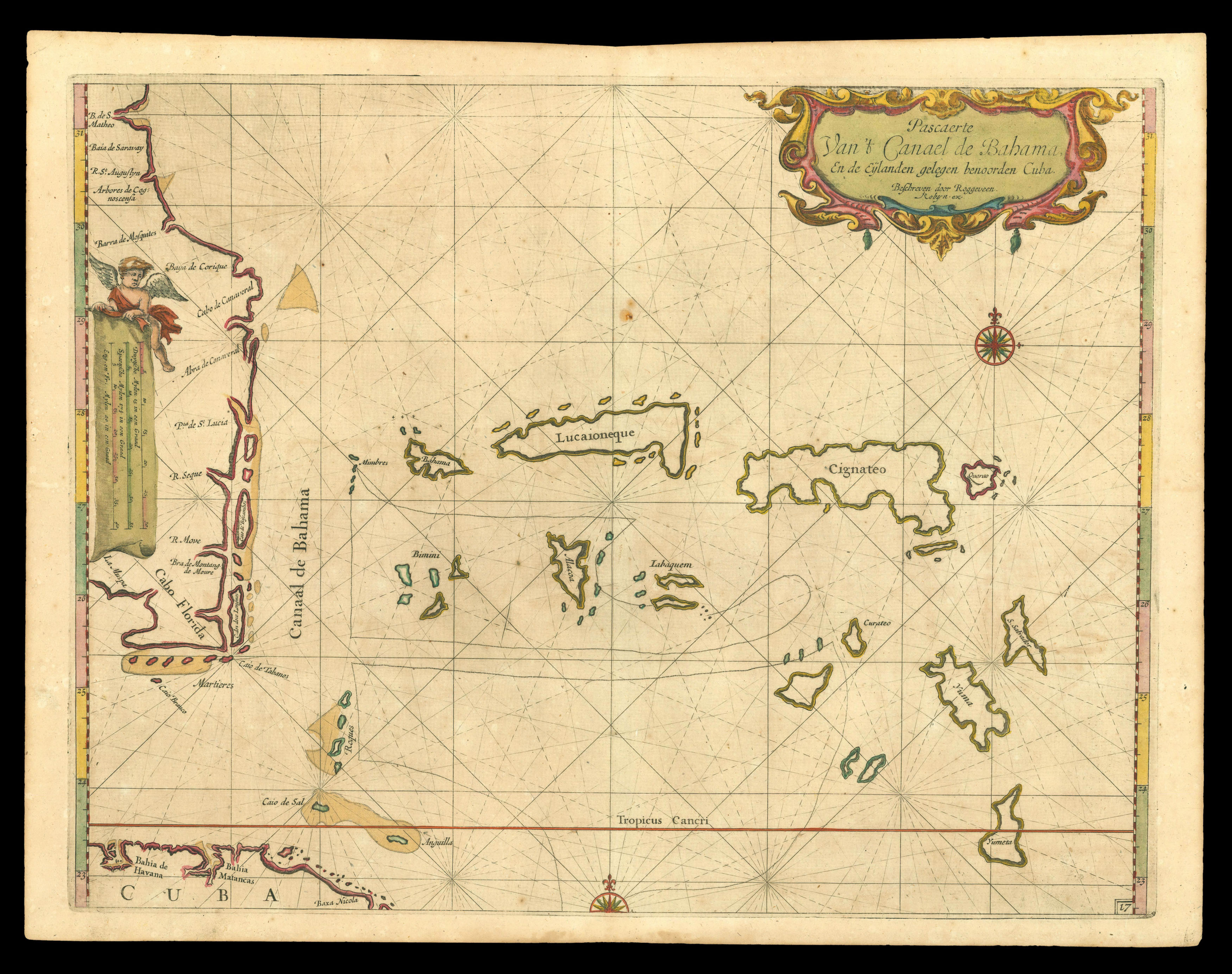
The first large-scale Dutch sea chart of the Bahamas and Florida's east coast - published in Roggeveen's exceedingly rare sea pilot 'Het Brandende Veen'.
"One of the most important of Roggeveen's charts, and the first Dutch one of the region. Through these waters passed the majority of Spain's wealth from the New World. Its publication provided a hugely increased scale on all prior documents. It depicts the east coast of Florida from st Augustine southwards, and ...
The first large-scale Dutch sea chart of the Bahamas and Florida's east coast - published in Roggeveen's exceedingly rare sea pilot 'Het Brandende Veen'.
"One of the most important of Roggeveen's charts, and the first Dutch one of the region. Through these waters passed the majority of Spain's wealth from the New World. Its publication provided a hugely increased scale on all prior documents. It depicts the east coast of Florida from st Augustine southwards, and all of the Bahamas." (Burden)
Roggeveen, born in Delshaven, came to Middleburg, the seat of both the Dutch East and West India Companies, in 1658. He worked for both companies teaching the art of navigation and helped to maintain their collections of hydrographic manuscripts and charts, including Spanish portolans of the West Indies. In the mid-1660s, assisted by his access to these collections, Roggeveen embarked upon compiling a series of large-scale charts of the North American coastline, West Indies, and, later, West Africa. Many of his charts are based upon the earlier large-scale work of Hessel Gerritsz and Joan Vingboons, both cartographers for the Dutch East and West India Companies, but Roggeveen's work was the first to show the whole coastline of North America and the Caribbean. He called this pilot 'Het Brandende Veen' or 'The Burning Fen'; a pun on his name, as 'veen' means 'fen', and a heap of burning fen represents a fire on the coast to guide or warn ships.
The first edition of the atlas was published in 1675 by Pieter Goos, however, due to the death of Goos in the same year, and that of Roggeveen four years later, a second edition would not be published until 1680, by which time the plates had been acquired by the chart dealer Jacobus Robijn. Robijn went on to republish the second edition in 1689, with a third edition appearing in 1698.