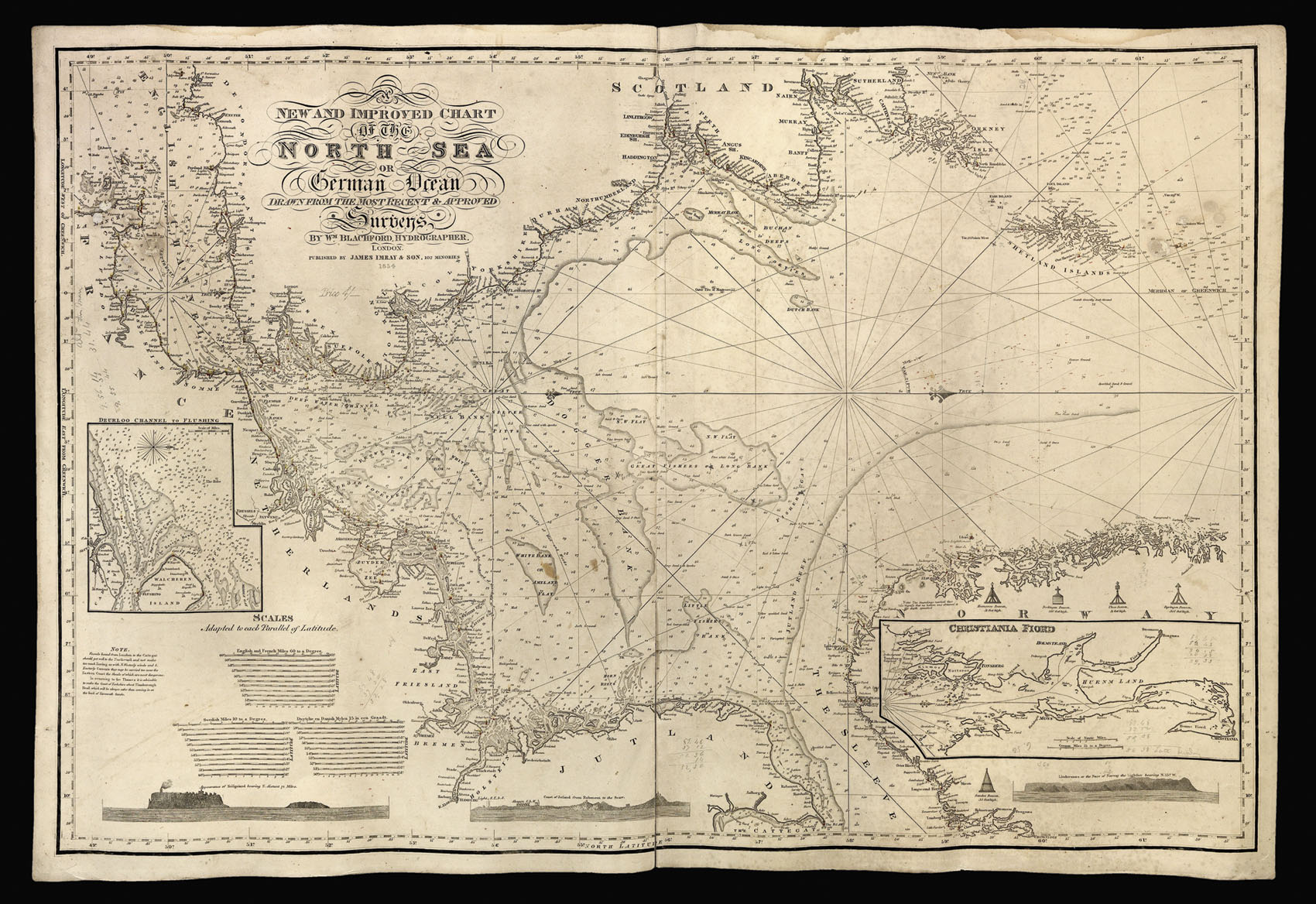
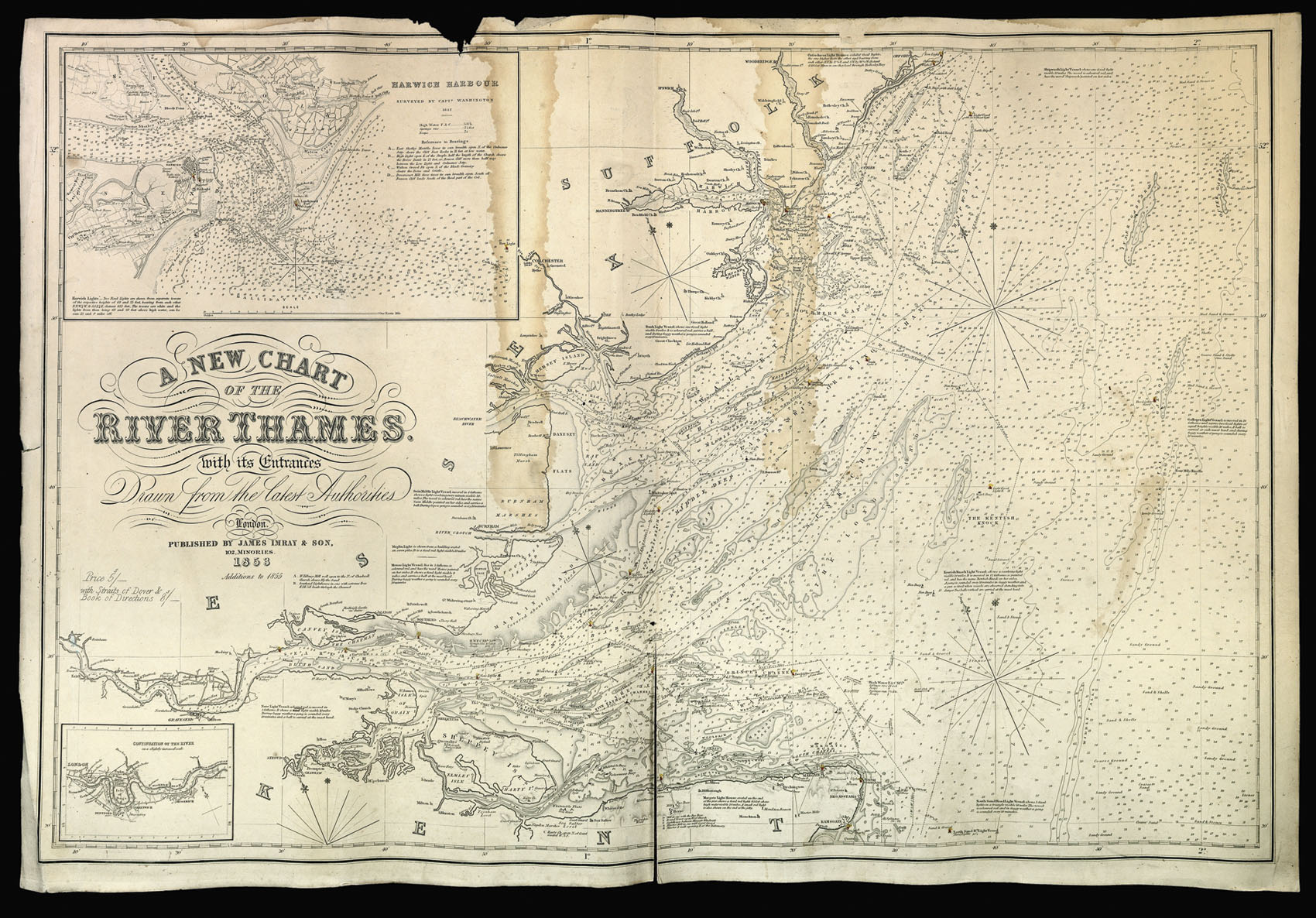
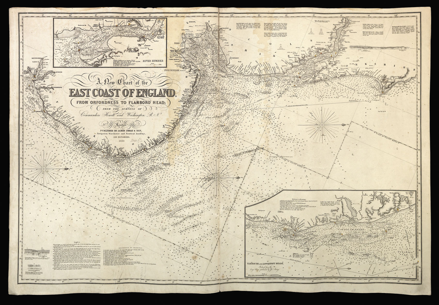
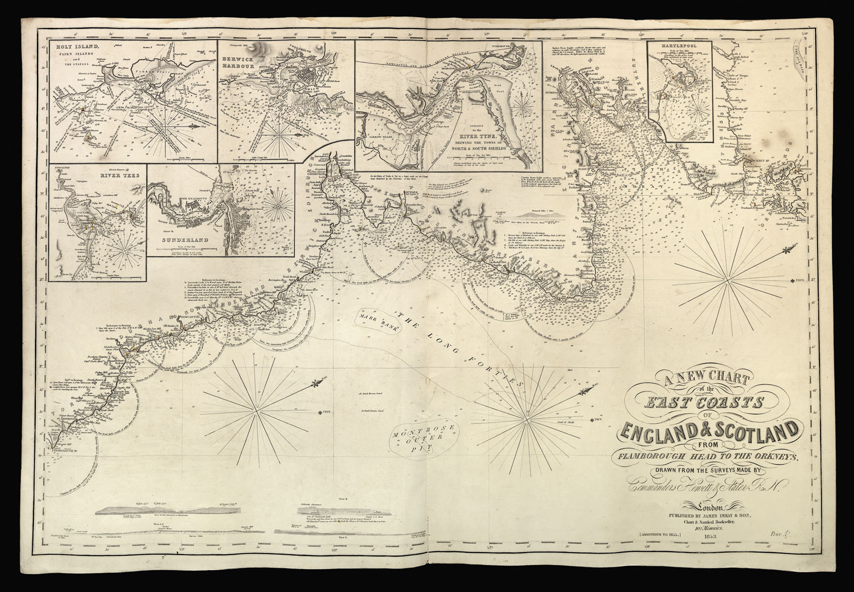
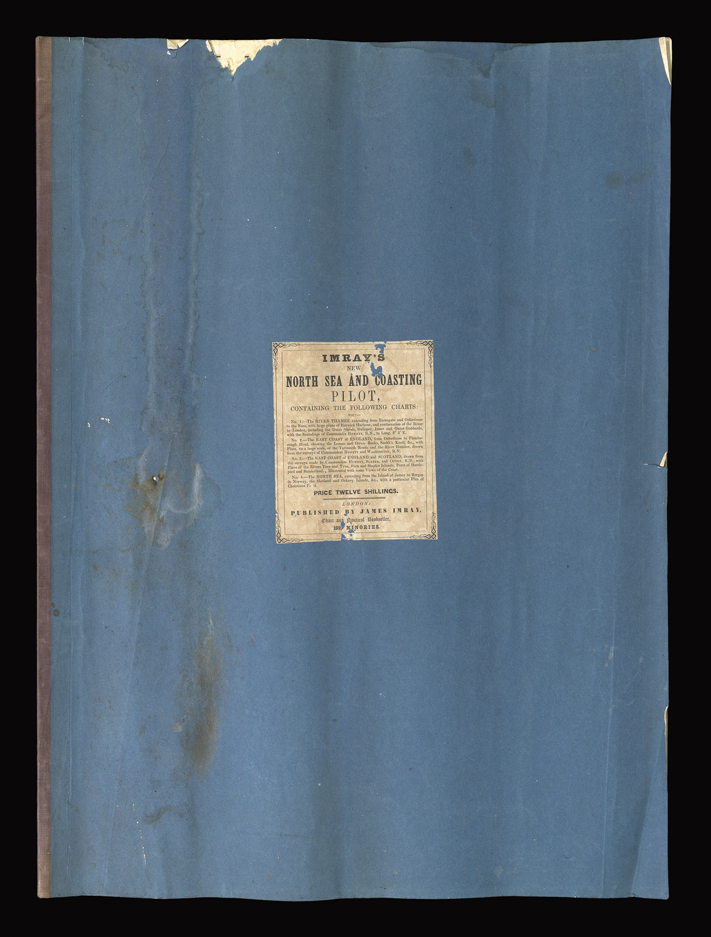
containing the following charts: viz:- No. 1. - The River Thames...; No. 2. - The East Coast of England...; No. 3. - The East Coast of England and Scotland...; No. 4. The North Sea...
Published by James Imray, Chart and Nautical Bookseller, 102, Minories,
[1855].
Large folio (690 by 500mm), title pasted to upper cover, four charts with recto pasted to the following chart's verso, to form an atlas, first and last chart backed in blue paper, some damp-staining and minor loss to upper left of first chart.
Rare bound set of charts for the East coast of England, and Scotland, and the North Sea.
By the mid nineteenth century the sea trade between London and ports such as Hull and Newcastle had grown dramatically with tonnage of shipping entering and exiting the port of Hull quadrupling between 1766 and 1832. The bulk of Hull's foreign trade was with the Baltic states with the number of vessels involved in the trade tripling between 1790 and 1830. Such huge growth led...
Rare bound set of charts for the East coast of England, and Scotland, and the North Sea.
By the mid nineteenth century the sea trade between London and ports such as Hull and Newcastle had grown dramatically with tonnage of shipping entering and exiting the port of Hull quadrupling between 1766 and 1832. The bulk of Hull's foreign trade was with the Baltic states with the number of vessels involved in the trade tripling between 1790 and 1830. Such huge growth led to demand for accurate and reliable charts.
It is highly unusual to find a set of blue-backed charts bound in such a fashion as to form a pilot. The majority of examples having been individual rolled to aid storage aboard the vessel. As stated in the pasted on title, the set of charts were intended not only as a coasting pilot to England's east coast but also as a pilot for the North Sea in order to aid Britain's trade with the Baltic states.
James Imray (1803-1870), worked originally in the stationery and account book publishing business. In 1836 Imray joined with Michael Blachford. The partnership flourished and soon began to compete with the larger firm of Norie and Wilson. In 1846 Imray bought out Blachford, and the company survived, led by his descendants, into the twentieth century, when it merged with Norie and Wilson.