Wallis first published a game of this nature in 1796 (see Whitehouse facing p.7 for an illustration), by the 1820's a number of new discoveries had been incorporated together with other refinements made to the game itself.
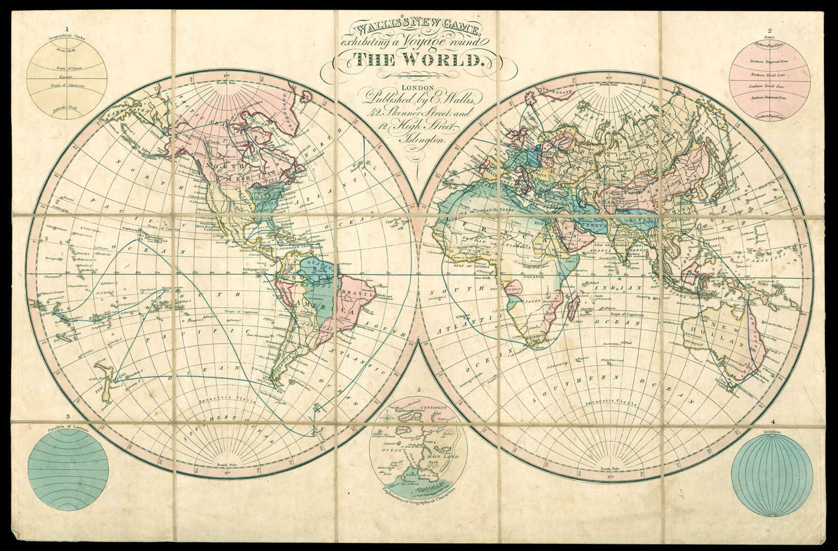
The sheet contains the world in two conjoined hemispheres with 5 additional hemispheres around the outside consisting of 'Geographical Circles,' 'Zones, ' 'Parallels of Latitude,' 'Meridians,' and an 'Explanation of Geographical Characters.' T...
Wallis first published a game of this nature in 1796 (see Whitehouse facing p.7 for an illustration), by the 1820's a number of new discoveries had been incorporated together with other refinements made to the game itself.
The sheet contains the world in two conjoined hemispheres with 5 additional hemispheres around the outside consisting of 'Geographical Circles,' 'Zones, ' 'Parallels of Latitude,' 'Meridians,' and an 'Explanation of Geographical Characters.' The players circumnavigate the world traveling east around Africa, through India, 'New Holland' then north to China and Japan, then south through North and South America, west to New Zealand the Pacific Islands before crossing back to the South Atlantic and returning to port in London.