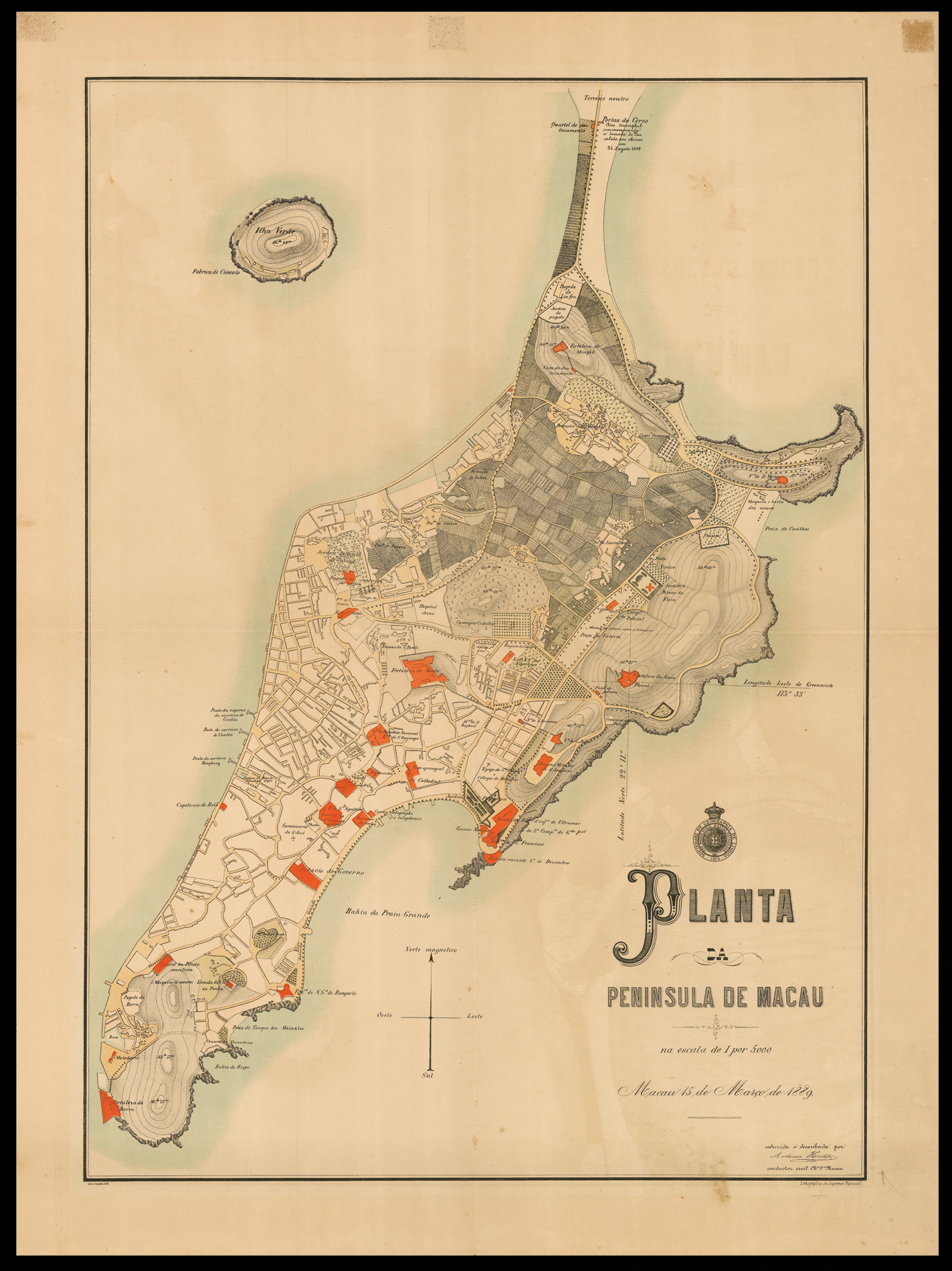
Large and very detailed plan of Macau in the late nineteenth century.
The map was published two years after the Sino-Portuguese Treaty of Peking following the Opium Wars, when China recognised Portugal's claim to the city, which served as a stopping point in the opium route. Military buildings, churches and schools are highlighted in red; all streets are shown and most are named. The north-east corner of the island was untouched at this point, prior to the exten...
Large and very detailed plan of Macau in the late nineteenth century.
The map was published two years after the Sino-Portuguese Treaty of Peking following the Opium Wars, when China recognised Portugal's claim to the city, which served as a stopping point in the opium route. Military buildings, churches and schools are highlighted in red; all streets are shown and most are named. The north-east corner of the island was untouched at this point, prior to the extensive process of land reclamation which allowed the redevelopment of the island in the mid-twentieth century.
Above the title is the insigna for the Lisbon Geography Society and below is the signature of Antonio Heiter, the civil engineer of public works who designed the plan. The National Press in Lisbon published plans of all their colonies as these did not have the latest machinery.
Rare, we are only able to trace two institutional examples, one at the Library of Congress and the other at the National Library of Australia.