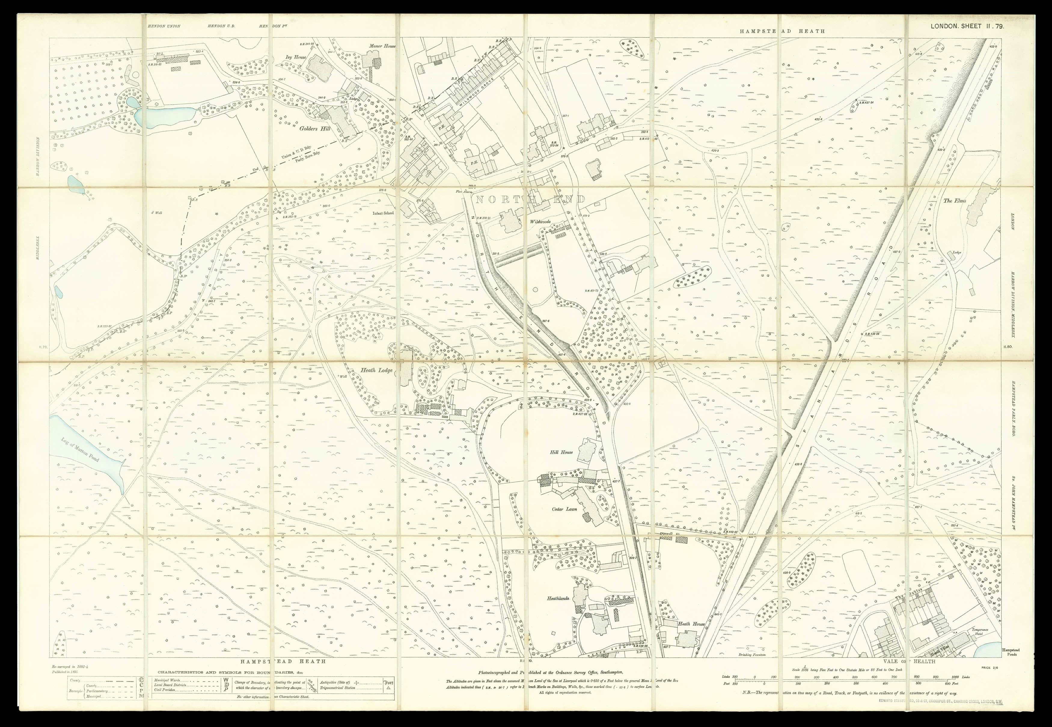
A map of Hampstead taken from OS London Middlesex, sheet II.79. It shows North End, an area bordering both Golders Hill Park and Hampstead Heath. The Heath had become an important public asset for Londoners over the preceding decades. The advent of the Hampstead Junction Railway in 1860 made the area more accessible from central London, and the Heath provided a much needed open space for inhabitants of the East End. In the year this map was published, the Bank Holidays Act ...
A map of Hampstead taken from OS London Middlesex, sheet II.79. It shows North End, an area bordering both Golders Hill Park and Hampstead Heath. The Heath had become an important public asset for Londoners over the preceding decades. The advent of the Hampstead Junction Railway in 1860 made the area more accessible from central London, and the Heath provided a much needed open space for inhabitants of the East End. In the year this map was published, the Bank Holidays Act was passed and several other London fairs were closed down, which only increased the area's popularity. Two years before this map was made, permission had been granted for the construction of the Charing Cross, Euston and Hampstead Railway, which would result in a station being built at North End but never used for its original purpose. It was later used in World War II to store classified material.
The Board of Ordnance, established in Tudor times, was officially custodian of all lands and installations necessary for the defence of the realm. Inspired by the lessons of the Jacobite uprising of 1745, the government ordered the Board of Ordnance to begin a survey of Scotland, and also of England's vulnerable southern coastlines.
Starting in 1747, William Roy and his surveyors, took eight years to complete what was known as the "Great Map", of Scotland, but his ambition was to create a large-scale accurate map of the whole of Britain. In order to put this plan into action the Board of Ordnance bought a new and improved Ramsden theodolite, and on the 21st of June, 1791, the Ordnance Survey was born.
The first Ordnance Survey map was published in 1801, of Kent, the area deemed most vulnerable to French invasion. The entire first series of maps wasn't published until 1870.
Rare: only two institutional examples recorded, at the NLS and the LoC