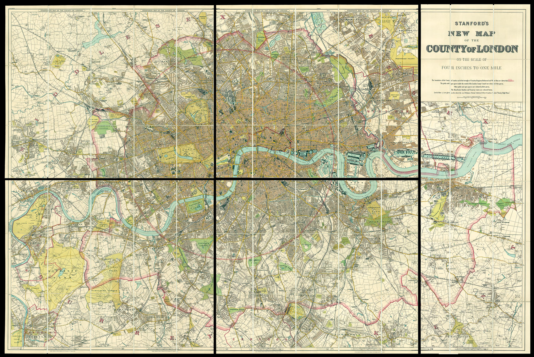
A fine example of Stanford's map of London, mounted here as five sheets instead of twenty as sold.
Edward Stanford (1827-1904) was a highly successful publisher, known for his accurate maps of London. He began his career working for Trelawny Saunders, an enterprising mapmaker who supplied a daily weather chart for the Great Exhibition. Stanford started his own business in 1853, was elected a fellow of the Royal Geographical Society the following year and set abo...
A fine example of Stanford's map of London, mounted here as five sheets instead of twenty as sold.
Edward Stanford (1827-1904) was a highly successful publisher, known for his accurate maps of London. He began his career working for Trelawny Saunders, an enterprising mapmaker who supplied a daily weather chart for the Great Exhibition. Stanford started his own business in 1853, was elected a fellow of the Royal Geographical Society the following year and set about expanding the cartographical aspect of the firm.