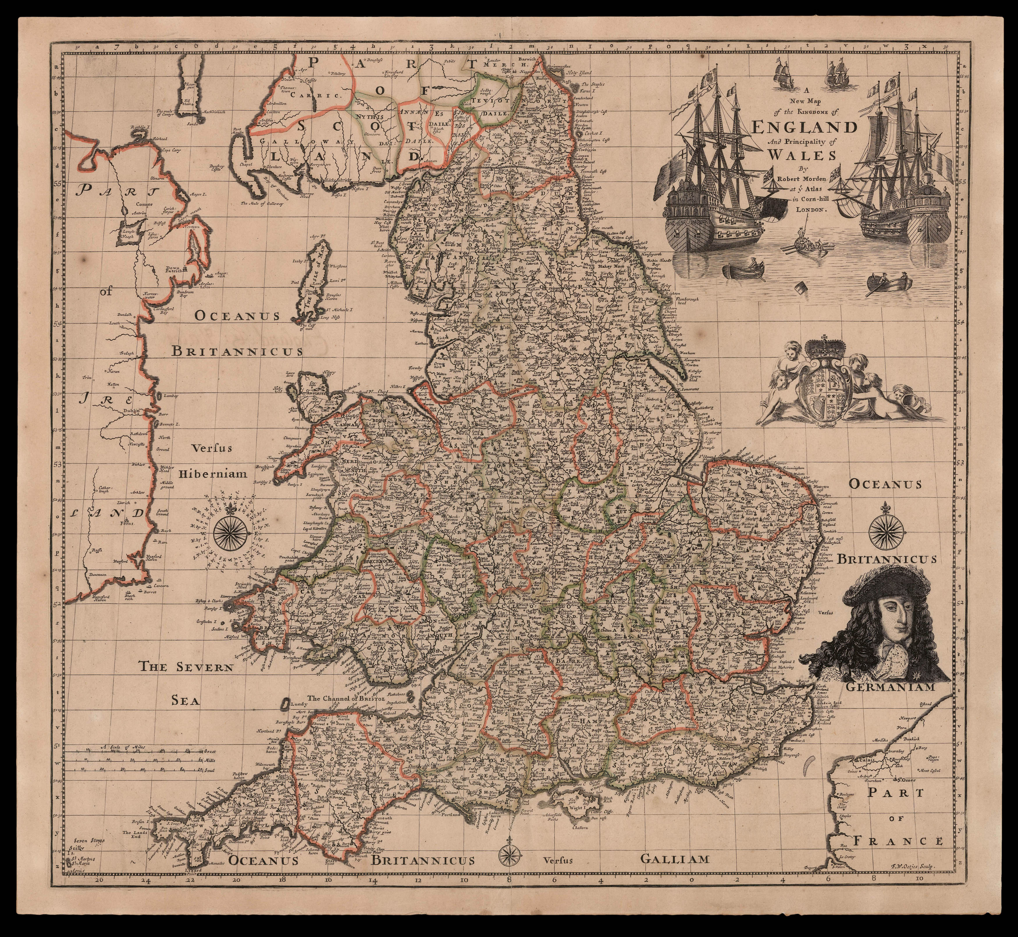
Rare separately issued map of England and Wales by Robert Morden.
To the upper right the title is flanked by by two large ships and several smaller vessels, below is the Stuart coat of arms, together with a striking portrait. It has been suggested that the image is of King William III (William of Orange) who ascended to the throne in 1688, as part of The Glorious Revolution.
Although the map is not dated it bears the name of the engraver F. W. Oetjes (...
Rare separately issued map of England and Wales by Robert Morden.
To the upper right the title is flanked by by two large ships and several smaller vessels, below is the Stuart coat of arms, together with a striking portrait. It has been suggested that the image is of King William III (William of Orange) who ascended to the throne in 1688, as part of The Glorious Revolution.
Although the map is not dated it bears the name of the engraver F. W. Oetjes (fl. 1690-1693); who is known to have been active in London around the beginning of the 1690s; probably of Dutch nationality he is known to have engraved maps of Robert Morden, Christopher Browne, and charts for Greenville Collins 'Great Britain Coasting Pilot' (1693)
Robert Morden (c.1650-1703) was a leading English mapmaker from the last quarter of the eighteenth century; his place and date of birth are not known, but it is thought he came from the north of England, perhaps the West Riding of Yorkshire. He was probably apprenticed to Joseph Moxon, who was born in Wakefield, Yorkshire, in the Weavers' Company, and made free by about 1666.
Rare we are only able to trace three institutional examples: the Bodleian, the British Library, and the National Library of Scotland.