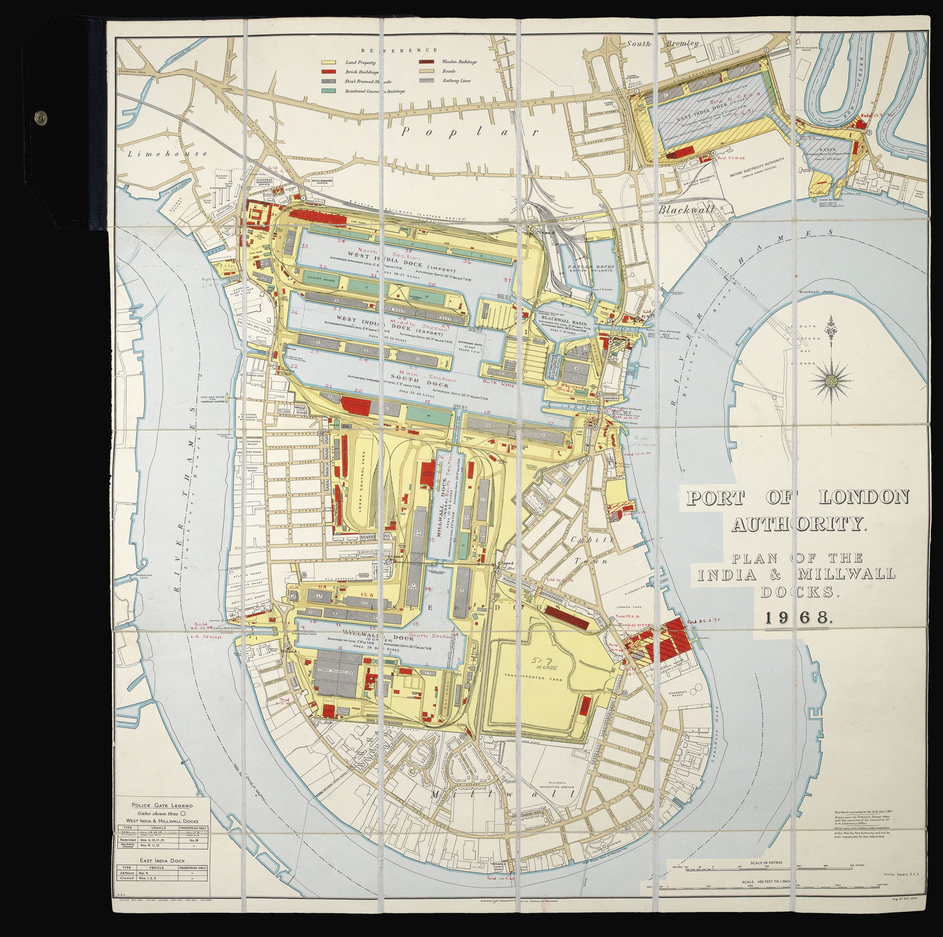
The West and East India Docks were opened in 1802 and 1803 respectively, after lobbying by merchants and shipowners. The trade with the West and East Indies was seasonal, and it was imperative that cargoes were transferred quickly. Congestion in the Port of London meant that was not the case. They closed in 1980 and 1967 - the process is visible here, as the basin next to the East India Dock has already been filled in, and the chemical and metal works around wharves of the ...
The West and East India Docks were opened in 1802 and 1803 respectively, after lobbying by merchants and shipowners. The trade with the West and East Indies was seasonal, and it was imperative that cargoes were transferred quickly. Congestion in the Port of London meant that was not the case. They closed in 1980 and 1967 - the process is visible here, as the basin next to the East India Dock has already been filled in, and the chemical and metal works around wharves of the Millwall Docks are no longer present.
Millwall Dock was built in 1868. The waste from the construction of the dock formed an area of wasteland known as Mudchute, now a park; in this map only Millwall Park below it is shown.
The Port of London Authority was formed in 1909. It was prompted by a series of industrial actions by dock workers, including their demand for the 'Docker's Tanner', a wage of 6d. an hour, in 1889. The Port was a vital part of the British economy: refining and processing industries grew up around goods brought in to the docks and it was the centre of British shipbuilding and repair. The PLA continues to supervise and manage the Port of London, the docks, and the London stretch of the River Thames. This map was issued from the former PLA headquarters in Trinity Square.