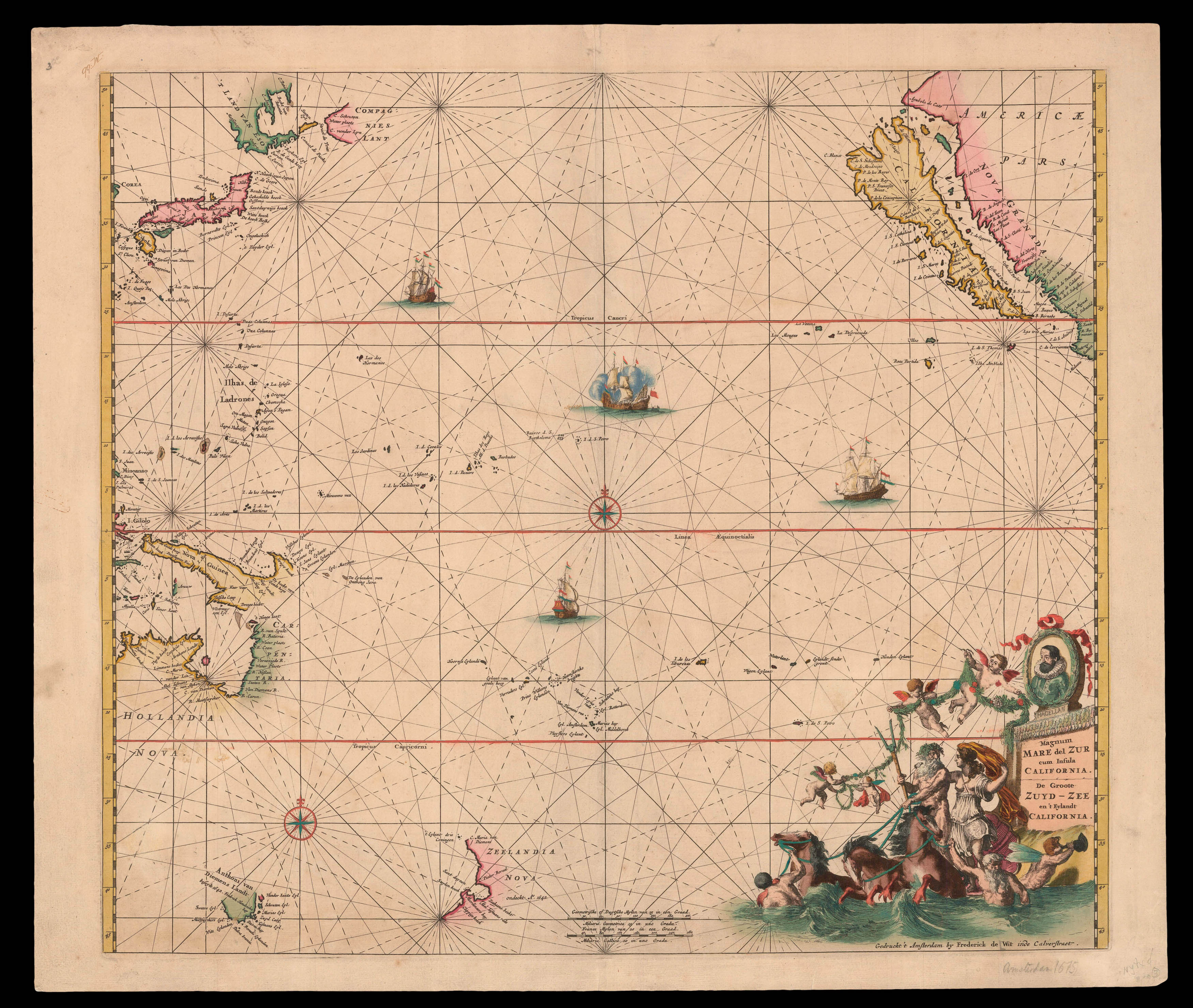
Second state of this magnificent sea chart of the Pacific, first published in the 'Orbis Maritimus ofte Zee Atlas' in 1675. Here with "I. de S. Andries" off the coast of California. Although much of this chart is "empty", it is filled with some of the most famous cartographic misconceptions. California is an island; the northen coastline of Australia is shown, with Tasmania a long way away from any known coastline; the partial coastline of New Zealand is marked; and to...
Second state of this magnificent sea chart of the Pacific, first published in the 'Orbis Maritimus ofte Zee Atlas' in 1675. Here with "I. de S. Andries" off the coast of California. Although much of this chart is "empty", it is filled with some of the most famous cartographic misconceptions. California is an island; the northen coastline of Australia is shown, with Tasmania a long way away from any known coastline; the partial coastline of New Zealand is marked; and to the north of Japan are both "Ezo" and "Compagnies lant". A highly decorative title cartouche fills the bottom right corner, depicting Neptune in a chariot and a medallion portrait of Magellan.