from an actual Survey made in the Years 1820 & 1821. By C. & I. Greenwood. To the Nobility, Clergy and Gentry, of Somersetshire, This Map of the County Is most respectfully Dedicated by the Proprietors.
Published for the Proprietors, by G. Pringle Junior, No.70 Queen Street, Cheapside,
October 1, 1822.
Large engraved map with original hand colour, on six sheets, dissected and mounted on linen, in three sections, edged in blue silk, housed in tree calf full-off slipcase, with red morocco label lettered in gilt to spine; the silk detaching in some areas, some pencil annotations.
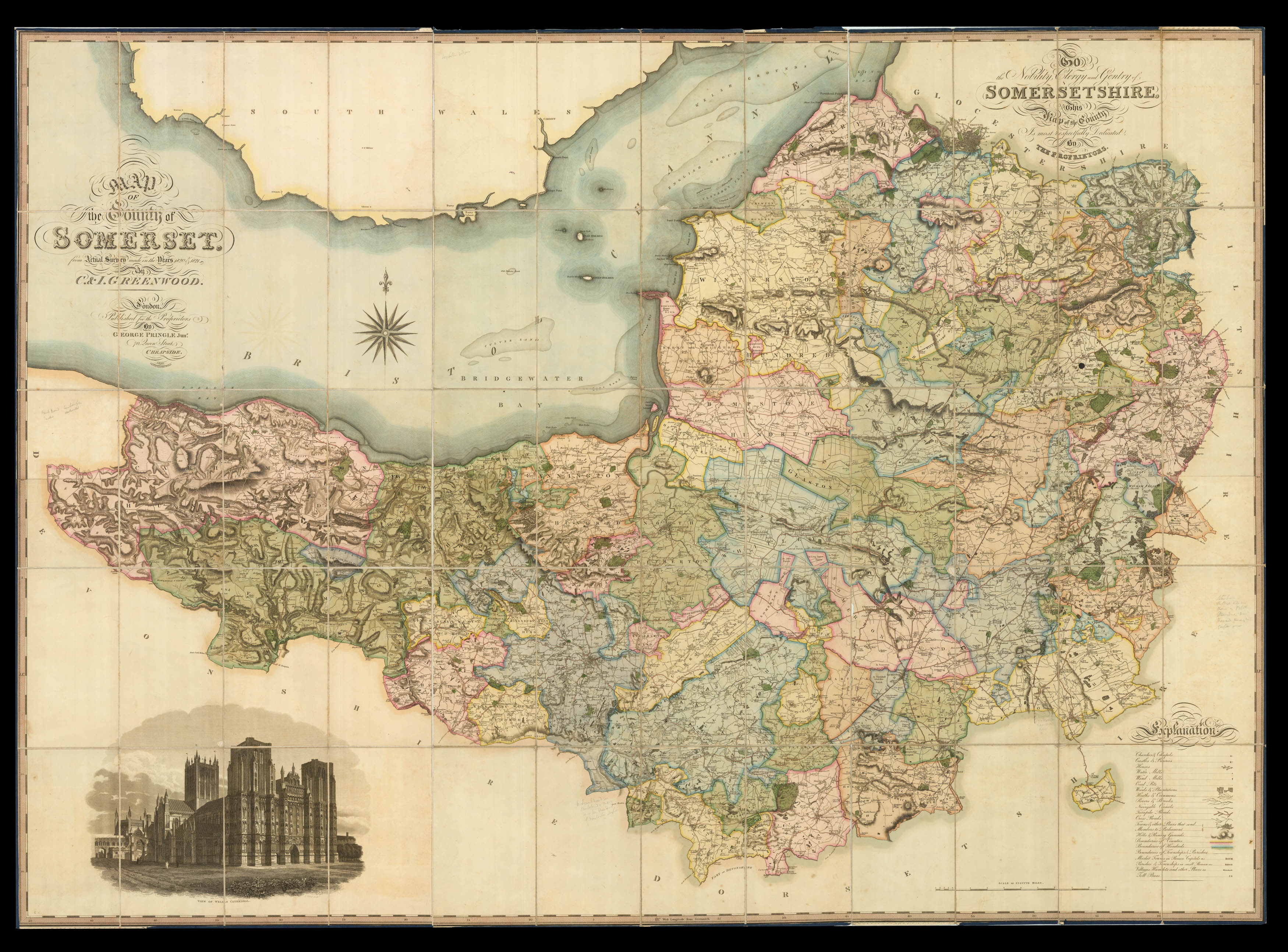
One of Greenwoods' earliest surveys reflecting considerable detail and showing boundaries of the counties and hundreds, woods, plantations, heaths and commons, hills and rising ground, churches and chapels, castles, priories and houses, rivers, brooks and navigable canals, water-mills, wind-mills and toll bars, turnpike and cross roads, and market towns, parishes, villages and hamlets. As with all Greenwoods' surveys it is the road system that is possibly the most impressiv...
One of Greenwoods' earliest surveys reflecting considerable detail and showing boundaries of the counties and hundreds, woods, plantations, heaths and commons, hills and rising ground, churches and chapels, castles, priories and houses, rivers, brooks and navigable canals, water-mills, wind-mills and toll bars, turnpike and cross roads, and market towns, parishes, villages and hamlets. As with all Greenwoods' surveys it is the road system that is possibly the most impressive, the surveyor showing the the most minor roads throughout the county. Below the map is a key denoting the various signs used on the map, and to the lower left is a view of Wells Cathedral.
The maps by Christopher and John Greenwood set new standards for large-scale surveys. Although they were unsuccessful in their stated aim to map all the counties of England and Wales it is probably no coincidence that of the ones they missed, Buckinghamshire, Cambridgeshire, Herefordshire, Hertfordshire, Norfolk and Oxfordshire, all except Cambridgeshire were mapped by Andrew Bryant in a similar style and at the same period. From a technical point of view the Greenwoods' productions exceeded the high standards set in the previous century though without the decoration and charming title-pieces that typified large scale maps of that period.
The Greenwoods started in 1817 with Lancashire and Yorkshire and by 1831 they had covered 34 counties. Their maps were masterpieces of surveying and engraving techniques, and in view of the speed at which they were completed, their accuracy is remarkable. They mark the boundaries of the counties, hundreds and parishes, churches and chapels, castles and quarries, farmhaouses and gentlemen's seats, heaths and common land, woods, parliamentary representatives and distances between towns. The price of 3 guineas each compares with the the first edition Ordnance Survey sheets of 7s 6d, though the latter did not relate to complete counties.