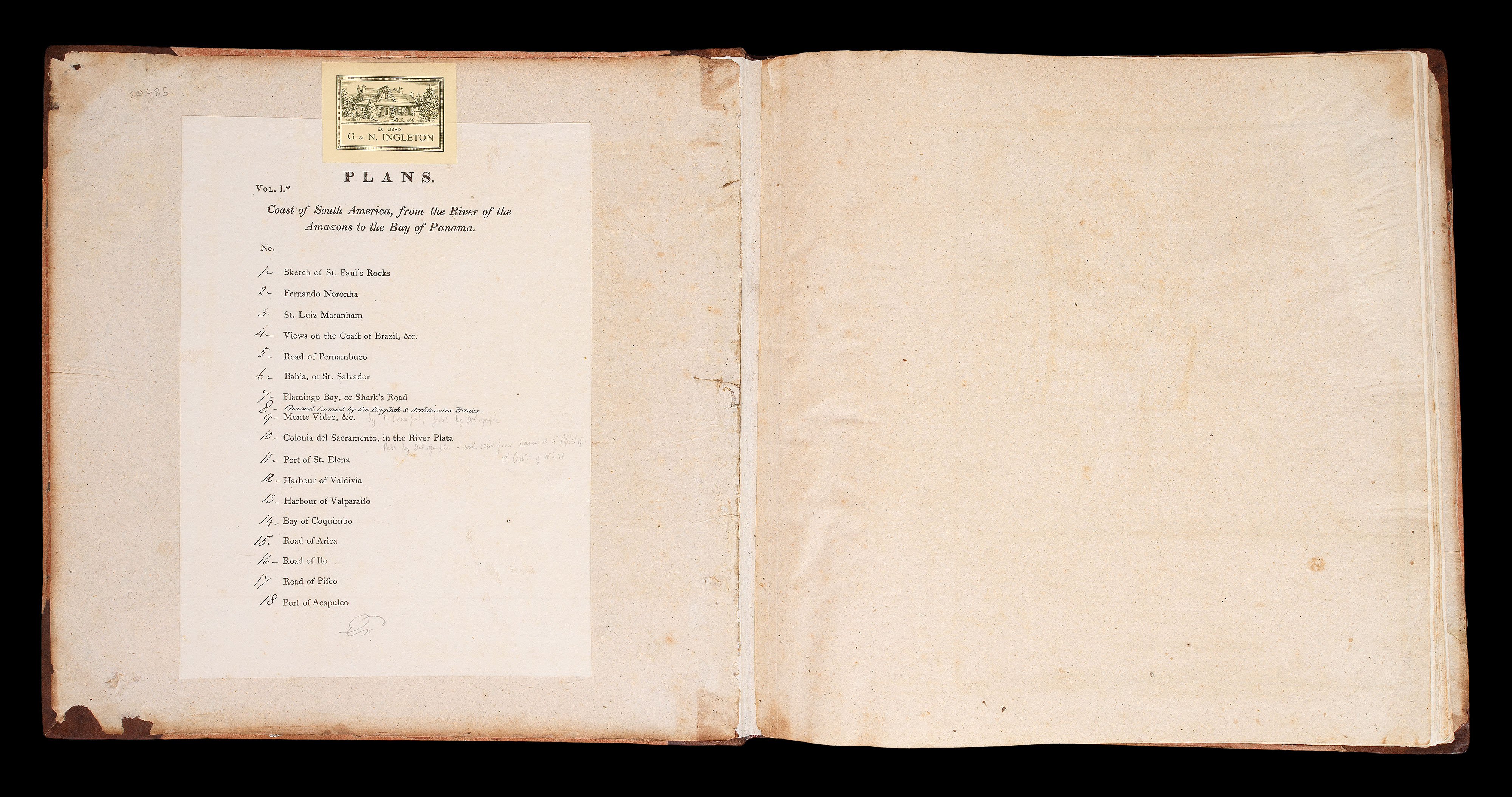
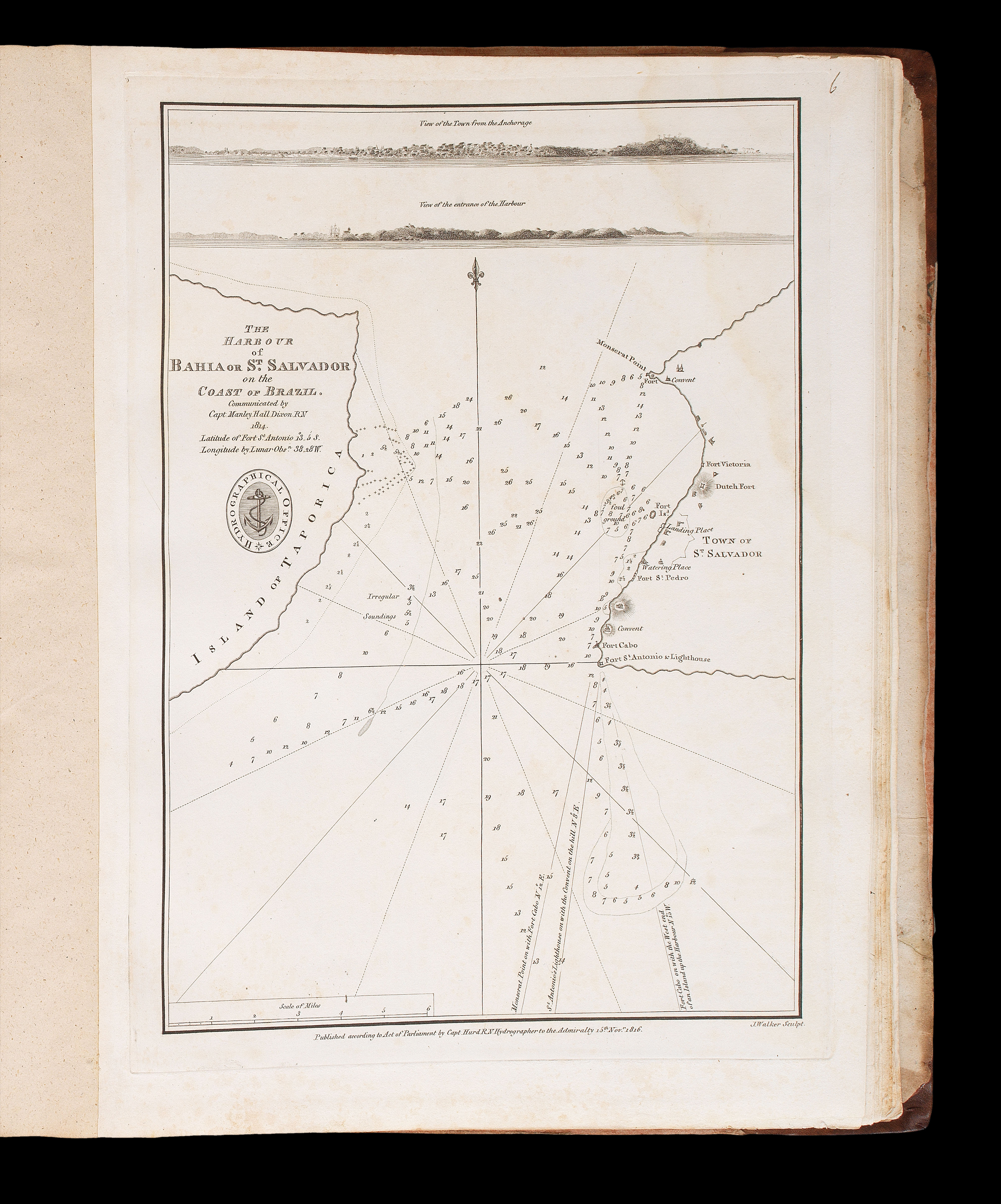
Quarto (335 by 330mm). 17 engraved charts, of which seven are double-page and two folding, printed list of maps to front pastedown, chart 8 'Plan of the Channel formed by the English & Archimedes...', added in manuscript to list, some light spotting and dampstaining, half calf over marbled paper boards, rebacked and recornered.
Collection of maritime charts of South America by the Hydrographical Office of the Admiralty under the supervision of Captain Thomas Hurd (c.1757-1823).
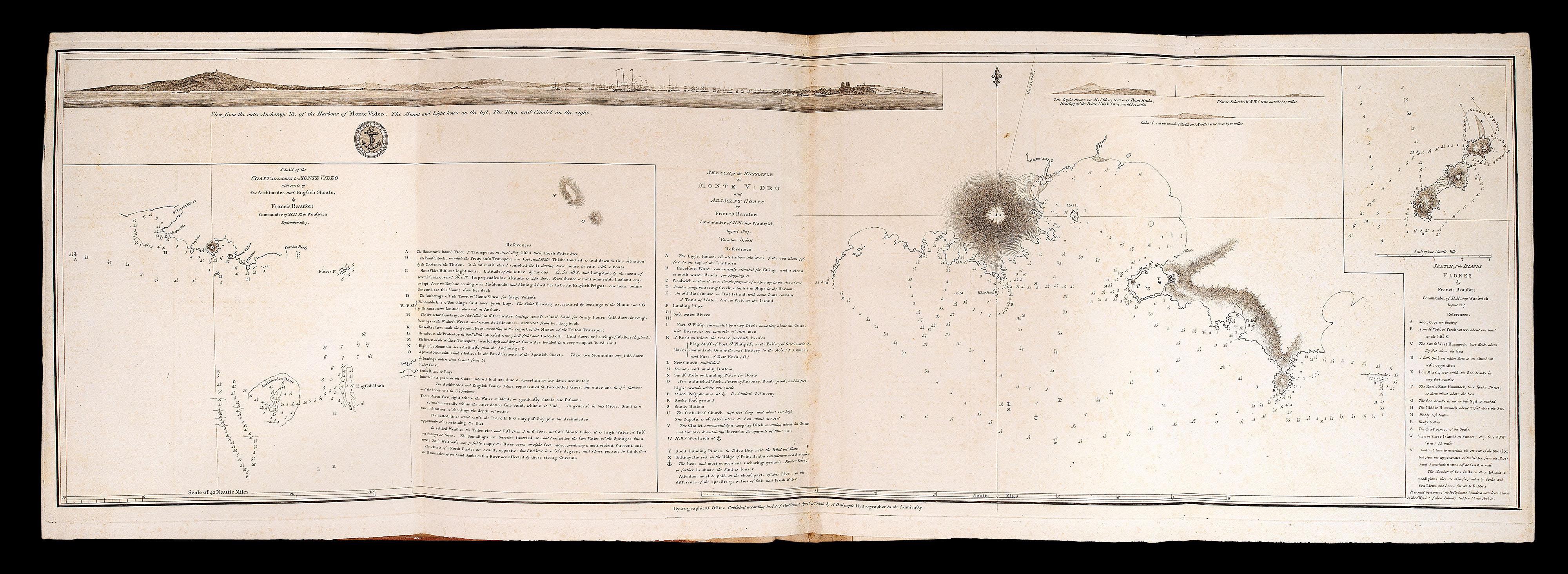
The earliest charts dated 1807 and 1808, (chart 9 'Sketch of the Entrance of Monte Video', and chart 10 'Plan of the Port and Portuguese Fort of Colonia del Sacramento'), were published under the supervision of Alexander Dalrymple whilst he was Hydrographer to the Admiralty. In 1808, Dalrymple was succeeded by C...
Collection of maritime charts of South America by the Hydrographical Office of the Admiralty under the supervision of Captain Thomas Hurd (c.1757-1823).
The earliest charts dated 1807 and 1808, (chart 9 'Sketch of the Entrance of Monte Video', and chart 10 'Plan of the Port and Portuguese Fort of Colonia del Sacramento'), were published under the supervision of Alexander Dalrymple whilst he was Hydrographer to the Admiralty. In 1808, Dalrymple was succeeded by Captain Thomas Hurd. "During his appointment, there was a significant increase in the number of charts engraved and issued to the navy. He was also able to organize a regular system of surveys under his control by specialist naval officers in command of ships specially allocated for their use. In 1821, he persuaded the Admiralty to place Admiralty charts on sale to the public so that they could be used by ships of the mercantile marine. At the time of his death, probably in London, on 29 April 1823 Hurd was also superintendent of chronometers and a commissioner for the discovery of longitude" (Andrew C.F. David for DNB).
The printed contents list to the front pastedown suggests these charts were published as a collected volume, this is reinforced by the fact that the list is labelled "Vol. I", although no record remains of its publication or publication of further volumes. Chart '8' 'Plan of the Channel formed by the English and Archimedes Banks' has been added in manuscript by a contemporary hand, as have the chart numbers.
We are unable to trace another example of this collection of charts to have come up at auction since the Second World War. Although individual charts are held at the British Library, we are unaware of any institutional examples of this collection.