By The Proprietors C. Greenwood & Co., Regent Street, Pall Mall,
September, 1st, 1827.
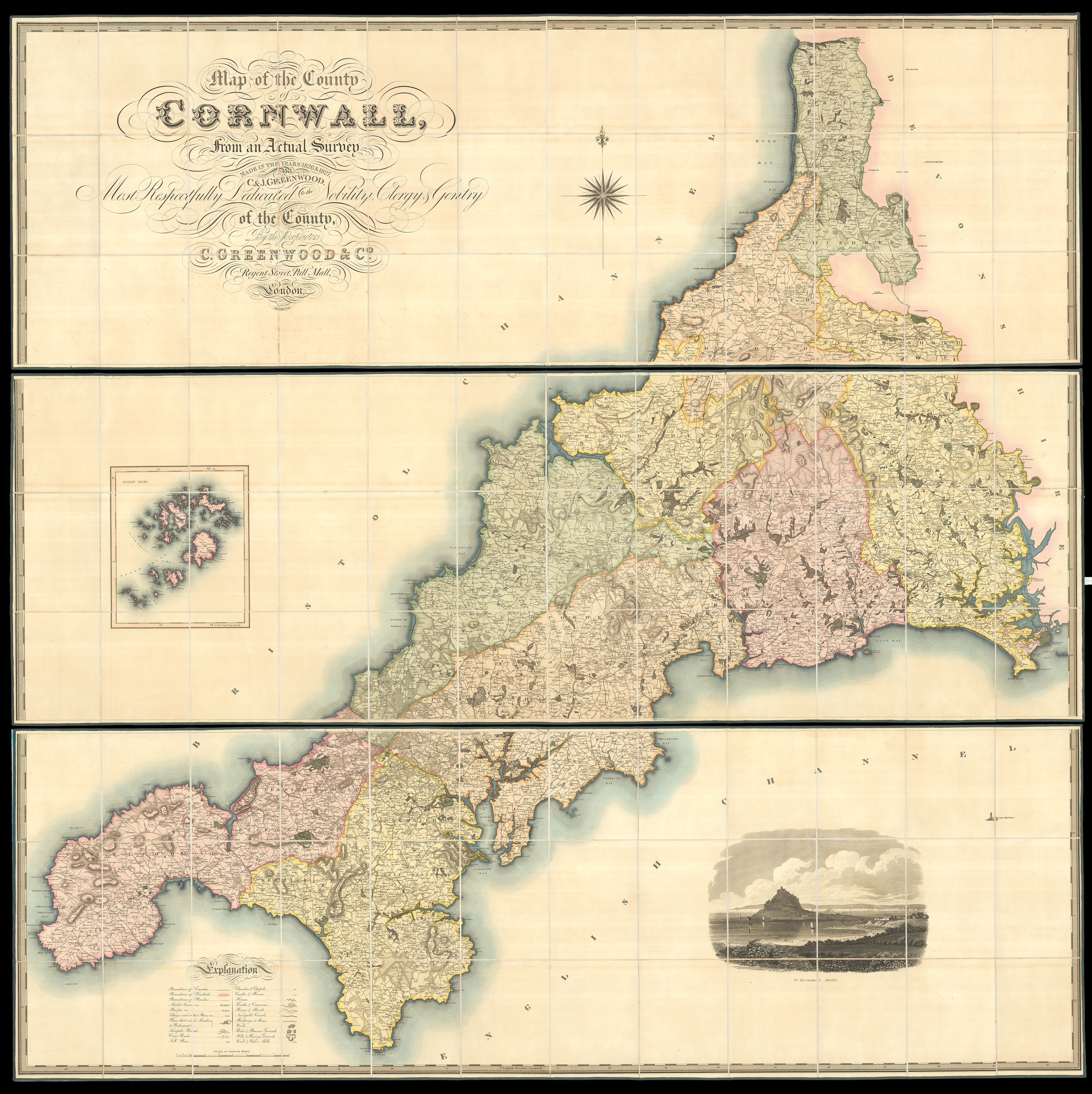
Large engraved map, dissected and mounted on linen, in two sections, fine original full wash colour, view of St Michaels Mount, edged in green silk, housed within original tree calf pull-off slipcase, red morocco label lettered in gilt to spine, rubbed.
The maps by Christopher and John Greenwood set new standards for large-scale surveys. Although they were unsuccessful in their stated aim to map all the counties of England and Wales it is probably no coincidence that of the ones they missed, Buckinghamshire, Cambridgeshire, Herefordshire, Hertfordshire, Norfolk and Oxfordshire, all except Cambridgeshire were mapped by Andrew Bryant in a similar style and at the same period. From a technical point of view the Greenwoods' pr...
The maps by Christopher and John Greenwood set new standards for large-scale surveys. Although they were unsuccessful in their stated aim to map all the counties of England and Wales it is probably no coincidence that of the ones they missed, Buckinghamshire, Cambridgeshire, Herefordshire, Hertfordshire, Norfolk and Oxfordshire, all except Cambridgeshire were mapped by Andrew Bryant in a similar style and at the same period. From a technical point of view the Greenwoods' productions exceeded the high standards set in the previous century though without the decoration and charming title-pieces that typified large scale maps of that period.
The Greenwoods started in 1817 with Lancashire and Yorkshire and by 1831 they had covered 34 counties. Their maps were masterpieces of surveying and engraving techniques, and in view of the speed at which they were completed, their accuracy is remarkable. They mark the boundaries of the counties, hundreds and parishes, churches and chapels, castles and quarries, farmhouses and gentlemen's seats, heaths and common land, woods, parliamentary representatives and distances between towns. The price of 3 guineas each compares with the first edition Ordnance Survey sheets of 7s 6d, though the latter did not relate to complete counties.