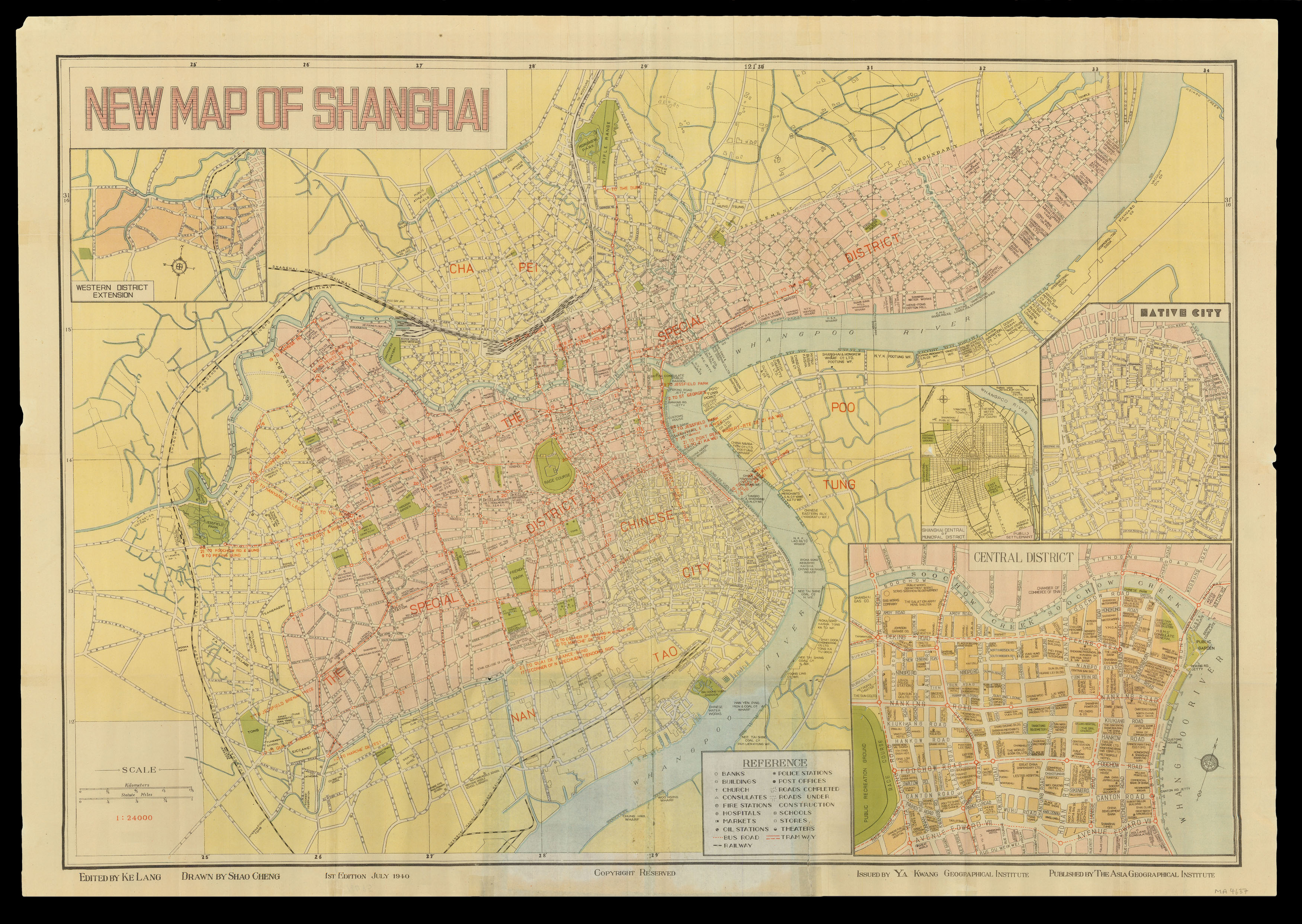
Detailed map of Shanghai, first printed in the International Settlement in 1940, following the Japanese invasion, before the Imperial Japanese Army entered and occupied the British and American controlled parts of the city in 1941.
The International Settlement and French Concession are coloured in pink, and denoted as "The Special District" in red block lettering. The areas around these two zones are shown in yellow. Roads, parks, cemeteries, schools, and importa...
Detailed map of Shanghai, first printed in the International Settlement in 1940, following the Japanese invasion, before the Imperial Japanese Army entered and occupied the British and American controlled parts of the city in 1941.
The International Settlement and French Concession are coloured in pink, and denoted as "The Special District" in red block lettering. The areas around these two zones are shown in yellow. Roads, parks, cemeteries, schools, and important municipal buildings, such as police stations and hospitals are labelled. Sports fields, the race track, and certain bookstores are also located. Tramways and bus routes are depicted.
The map features four insets: the "native city", which is located just outside of the concessions; the Central District and the Bund, "Shanghai Central of Municipal District"; and the Western District Extension.
The first edition of the map was published in July of 1940, then reissued in 1945. This example is the 1945 edition but bears the 1940 date, with have an updated date on the binder.