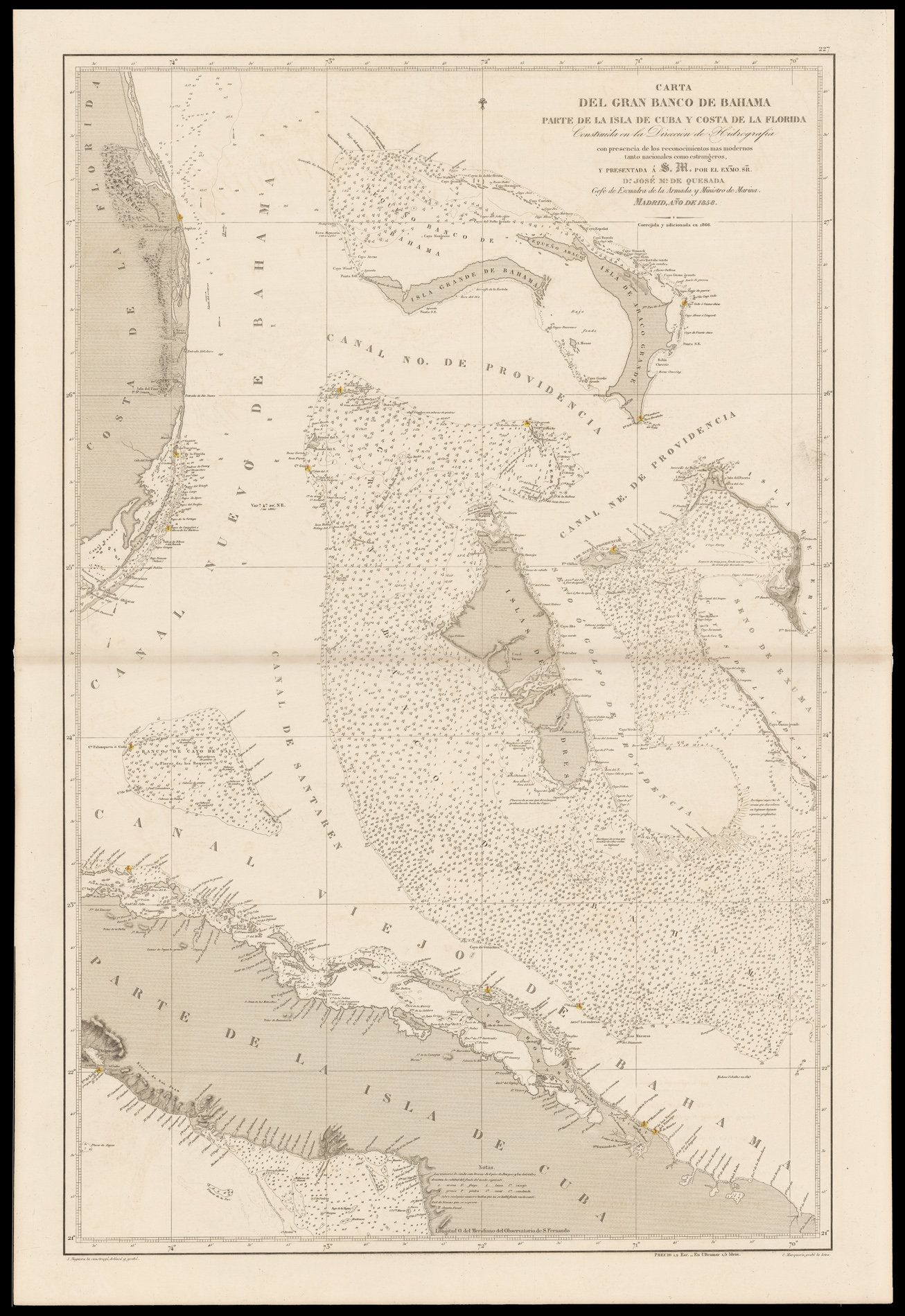
Carta del Gran Banco de Bahama, Parte de la Isla de Cuba y Costa de la Florida
Construido en la Dirección de Hidrografía con presencia de los reconocimientos mas modernos tanto nacionales como estrangeros y presentada á S.M. por el Exmo. Sr. Dn. José M.a de Quesada Gefe de Escuadra de la Armada y Ministro de Marina. Madrid, año de 1858.
Detailed chart of the Bahamas, centred on Andros, and showing the coast of Florida with Miami and central Cuba, from the banks off the east coast of Florida from Hutchinson Island to Key Largo. A detailed chart showing all the many small islands, soundings. In Florida, Fort Jupiter, with its important lighthouse, is shown, as is the small town of Miami. The numerous lighthouses are heightened in red and yellow.
Engaved by Juan Noguera and C. Marquerie for the Di...
Detailed chart of the Bahamas, centred on Andros, and showing the coast of Florida with Miami and central Cuba, from the banks off the east coast of Florida from Hutchinson Island to Key Largo. A detailed chart showing all the many small islands, soundings. In Florida, Fort Jupiter, with its important lighthouse, is shown, as is the small town of Miami. The numerous lighthouses are heightened in red and yellow.
Engaved by Juan Noguera and C. Marquerie for the Direccion de Hydrografia under Quesado, who was the chief of cartography for the Ministry of the Navy, in 1858 and updated to 1866. The official blind-stamp of the Direccion de Hydrografia, Madrid appears in the lower left-hand corner.