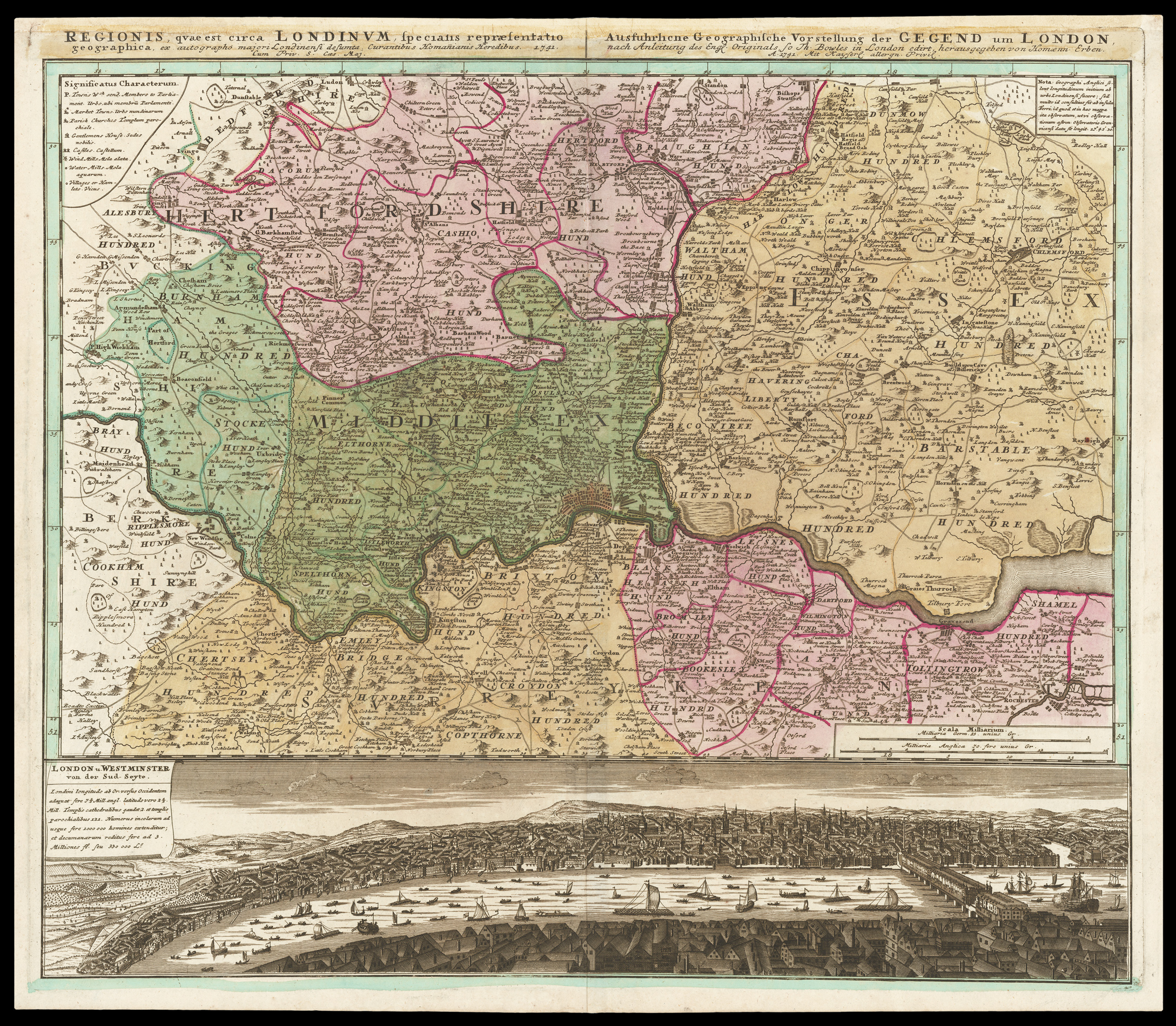
This finely engraved map was, as Homann acknowledges in the title, based upon Thomas Bowles' map of a year earlier: 'A New Correct Map of thirty Miles Round London...'. The map is coloured to show hundreds and counties, and depicts towns that return MPs, market towns, churches, gentlemen's houses, castles, windmills, watermills, and villages. Below the map is a prospect of London and Westminster, which has been reduced from a two-sheet 'South Prospect of London and Westmins...
This finely engraved map was, as Homann acknowledges in the title, based upon Thomas Bowles' map of a year earlier: 'A New Correct Map of thirty Miles Round London...'. The map is coloured to show hundreds and counties, and depicts towns that return MPs, market towns, churches, gentlemen's houses, castles, windmills, watermills, and villages. Below the map is a prospect of London and Westminster, which has been reduced from a two-sheet 'South Prospect of London and Westminster', printed and sold by John Bowles, circa 1722.