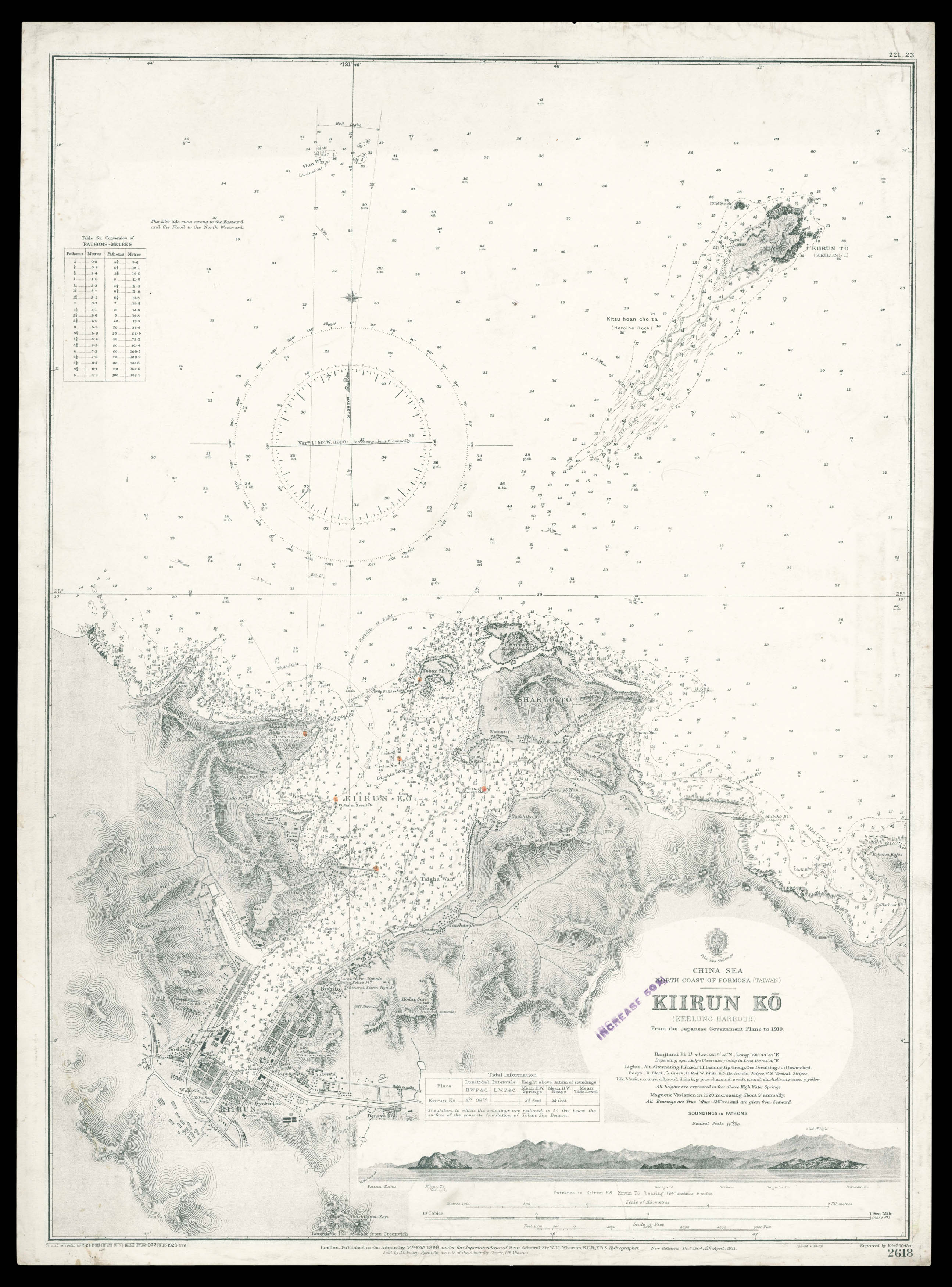
New Edition 11th April, 1921. Small corrections to 1923.
Engraved chart, including tidal information, compass roses, soundings, seabed notations, currents, sandbanks, shoals, lighthouses and beacons picked out in yellow and red, inland elevations, detailing, and buildings.
Detailed chart of the Keelung Port on the north coast of Taiwan.
Taiwan at the time of the chart's publication was under the control of the Japanese, who in 1895 had gained control of the island from the Chinese after the First Sino-Japanses War. Under the adminstration of the Japanese Keelung became one of the major trading ports in Taiwan. Although heavily bombed during the Second World War, the port today is one of the busiest c...
Detailed chart of the Keelung Port on the north coast of Taiwan.
Taiwan at the time of the chart's publication was under the control of the Japanese, who in 1895 had gained control of the island from the Chinese after the First Sino-Japanses War. Under the adminstration of the Japanese Keelung became one of the major trading ports in Taiwan. Although heavily bombed during the Second World War, the port today is one of the busiest container ports in the world.
The British Hydrographic Office was founded in 1795 by George III, who appointed Alexander Dalrymple as the first Hydrographer to the Admiralty. The first charts were produced in 1800. Unlike the U. S. Coast Survey the Hydrographic Office was given permission to sell charts to the public and they produced a great number of sea charts covering every corner of the globe. Most of the Admiralty charts produced by the Hydrographic Office delineated coastline as well as high and low water marks and record depth of water as established by soundings. In addition these charts included information on shoals, reefs, and other navigational hazards that plagued mariners across the world. Thanks to the innovations of Sir Francis Beaufort, who developed the Beaufort Scale of wind strength, the British Hydrographic Office became one of the leading producers of sea charts. In fact, such was their accuracy that the phrase "Safe as an Admiralty Chart" was coined.
![[Anonymous] Palo Alto.](https://omega.crouchrarebooks.com/wp-content/uploads/2025/03/15082_1H-3-scaled.jpg) Welcome to Palo Alto
1 × £1,550
Welcome to Palo Alto
1 × £1,550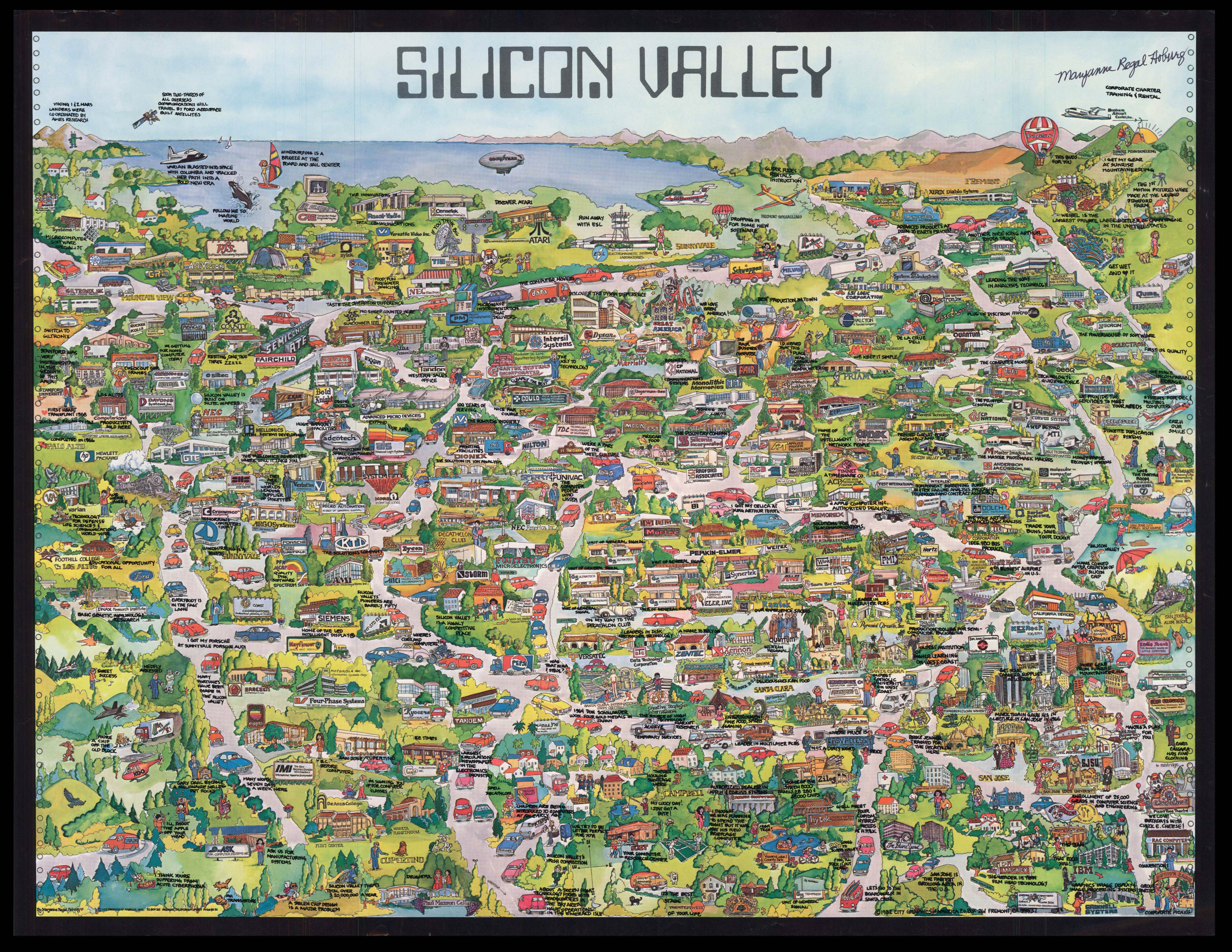 Foundation map of Silicon Valley - inscribed by the artist
1 × £28,000
Foundation map of Silicon Valley - inscribed by the artist
1 × £28,000![STAMPIOEN, Jan Jansz the Younger, [and] Marten CALMAM Onderwys in 't Regte Gebruyk van het Hemels-Plyn](https://omega.crouchrarebooks.com/wp-content/uploads/2025/03/1992_1H.jpg) Telling the time with stars
1 × £25,000
Telling the time with stars
1 × £25,000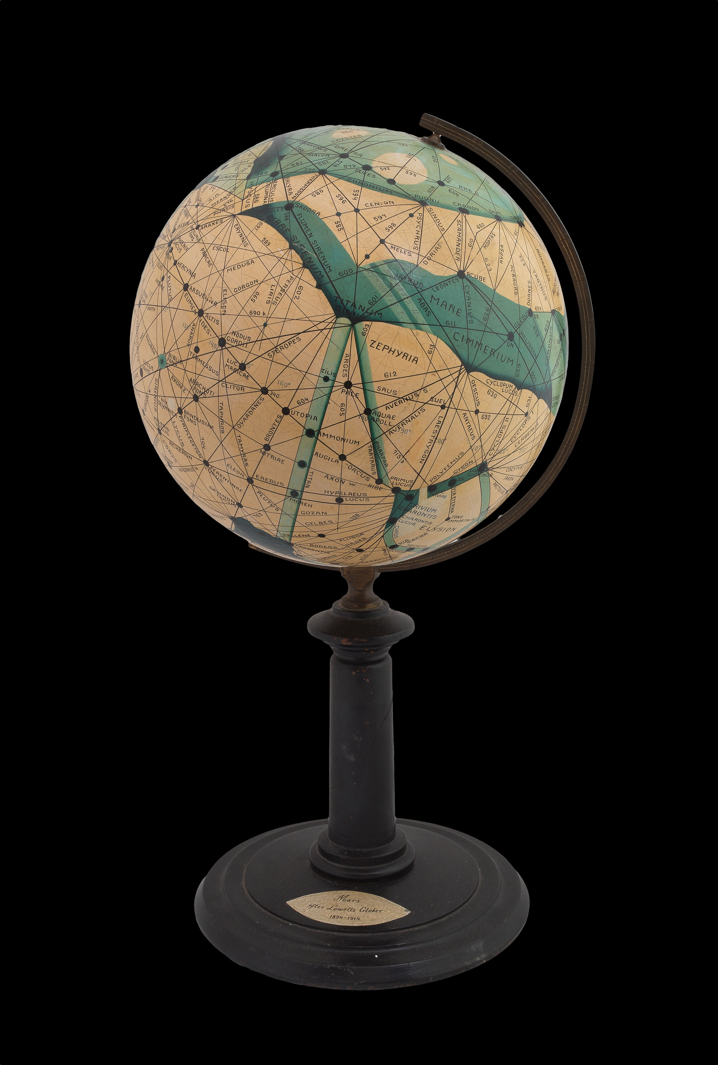 Life on Mars
1 × £60,000
Life on Mars
1 × £60,000![REMONDINI PRESS [Set of 2 - pair of golds, 23 & 24] [Arte Povera?]](https://omega.crouchrarebooks.com/wp-content/uploads/2025/03/3078_1H.jpg) Remondini binding papers
1 × £2,400
Remondini binding papers
1 × £2,400![BACH PHI, P. [for Seagate Technology] Silicon Valley 1991](https://omega.crouchrarebooks.com/wp-content/uploads/2025/03/15015_1H-3-scaled.jpg) Seagate's promotional poster map of Silicon Valley
1 × £8,000
Seagate's promotional poster map of Silicon Valley
1 × £8,000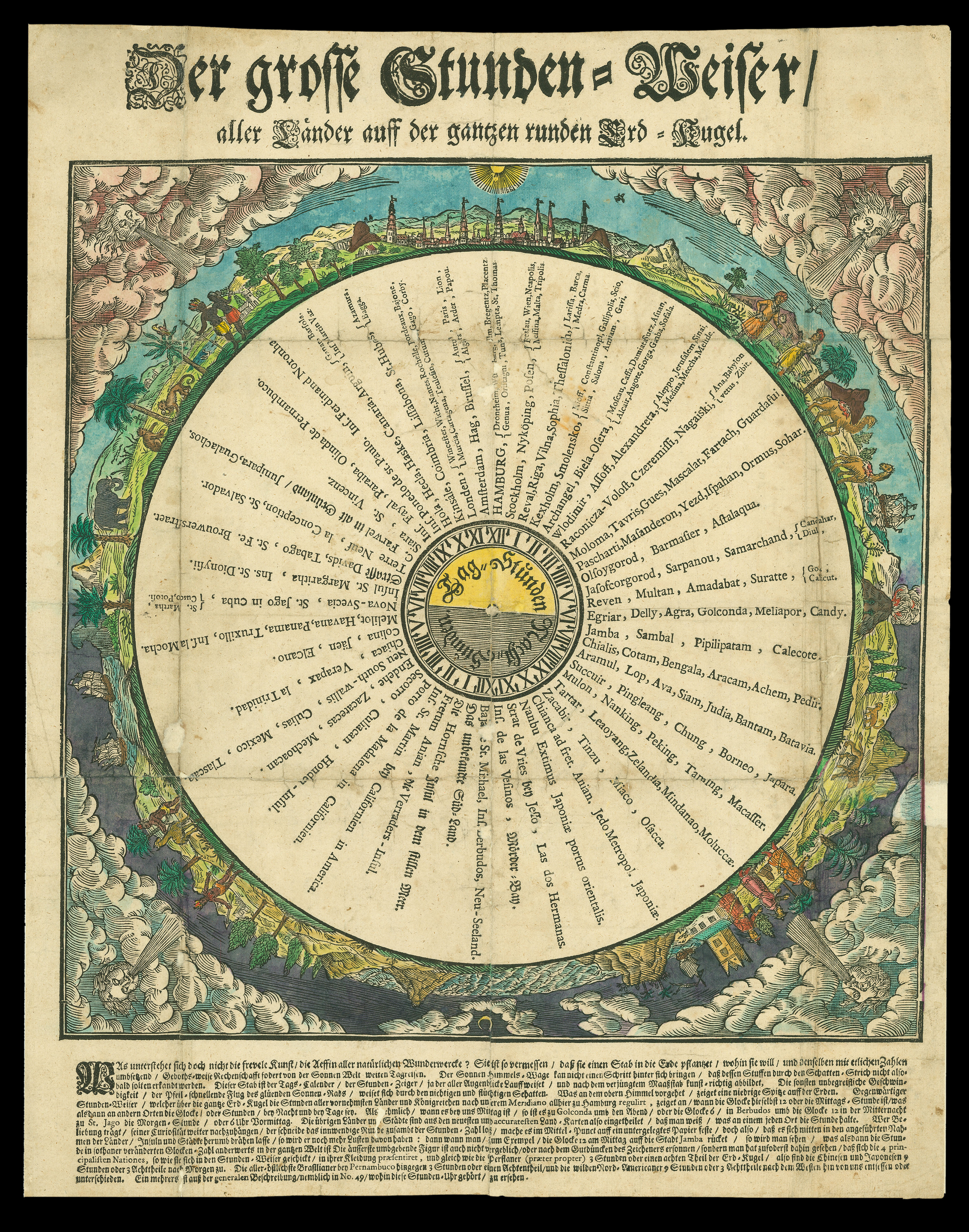 Time Zones
1 × £750
Time Zones
1 × £750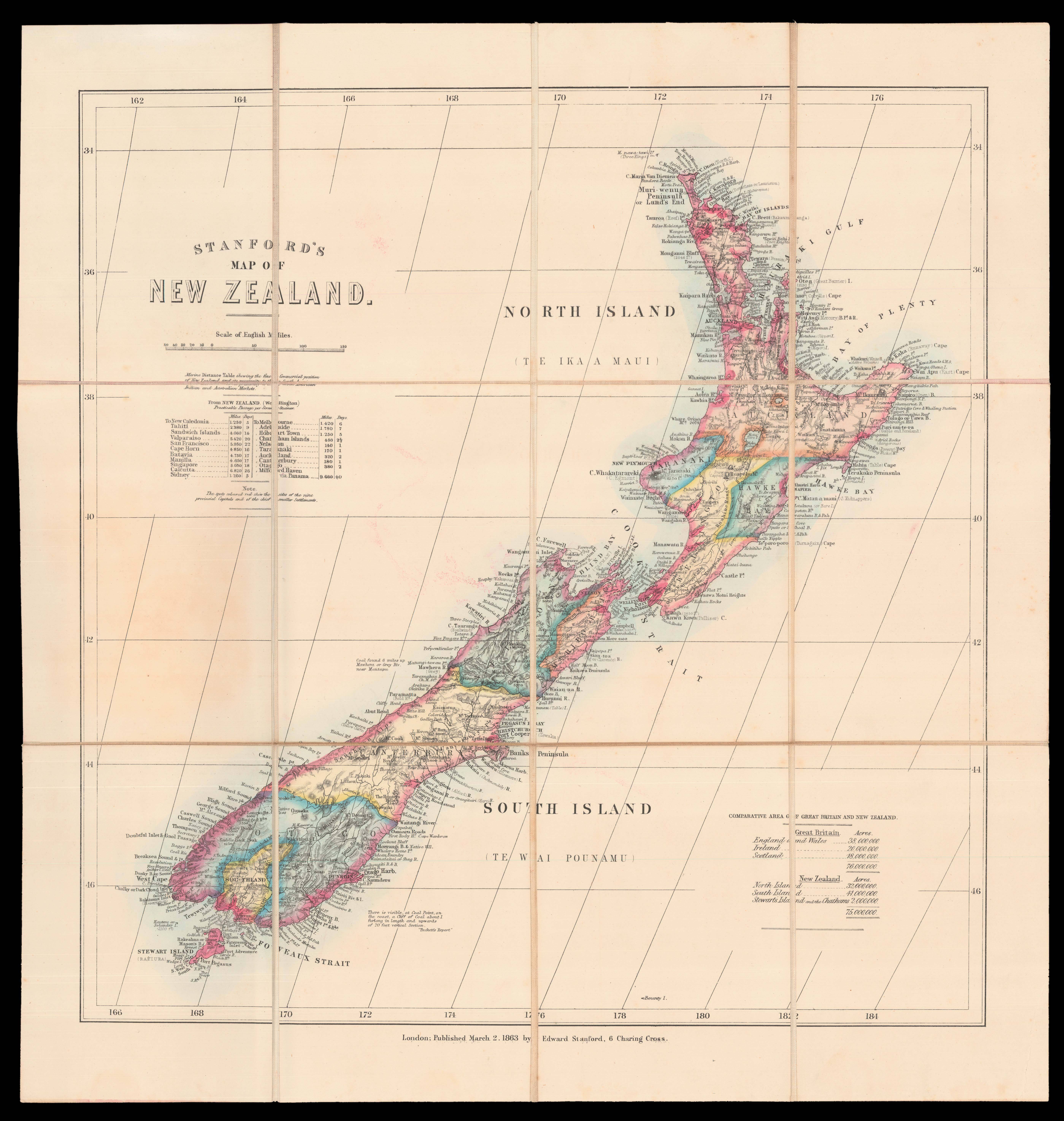 Stanford's map of New Zealand
1 × £1,600
Stanford's map of New Zealand
1 × £1,600