Surveyed by Mr. A.M. Bisbee Coast Inspector I.M. Customs Service, assisted by Mr. H.C. Müller, 1894. Re-sounded by Mr. H.C. Müller I.M. Customs Service 1906-7.
30th Nov 1900. Large corrections to 1908. Small corrections to 1924.
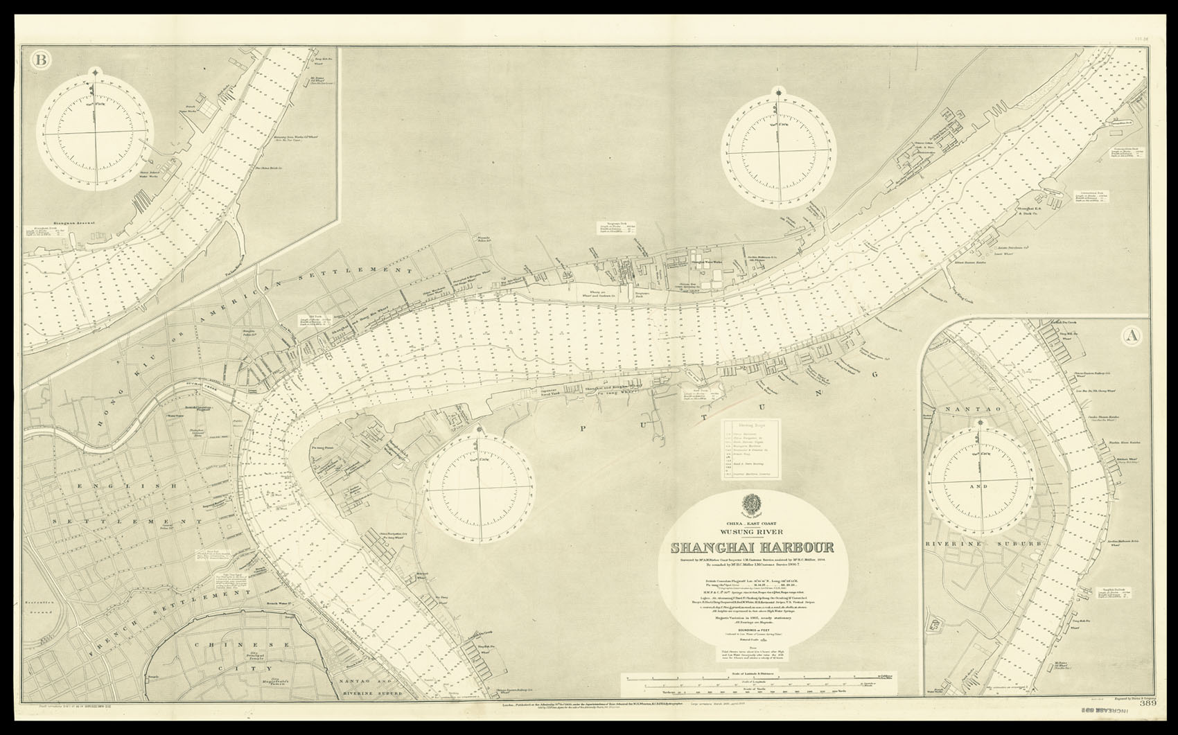
Engraved chart, including tidal information, compass roses, soundings, seabed notations, currents, sandbanks, shoals, lighthouses and beacons picked out in yellow and red, inland elevations, detailing and buildings, insets of upper and lower parts of river.
Detailed chart of China East Coast Wusung River Shanghai Harbour.
At the time the chart was published, Shanghai had become the most important port in Asia, with tea, silks and porcelain being exported to Europe and America, and a great deal of opium being imported. The city was home to some 3 million inhabitants, of which 35,000 were foreigners. Although small in number the foreigners (mainly British, French, American, and Japanese), due to land concessions, cont...
Detailed chart of China East Coast Wusung River Shanghai Harbour.
At the time the chart was published, Shanghai had become the most important port in Asia, with tea, silks and porcelain being exported to Europe and America, and a great deal of opium being imported. The city was home to some 3 million inhabitants, of which 35,000 were foreigners. Although small in number the foreigners (mainly British, French, American, and Japanese), due to land concessions, controlled almost half the city and much of the import and export trade. Although not marked on the chart the city was also notorious for its numerous opium dens and whorehouses; with such earthly temptations well catered for, and no passports or visas required, Shanghai became an infamous and exotic port of call.
The British Hydrographic Office was founded in 1795 by George III, who appointed Alexander Dalrymple as the first Hydrographer to the Admiralty. The first charts were produced in 1800. Unlike the U. S. Coast Survey the Hydrographic Office was given permission to sell charts to the public and they produced a great number of sea charts covering every corner of the globe. Most of the Admiralty charts produced by the Hydrographic Office delineated coastline as well as high and low water marks and record depth of water as established by soundings. In addition these charts included information on shoals, reefs, and other navigational hazards that plagued mariners across the world. Thanks to the innovations of Sir Francis Beaufort, who developed the Beaufort Scale of wind strength, the British Hydrographic Office became one of the leading producers of sea charts. In fact, such was their accuracy that the phrase 'Safe as an Admiralty Chart' was coined.