This admiralty chart of the North Sea depicts the body of water in between the British Isles and Scandinavia, bordered to the south by Belgium and Germany. Depth soundings appear across the Sea, as do tracks of voyages, and on the land toponyms are found around the coastlines, harbours with lighthouses being indicated by red and yellow circles. Magnetic variations are updated on the present map up to 1912. The chart was published under the superintendence of Rear Admiral He...
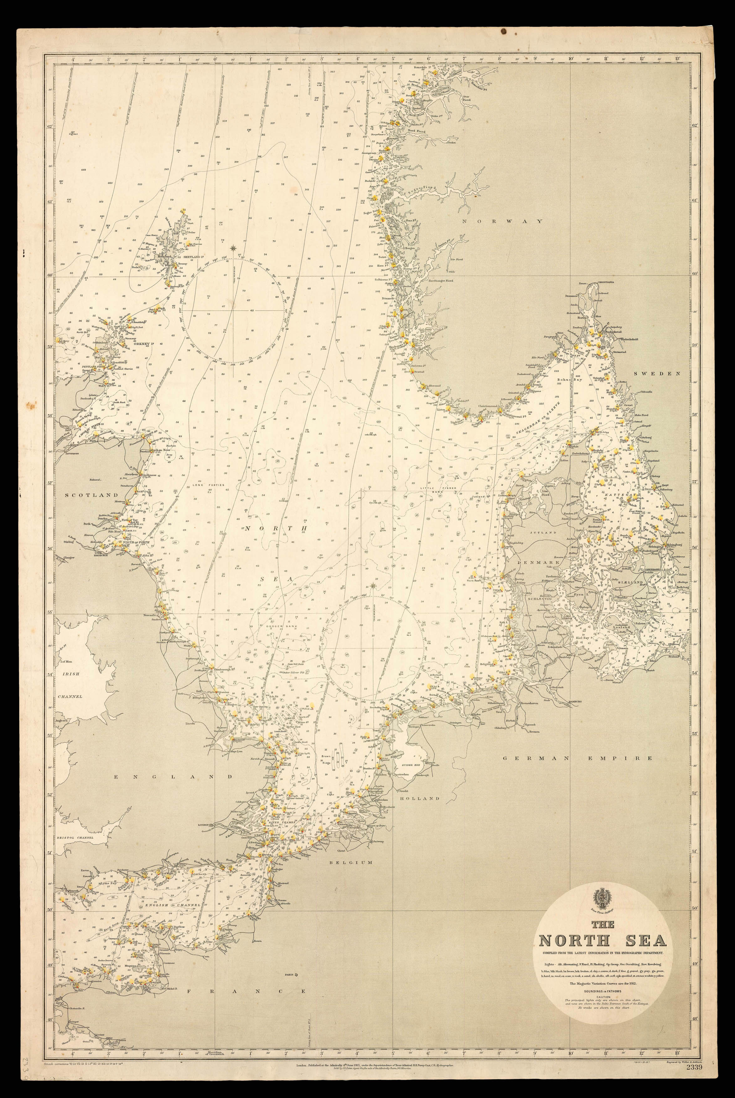
This admiralty chart of the North Sea depicts the body of water in between the British Isles and Scandinavia, bordered to the south by Belgium and Germany. Depth soundings appear across the Sea, as do tracks of voyages, and on the land toponyms are found around the coastlines, harbours with lighthouses being indicated by red and yellow circles. Magnetic variations are updated on the present map up to 1912. The chart was published under the superintendence of Rear Admiral Herbert Edward Purey-Cust, who retired shortly after its publication.