Edinburgh & London, Printed & Sold by John & James Ainslie Booksellers & Stationers, St. Andrew's Street Newtown; William Faden, Geographer to the King, Charing Cross,
Jan[uar]y 1st 1789.
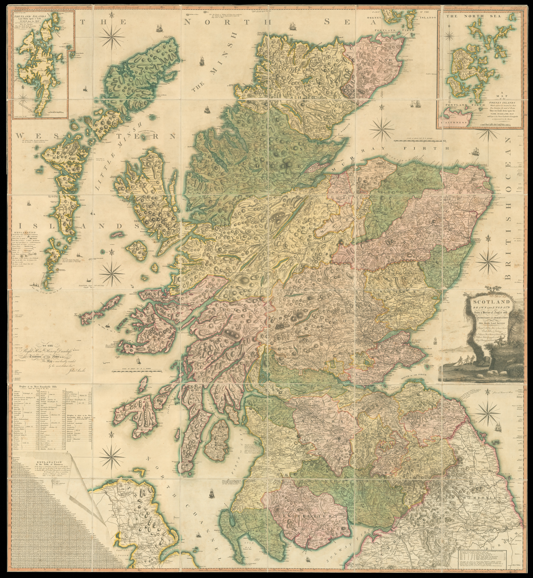
Large engraved map on nine sheets, dissected and mounted on linen, fine original hand-colour, insets of the Shetland and Orkney Isles, table of distances between towns, and heights of the 'Most Remarkable Hills', lower left, folding into original full calf, pull-off slipcase, red morocco gilt label to spine, rubbed.
First published in 1789 this large and rare map would become the benchmark map of Scotland, until Aaron Arrowsmith's map of Scotland some 20 years late. The map is on the same scale (approx. 4 inches to 1 mile) as Dorret's map of 1850, however, it surpasses it in terms of clarity and accuracy; and for the first time the Great Glen from Inverness to Fort William is accurately depicted, as are many of the islands that m...
Ainslie's large and detailed map of Scotland.
First published in 1789 this large and rare map would become the benchmark map of Scotland, until Aaron Arrowsmith's map of Scotland some 20 years late. The map is on the same scale (approx. 4 inches to 1 mile) as Dorret's map of 1850, however, it surpasses it in terms of clarity and accuracy; and for the first time the Great Glen from Inverness to Fort William is accurately depicted, as are many of the islands that make up the Western Isles.
John Ainslie (1745-1828) was, without doubt, the outstanding Scottish cartographer of his generation, producing a vast range of town plans, estate surveys and county and national maps and charts in a very prolific career. He is best remebered for his nine-sheet map of Scotland and his travelling map of Scotland, however, he also surveyed numerous Scottish counties including the Stewartry of Kirkcudbright in 1796. In 1812, he produced a comprehensive treatise on land surveying based on his practical experience.