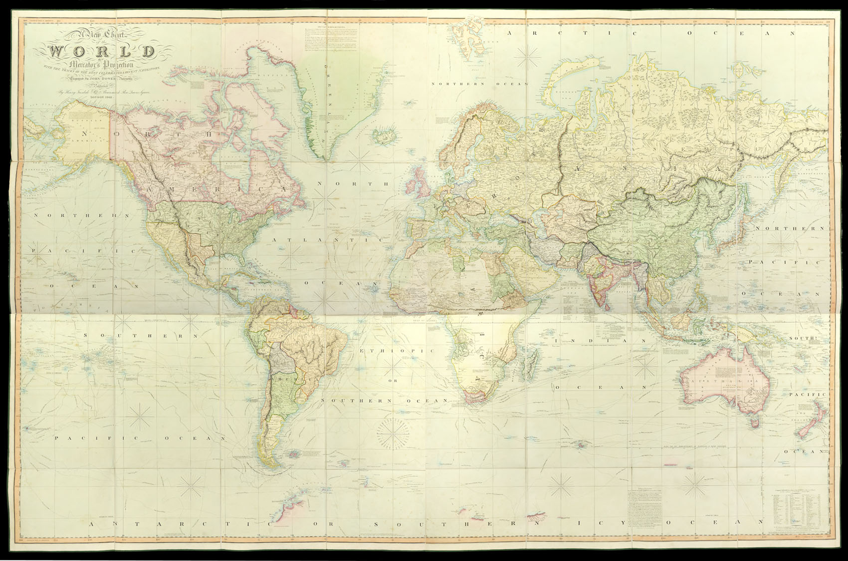
Published By Henry Teesdale & Co., Brunswick Row, Queens Square, London,
1842.
Large engraved map on four sheets, fine original full wash colour, edged in green silk, dissected and mounted on linen, folding into maroon morocco covers, lavishly gilt.
One of the first world maps to show Texas as an independent Republic.
A fine copy of this large world wall map. The fledgling Republic of Texas, declared in 1836, is recognised in this edition of the map, while English and American claims to the Oregon territory are noted. The latest additions record Dumont D'Urville's discoveries of 1840 in Antarctica.
...
One of the first world maps to show Texas as an independent Republic.
A fine copy of this large world wall map. The fledgling Republic of Texas, declared in 1836, is recognised in this edition of the map, while English and American claims to the Oregon territory are noted. The latest additions record Dumont D'Urville's discoveries of 1840 in Antarctica.