A striking separately issued carte-a-figures map in the grand seventeenth century Dutch style.
Although the map is dated 1669, bears an Amsterdam imprint, and the name 'G. Janssonio' (the early patronym of the great mapmaker Willem Blaeu). The works somewhat antiquated geography, especially in its treatment of the Great Sothern Continent, and its naive engraving style suggests the map was most likely a pirated example published in Italy, most likely Venice.
The Map The maps terrestrial information is taken from Nicolas van Geelkercken's Orbis Terrarum Descriptio Duobis Planis..., first published in 1617, with the engraver of the present map borrowing heavily from the 1632 second edition, with its distinctive treatment of Terra del Fuego after Le Maire's voyage. Other geographical features in the America's include California as a peninsula, the marking of the fabled Straits of Anian between America and Asia, and the long St Lawrence River, which bisects North America. Antarctica is dominated by Terra Australis Incognita, the theorised southern land mass, which here includes a huge New Guinea. Where the map does differ from Geelkercken's is in its treatment of the treatment of Spitzbergen, with its much longer coastline.
Terra Australis Ingognita is dominated by two large cartouches, also borrowed from Geelkercken. The text to the western hemisphere providing information on the Americas and its discovery, flanked by native American and a conquistador; with the eastern providing a general overview of the map, and surmounted by a classical figure.
The celestial planisphere are based on a somewhat later map: Janzoon Visscher's, 'Orbis Terrarum Typus' of 1638, as are the personifications of elements and the seasons.
The work is framed by a remarkably large number of native figures and city views: to the upper and lower border are 20 vignettes depicting the peoples of the world; with the map flanked by 18 views of the its principal cities and ports.
Rarity The work is particularly rare with Shirley recording only one institutional example: the Newberry Library Chicago, though with the date crudely altered to 1630. A further example appeared on the market in 1982, but we are unable to trace its whereabouts. The issue is somewhat muddied by the fact that an almost identical map dated 1655, and bearing the address of Stefano Mozzi Scolari 'In Venetia a S. Fosca', is known in German private collection. Although the two works are clearly engraved from different plates, it does suggest that the current example was published in Italy most likely in Venice.
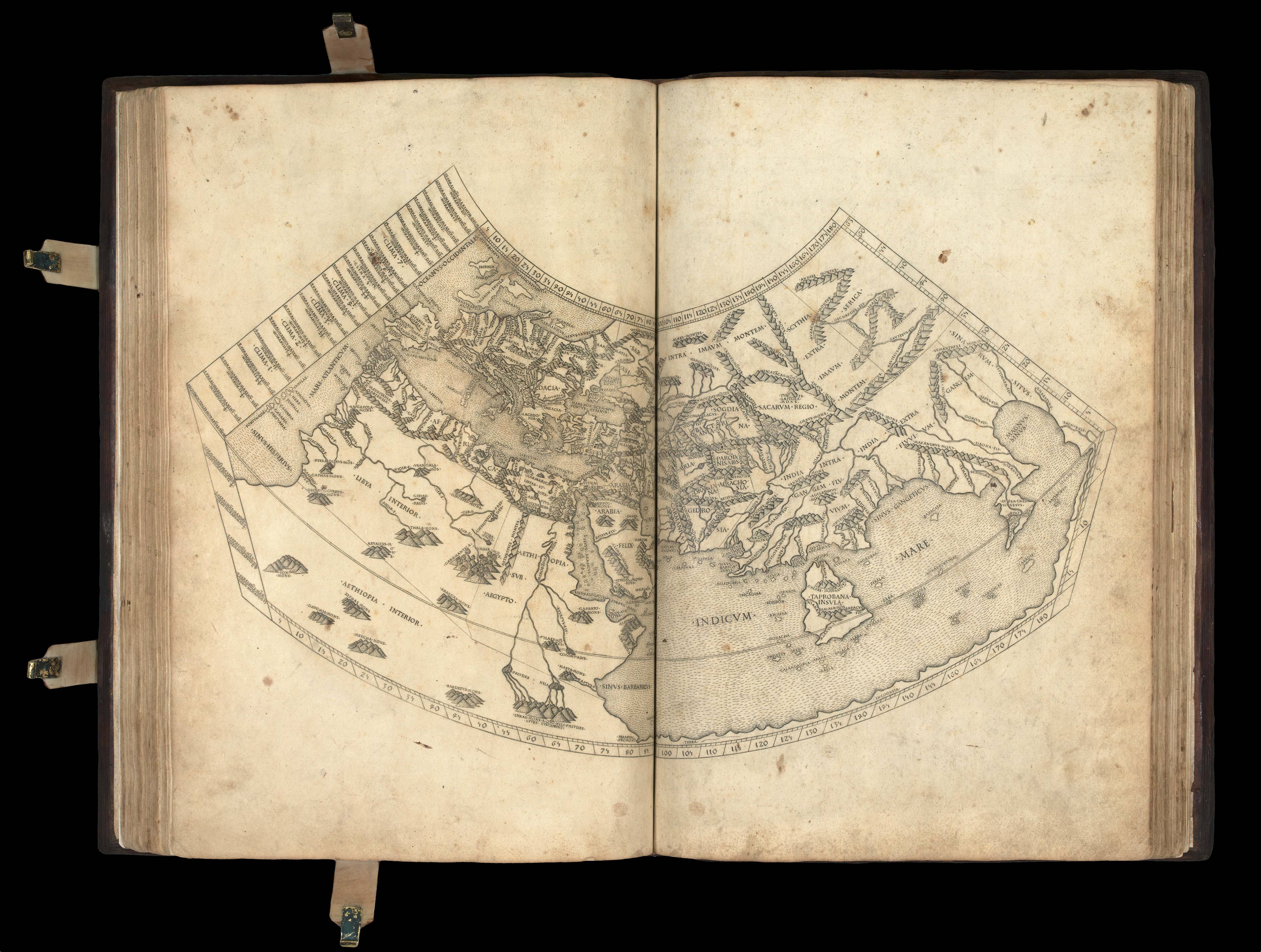 Ptolemy's first projection, with the "finest Ptolemaic plates produced until Gerard Mercator"


![[ANONYMOUS after GEELKERCKEN, Nicoalas van] Orbis Terrarum Tipus de Integro Multis in Locis Emendatus](https://omega.crouchrarebooks.com/wp-content/uploads/2025/02/20587_1H-scaled.jpg)