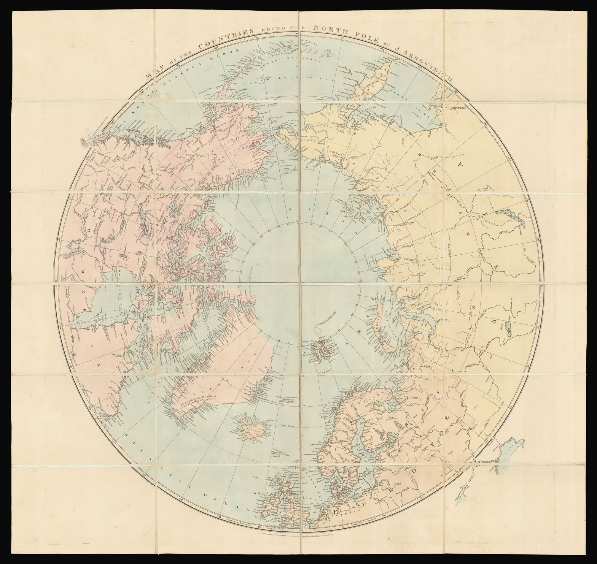
First published by Aaron Arrowsmith in 1818, the current map, by his grandson John, is updated to include the most recent explorations.
On a polar projection, the map includes the north pole and its surrounding continents and countries. Therefore, it visualises the whole arctic region up to 80 degrees north. The region ranging from 80 to 90 degrees north was considered undiscovered at the time of the map's publication, Arrowsmith simply noting the northernmost la...
First published by Aaron Arrowsmith in 1818, the current map, by his grandson John, is updated to include the most recent explorations.
On a polar projection, the map includes the north pole and its surrounding continents and countries. Therefore, it visualises the whole arctic region up to 80 degrees north. The region ranging from 80 to 90 degrees north was considered undiscovered at the time of the map's publication, Arrowsmith simply noting the northernmost latitude achieved to date, of 82 degrees, north of Spitzbergen, Norway. The region north of Canada is highlighted in purple, to show the extent of the coastal exploration to 1850.
Several important expeditions are marked including Parry's, and Franklin's voyages. Franklin's last expedition of 1845, to find the Northwest passage, ended in disaster with the disappearance of Franklin and his entire crew. Several expeditions were sent out to find Franklin, such as the Rae-Richardson (1849), McClure's (1850), and the American Grinnell (1850). The Rae-Richardson voyage is marked by a dotted line denoting the extent of the pack ice in 1849. A note above Smith Sound states "Coasts examined by the Expeditions of 1850", this is most like the Inglefield expedition, of 1852, who had been sponsored by Franklin's widow to search for the missing explorer.