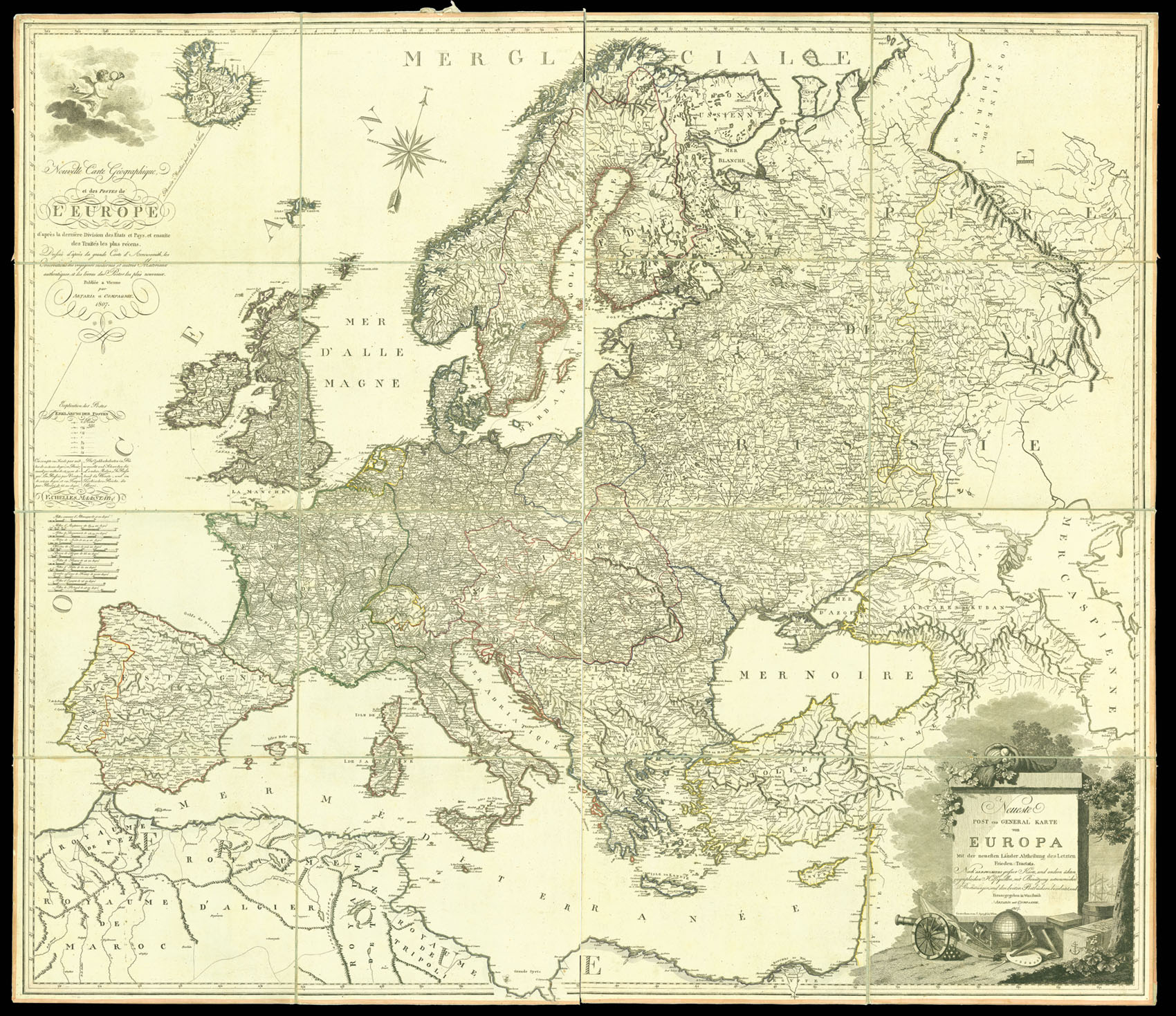
A wall map of Europe and its post roads. It has two title cartouches, one in French surmounted by a trumpeting putto, and one in German surrounded by decorative elements representing naivgation and warfare. The map covers Europe from Spain and the Strait of Gibraltar to Russia and the Caspian Sea. It was made in the midst of the Napoleonic Wars in Europe; Britain had just formed the Fourth Coalition against France with Prussia, Russia, Saxony and Sweden. However, when the m...
A wall map of Europe and its post roads. It has two title cartouches, one in French surmounted by a trumpeting putto, and one in German surrounded by decorative elements representing naivgation and warfare. The map covers Europe from Spain and the Strait of Gibraltar to Russia and the Caspian Sea. It was made in the midst of the Napoleonic Wars in Europe; Britain had just formed the Fourth Coalition against France with Prussia, Russia, Saxony and Sweden. However, when the map was in print, the French were still advancing through Europe. Napoleon attacked Russia in February 1807, and created a French duchy in Warsaw later that year.
Aaron Arrowsmith (1750-1823), "easily the foremost cartographer of his time" (R.V. Tooley), was the founder of the Arrowsmith dynasty of cartographers. Born in County Durham, he was in London by 1777 when he witnessed the will of Andrew Dury, a mapseller and publisher, and was probably training with him; he may have trained with William Faden, Geographer to the King, but was certainly employed by John Cary in 1782, as he is credited with the survey work for 'Cary's Actual Survey, of the Great Post Roads between London and Falmouth', published in 1784; he is frequently credited with some of the survey work for Cary's county atlas, 'Cary's New and Correct English Atlas: being a set of county maps from actual surveys' (1787), but the sources are silent on this and by this time Arrowsmith had established his own business.
Arrowmsith's maps set a new standard; he was assiduous in analysing and verifying his sources, discarding not only the fictional but also the uncertain, going to printed and manuscript sources for his information, and engraved in a clear and highly legible style. Arrowsmith was also diligent in revising and improving his maps to keep them current, and served as an inspiration for the next generation of (particularly American) surveyors.
The publishers, Carlo and Francesco Artaria, originally founded their publishing house in Vienna in 1770 for art and maps. They started printing music eight years later, and went on to publish the work of Joseph Hadyn and Wolfgang Amadeus Mozart.