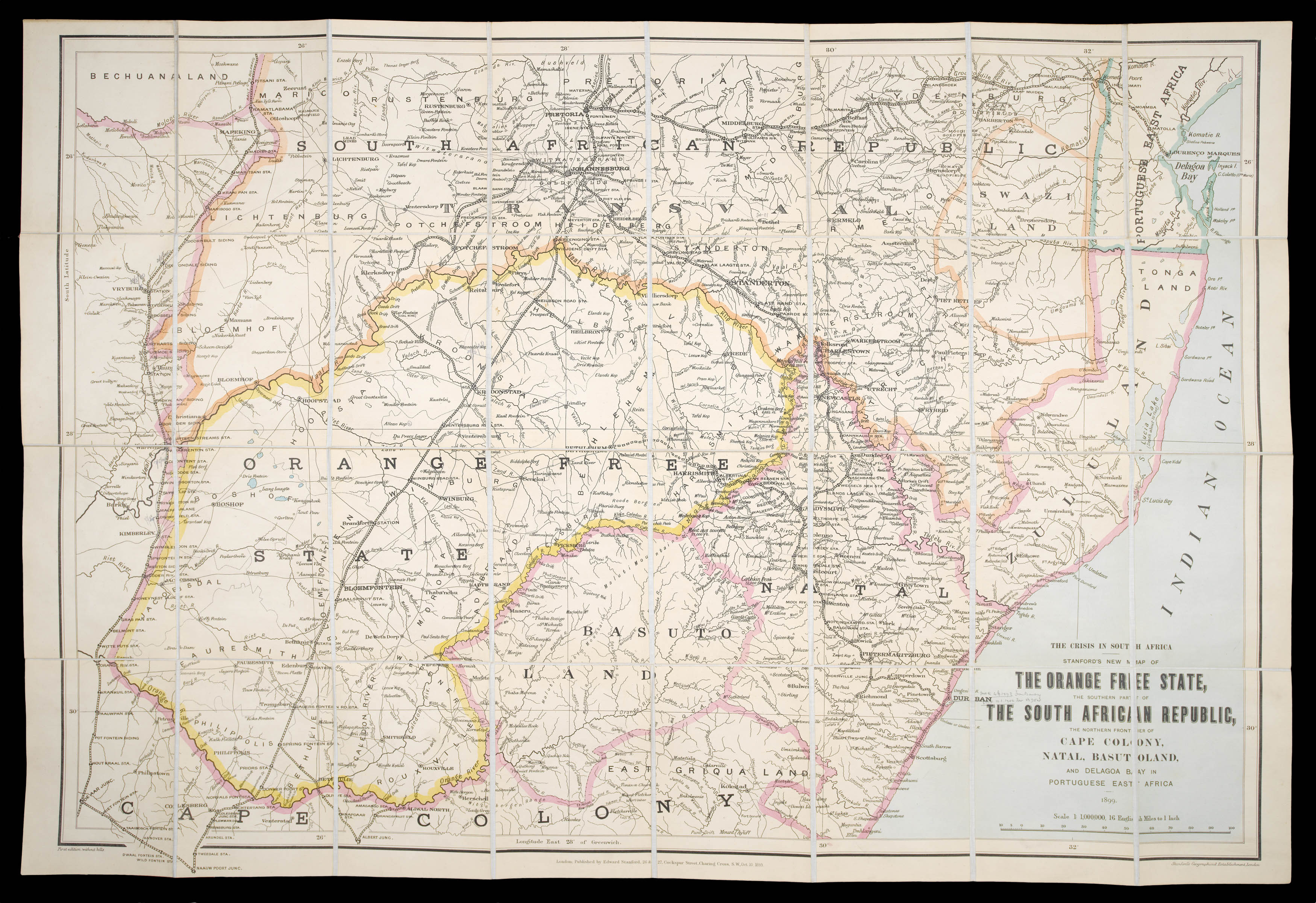
Stanford's New Map of the Orange Free State. the Southern African Republic, the Northern Frontier of Cape Colony, Natal, Batusoland and Delagoa Bay in Portuguese East Africa.
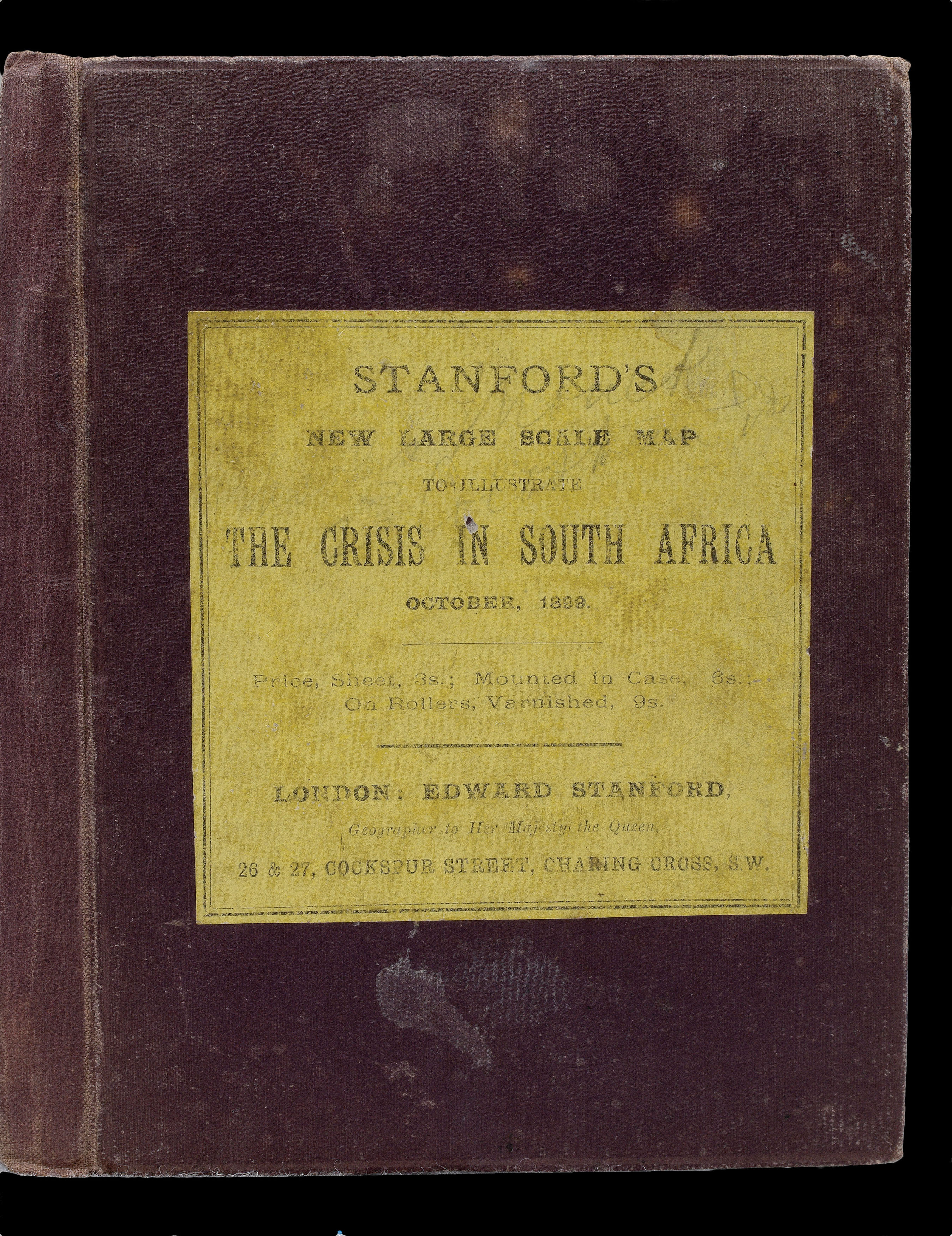
Edward Stanford, 26 & 27 Cockspur Street, Charing Cross,
10th October 1899
Lithographed and coloured, dissected and mounted on linen, bound in red cloth, publisher's label pasted on, yellow advertisement at endpaper of cover and map when folded, owners signature "Charles Monet" and possible address on endpaper
First issued in 1899, sometimes issued as two separate maps: of the Orange Free State; and the Southern Part of the South African Republic. With an inset of the southern tip of South Africa lower right and a table of distances lower left.
The South African War, also called the Boer War, the Second Boer War, or the Anglo-Boer War, was fought between Great Britain and the two Boer (Afrikaner) republics—the South African Republic (Transvaal) and the Orange Free Stat...
First issued in 1899, sometimes issued as two separate maps: of the Orange Free State; and the Southern Part of the South African Republic. With an inset of the southern tip of South Africa lower right and a table of distances lower left.
The South African War, also called the Boer War, the Second Boer War, or the Anglo-Boer War, was fought between Great Britain and the two Boer (Afrikaner) republics—the South African Republic (Transvaal) and the Orange Free State— between October 1899 and May 1902, resulting in British victory.
Edward Stanford (1827–1904), map maker and publisher, began his career in earnest when in 1853 he purchased his employer Trelawney Saunders' business, selling maps and charts in a stationer's shop at 6 Charing Cross. Stanford became sole proprietor and expanded his shop to 7 and 8 Charing Cross whilst acquiring premises on Trinity Place for a printing works. "This bold move solidified Stanfords as the largest, and indeed only map maker and seller in London at a time when British colonialism, the rise of the railways and the continuing popularity of the Grand Tour, meant demand for readily accessible, high quality cartography was building at remarkable pace." (Stanford's online). The company moved to their iconic London address in Longacre in 1873.