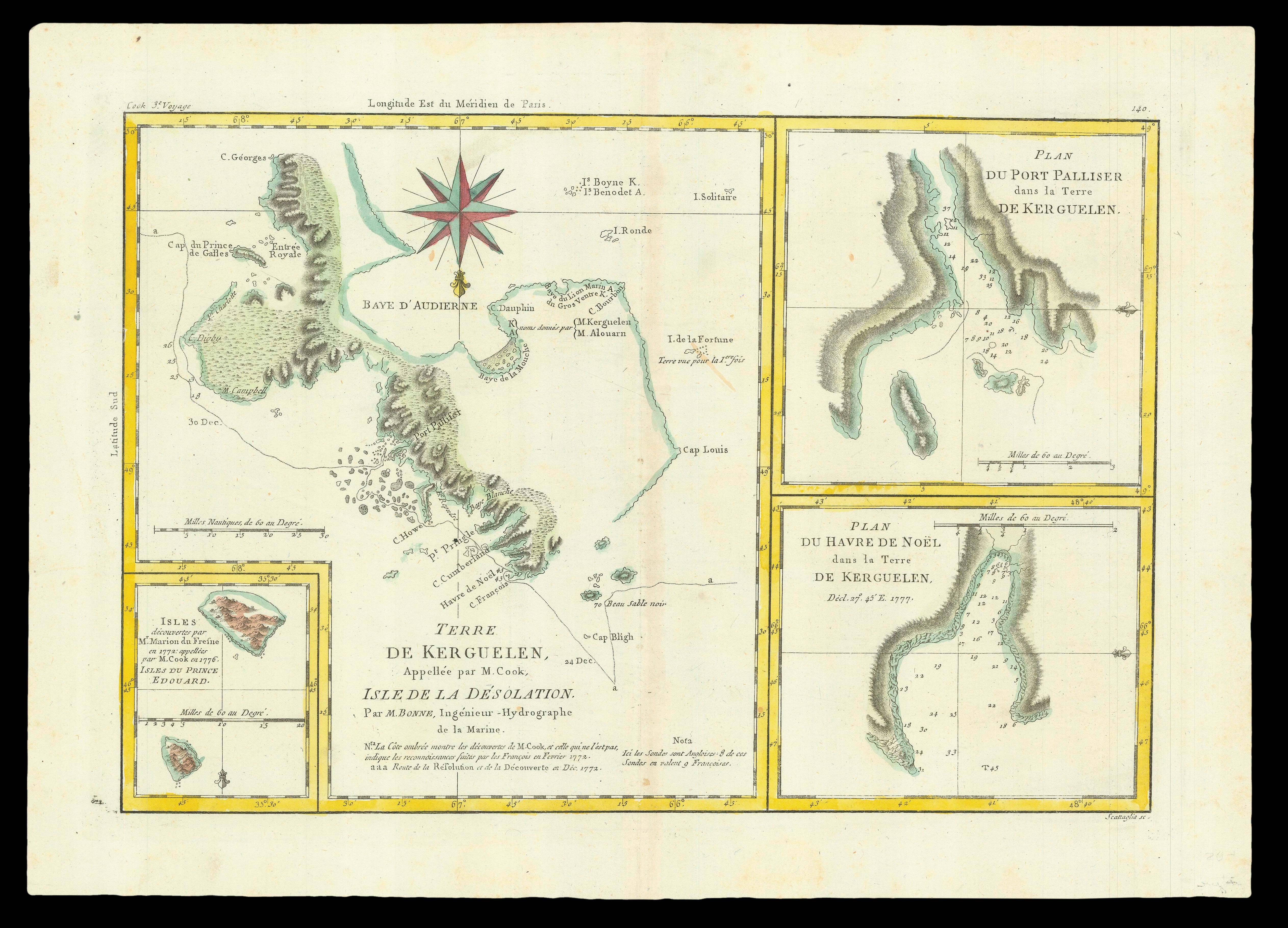
Published in the 'Atlas encylopédique', a French compilation of voyages including a French translation of the journals of Cook's third voyage. The main chart depicts Kerguelen Island, or Desolation Island, in the southern Indian Ocean, which Captain James Cook visited on his third voyage in December 1776, finding shelter from a storm there on Christmas Day. The central map shows Cook's track around the south of the island, with the incorrect date of 1772.
The she...
Published in the 'Atlas encylopédique', a French compilation of voyages including a French translation of the journals of Cook's third voyage. The main chart depicts Kerguelen Island, or Desolation Island, in the southern Indian Ocean, which Captain James Cook visited on his third voyage in December 1776, finding shelter from a storm there on Christmas Day. The central map shows Cook's track around the south of the island, with the incorrect date of 1772.
The sheet also includes two detailed charts of harbours on the island: 'Plan du Port Palliser, dans la Terre de Kerguelen'; and 'Plan du Havre de Noel, dans la Terre de Kerguelen', as well as an inset bottom left showing two islands discovered by Cook and Marion du Fresne.
 There was once a young man from Nantucket
1 × £3,000
There was once a young man from Nantucket
1 × £3,000