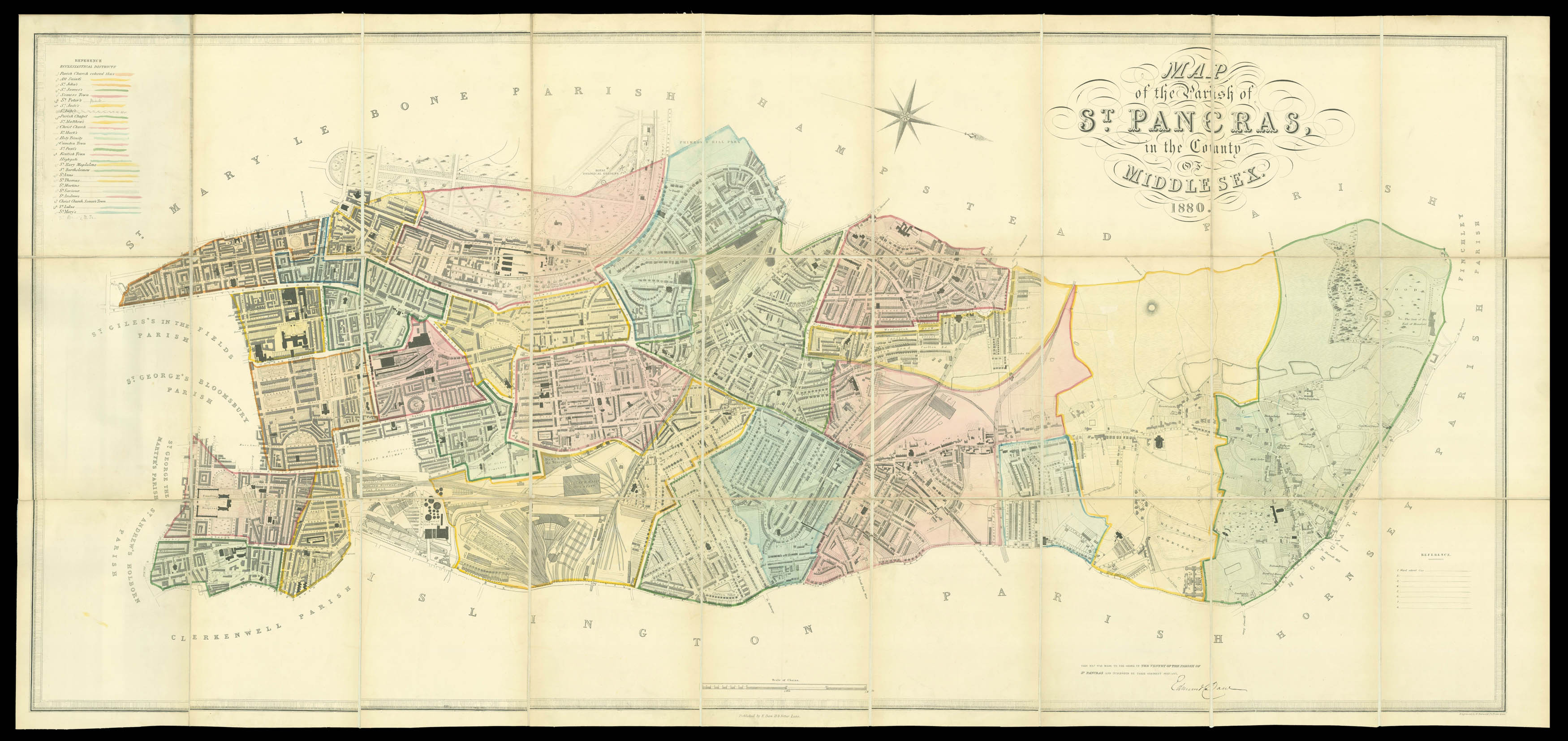
in the County of Middlesex 1874. The map is made to the order of the Vestry of the Parish of St. Pancras and published by their Obedient Servant Edmund Daw.
Large folding engraved plan with contemporary hand-colour in full, laid down on linen in 27 sections, folding into original publisher's green cloth covers.
The plan is orientated with north to the right, and extends west to east from the Royal Zoological Gardens, to the Euston Station and north to south from Highgate to University College London. With a list of Ecclesiastical districts upper left, list of wards with their distinguishing colours lower right.
Large scale Victorian plans are particularly rare, the present plan is no exception. We are only able to trace one institutional example, that in the British Lib...
The plan is orientated with north to the right, and extends west to east from the Royal Zoological Gardens, to the Euston Station and north to south from Highgate to University College London. With a list of Ecclesiastical districts upper left, list of wards with their distinguishing colours lower right.
Large scale Victorian plans are particularly rare, the present plan is no exception. We are only able to trace one institutional example, that in the British Library.
 Du vin, Monseigneur?
1 × £2,000
Du vin, Monseigneur?
1 × £2,000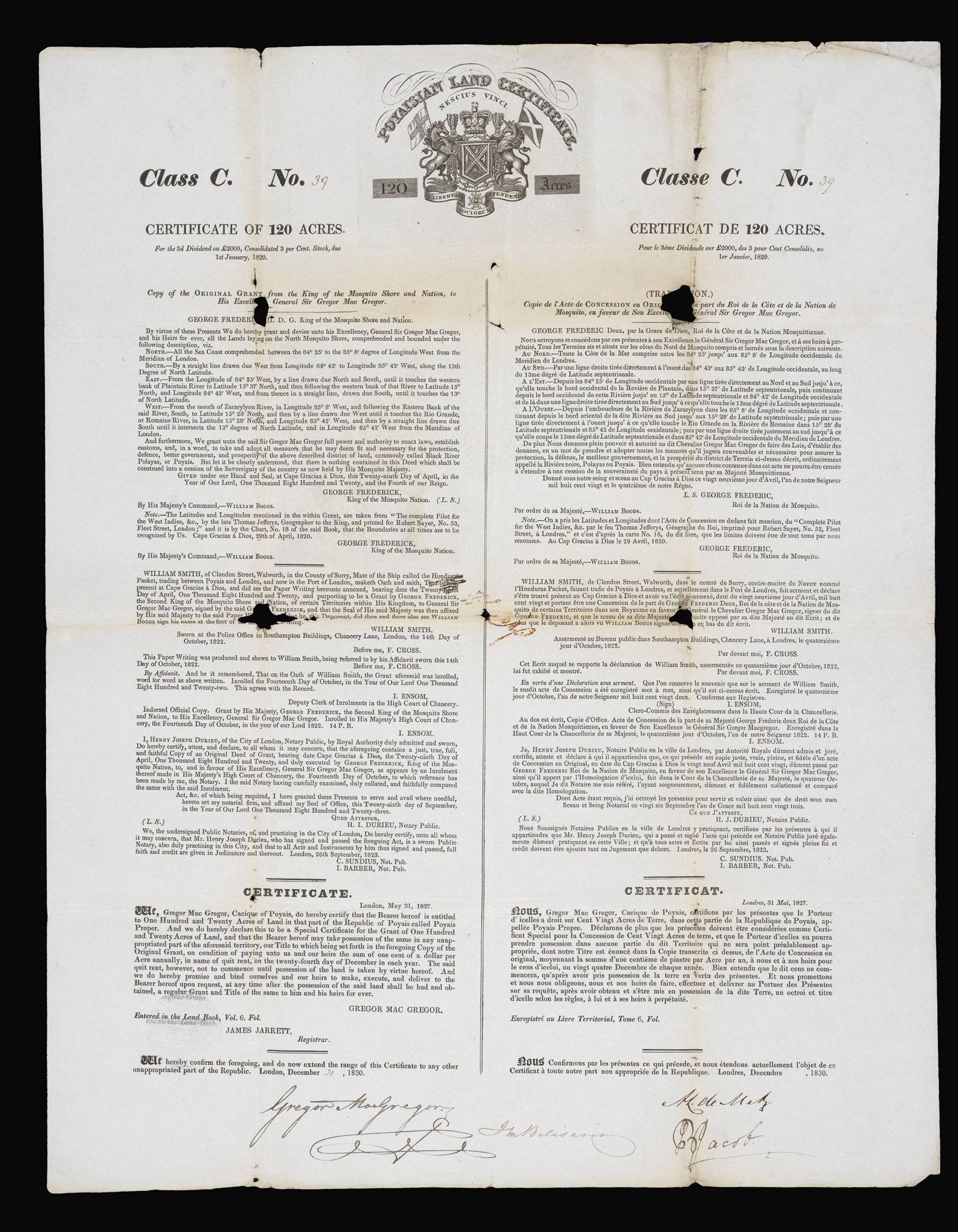 "The Fraud of the Prince of Poyais"
1 × £800
"The Fraud of the Prince of Poyais"
1 × £800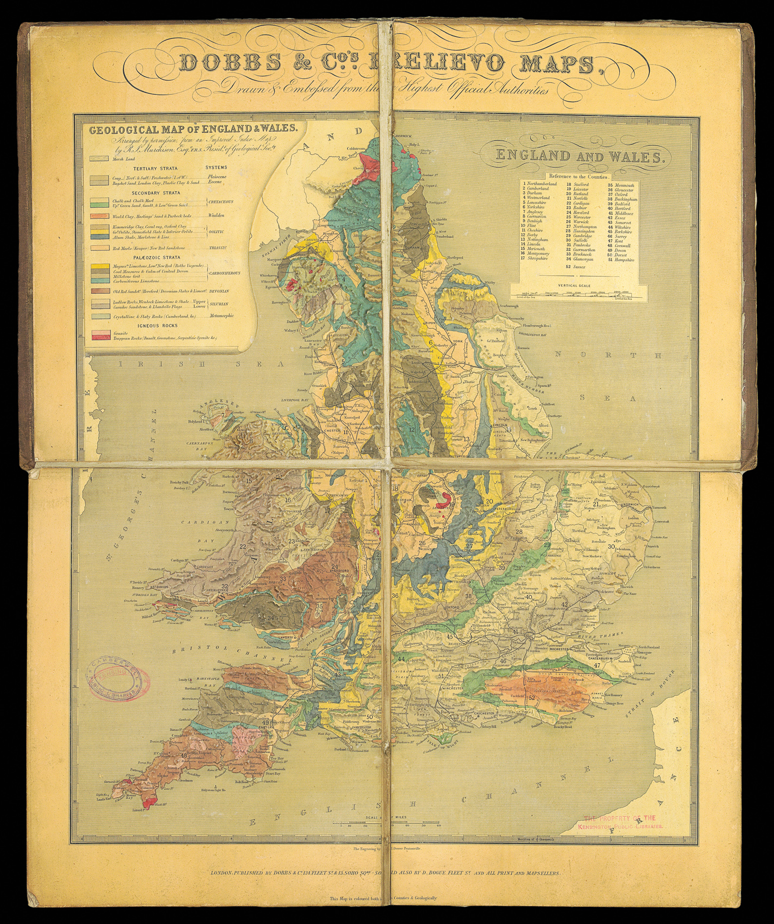 Rare Embossed Geological map of England and Wales
1 × £4,000
Rare Embossed Geological map of England and Wales
1 × £4,000 South America
1 × £1,500
South America
1 × £1,500