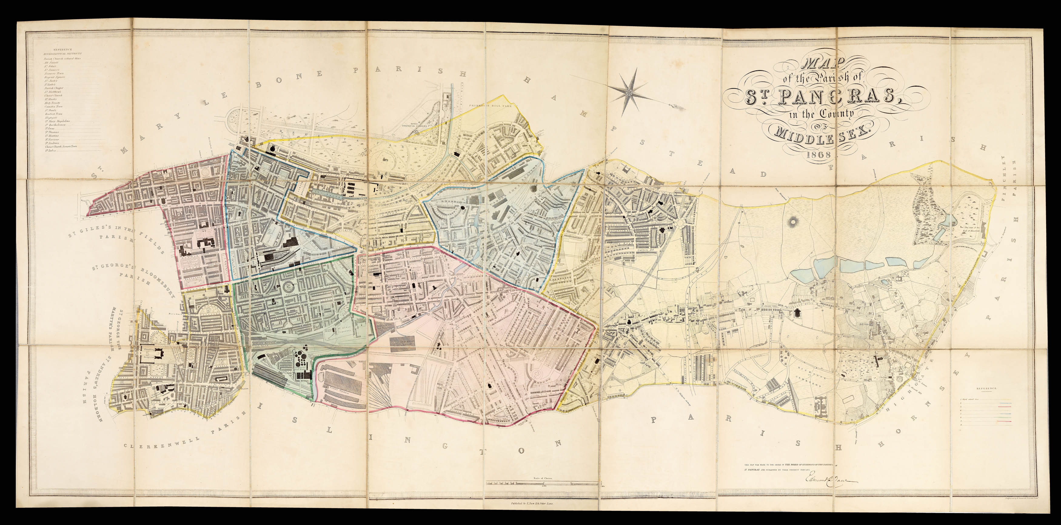
in the County of Middlesex 1874. The map is made to the order of the Vestry of the Parish of St. Pancras and published by their Obedient Servant Edmund Daw.
Large engraved plan with contemporary hand-colour in full, laid down on linen in 27 sections, list of Ecclesiastical districts upper left, list of wards with their distinguishing colours lower right.
Rare and detailed plan of St Pancras, orientated with north to the right, and extending from the Royal Zoological Gardens, to Euston Station and from Highgate to University College London. The plan is coloured according to wards and has a key to ecclesiastical districts to the upper left.
Large-scale Victorian plans are particularly rare, and this plan is no exception: one institutional example known, at the British Library.
Approximately 5 statue mil...
Rare and detailed plan of St Pancras, orientated with north to the right, and extending from the Royal Zoological Gardens, to Euston Station and from Highgate to University College London. The plan is coloured according to wards and has a key to ecclesiastical districts to the upper left.
Large-scale Victorian plans are particularly rare, and this plan is no exception: one institutional example known, at the British Library.
![[Anonymous] [Globe form inkwell].](https://omega.crouchrarebooks.com/wp-content/uploads/2025/03/15729_1H.jpg) Sign on the meridian line
1 × £4,500
Sign on the meridian line
1 × £4,500![WESTERMAYER, C[onrad] Johann Gabriel Doppelmair. Geb. zu Nürnberg 1671. Gest deselbst den 1. December 1750.](https://omega.crouchrarebooks.com/wp-content/uploads/2025/03/17740_1H.jpg) Johann Gabriel Doppelmayr
1 × £250
Johann Gabriel Doppelmayr
1 × £250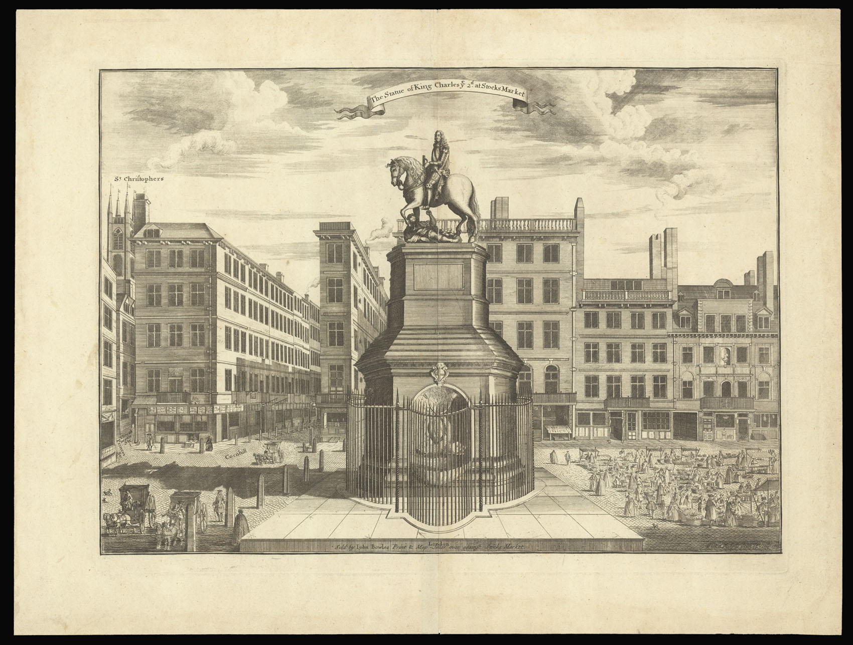 Standing on Cromwell's Head
1 × £500
Standing on Cromwell's Head
1 × £500