Frederick de Wit inde Kalverstraet inde Witte Paskaert,
[c1688].
Double-page engraved map (455 by 545mm to the neatline, full margins), with contemporary hand-colour in full (light oxidation strengthened with Japanese tissue on verso, old vertical fold).
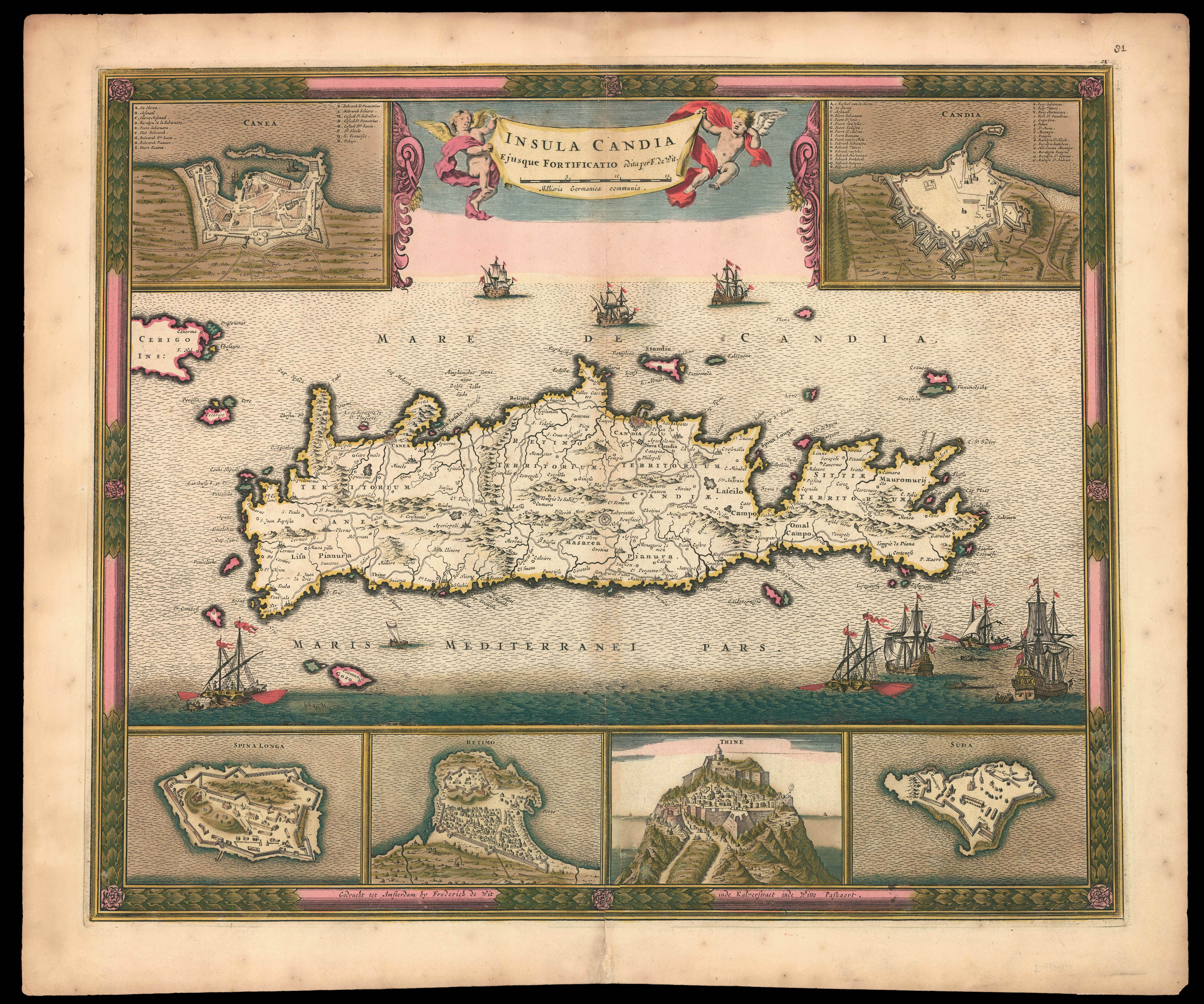
A fine and attractive map of Crete with rich contemporary hand-colouring. The island of Crete is set within the calm Mediterranean Sea, which teems with galleons, their tenders and local fishing boats. All are surrounded by six detailed insets of the fortified cities of Canea, Candia, Retimo, and Thine, and the islands of Spina Longa and Suda.
The map is based on the earlier work of French military engineer Sébastien de Pontault Beaulieu, 'Plan de L'Isle de Candi...
A fine and attractive map of Crete with rich contemporary hand-colouring. The island of Crete is set within the calm Mediterranean Sea, which teems with galleons, their tenders and local fishing boats. All are surrounded by six detailed insets of the fortified cities of Canea, Candia, Retimo, and Thine, and the islands of Spina Longa and Suda.
The map is based on the earlier work of French military engineer Sébastien de Pontault Beaulieu, 'Plan de L'Isle de Candie Iadis Crete', 1674.
When Frederick de Wit (1630-1706) moved to Amsterdam in 1648 he was already a well-established cartographic artist, engraving a plan of Haarlem around 1648 and providing city views for Antonius Sanderus's 'Flandria Illustrata'. He was apprenticed to Willem Blaeu, but by 1654 he had his own business, issuing his own map of the world, 'Nova Totius Terrarum Orbis Tabula', as both a wall map and a folio mapsheet in 1660. Two years later, he began to print atlases, the earliest of which were small compilations of prints from the stock of contemporaries. His later work included larger atlases of his own work. By the 1670s, de Wit was making atlases with over 150 maps.