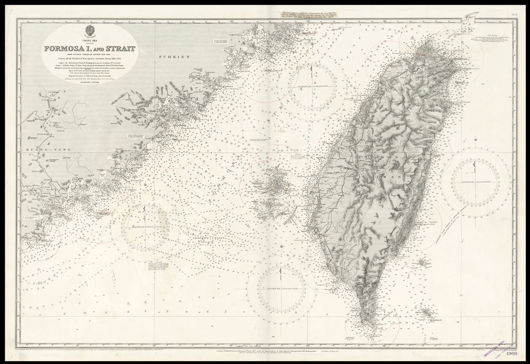
Engraved chart, including tidal information, compass roses, soundings, seabed notations, sandbanks, shoals, lighthouses and beacons picked out in yellow and red, inland elevations and detailing, a few red ink archs showing the radius of lighthouse illumination.
Detailed chart of Taiwan, published during Japanese colonial rule.
The British Hydrographic Office was founded in 1795 by George III, who appointed Alexander Dalrymple as the first Hydrographer to the Admiralty. The first charts were produced in 1800. Unlike the U. S. Coast Survey the Hydrographic Office was given permission to sell charts to the public and they produced a great number of sea charts covering every corner of the globe. Most of the Admiralty charts...
Detailed chart of Taiwan, published during Japanese colonial rule.
The British Hydrographic Office was founded in 1795 by George III, who appointed Alexander Dalrymple as the first Hydrographer to the Admiralty. The first charts were produced in 1800. Unlike the U. S. Coast Survey the Hydrographic Office was given permission to sell charts to the public and they produced a great number of sea charts covering every corner of the globe. Most of the Admiralty charts produced by the Hydrographic Office delineated coastline as well as high and low water marks and record depth of water as established by soundings. In addition these charts included information on shoals, reefs, and other navigational hazards that plagued mariners across the world. Thanks to the innovations of Sir Francis Beaufort, who developed the Beaufort Scale of wind strength, the British Hydrographic Office became one of the leading producers of sea charts. In fact, such was their accuracy that the phrase 'Safe as an Admiralty Chart' was coined.
 Globi Neerlandici
1 × £330
Globi Neerlandici
1 × £330