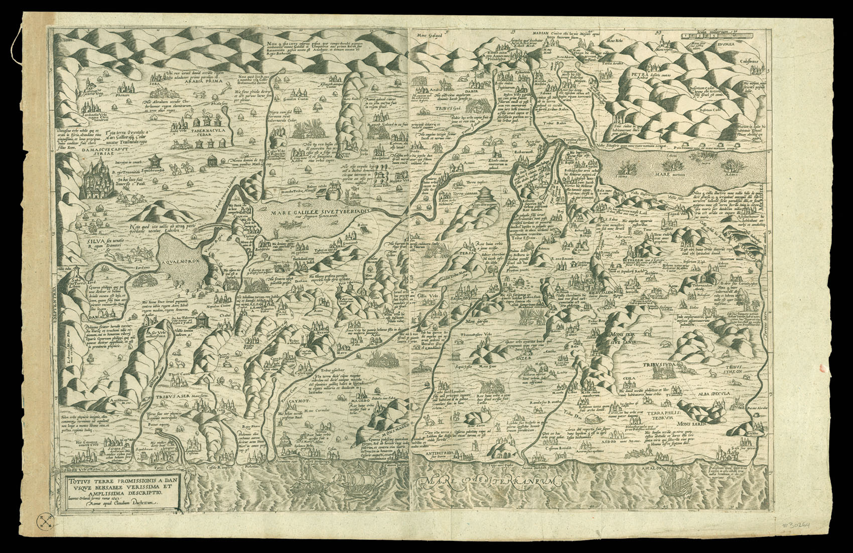
Highy detailed early map of the Holy Land, first issued by Claudio Duchetti in Rome in 1572.
The title translates as "A true and large description of the Promised Land, from Dan to Beersheba."
The map is printed with two plates and oriented with East at the top and shows the shoreline of Palestine from Gaza to Sidon. Laor notes:
"Although the title claims to be a true description, there are many errors in the location of the places. The imp...
Highy detailed early map of the Holy Land, first issued by Claudio Duchetti in Rome in 1572.
The title translates as "A true and large description of the Promised Land, from Dan to Beersheba."
The map is printed with two plates and oriented with East at the top and shows the shoreline of Palestine from Gaza to Sidon. Laor notes:
"Although the title claims to be a true description, there are many errors in the location of the places. The important cities with the buildings are represented and the different episodes mentioned in the Bible are explained on the map. In the Dead Sea, the cities are shown as burning".
Laor noted the original edition and this edition by Giovanni Orlandi, published in 1602, which is largely identical to the original, with the exception of the added credit in the title.
We note only the examples in the Bibliotheque Nationale de France and the Jewish National & University Library for the original Duchetti edition and an unrecorded Florimi edition in the BNF and British Library. Laor does not note the location of the Orlandi edition, but does indicate that the source of his record for the original Duchetti as being Beans 42, a reference to one of the Lafreri Atlases collated by George Beans.
The present example is trimmed to the plate mark and mounted on a larger sheet of paper. A comparison to the Jewish national & University Library copy shows that the map is complete, with no loss of image (see: www.jnul.huji.ac.il/dl/maps/pal/html/heb/pal002368527.htm).
 First edition
1 × £1,500
First edition
1 × £1,500![HOLLAR, W[enceslaus] [after Peter Paul RUBENS] Peter Paul Rubens](https://omega.crouchrarebooks.com/wp-content/uploads/2025/03/18246_1H.jpg) Rubens by Hollar
1 × £400
Rubens by Hollar
1 × £400![[HONDIUS, Colette] [Mercator Hondius Double Portrait] Gerardus Mercator natus Rupelmundae III non Martii anno CDDXII: visit ann. LXXXII. M. VIII. D. XXVI: denatus IV non. Decembris anno CDDXCIV. Iudocus Hondius natus in pago Flandriae dicto Wackene XVI Kalen Novembris anno CDDLXIII: vixit ann. XLVII. M. VII. D. XXIX: denatus XIV Kal. Martii anoo CDDCXII.](https://omega.crouchrarebooks.com/wp-content/uploads/2025/03/12525_1H.jpg) The celebrated double-portrait of Gerard Mercator and Jodocus Hondius
1 × £2,500
The celebrated double-portrait of Gerard Mercator and Jodocus Hondius
1 × £2,500 An innovative globe
1 × £3,000
An innovative globe
1 × £3,000![HOLLAR, W[enceslaus] [after] Ant[hony] van DYCK Carolus II DG Magna Brittania Fra et Hibernia Rex](https://omega.crouchrarebooks.com/wp-content/uploads/2025/03/18289_1H.jpg) The young Charles II
1 × £400
The young Charles II
1 × £400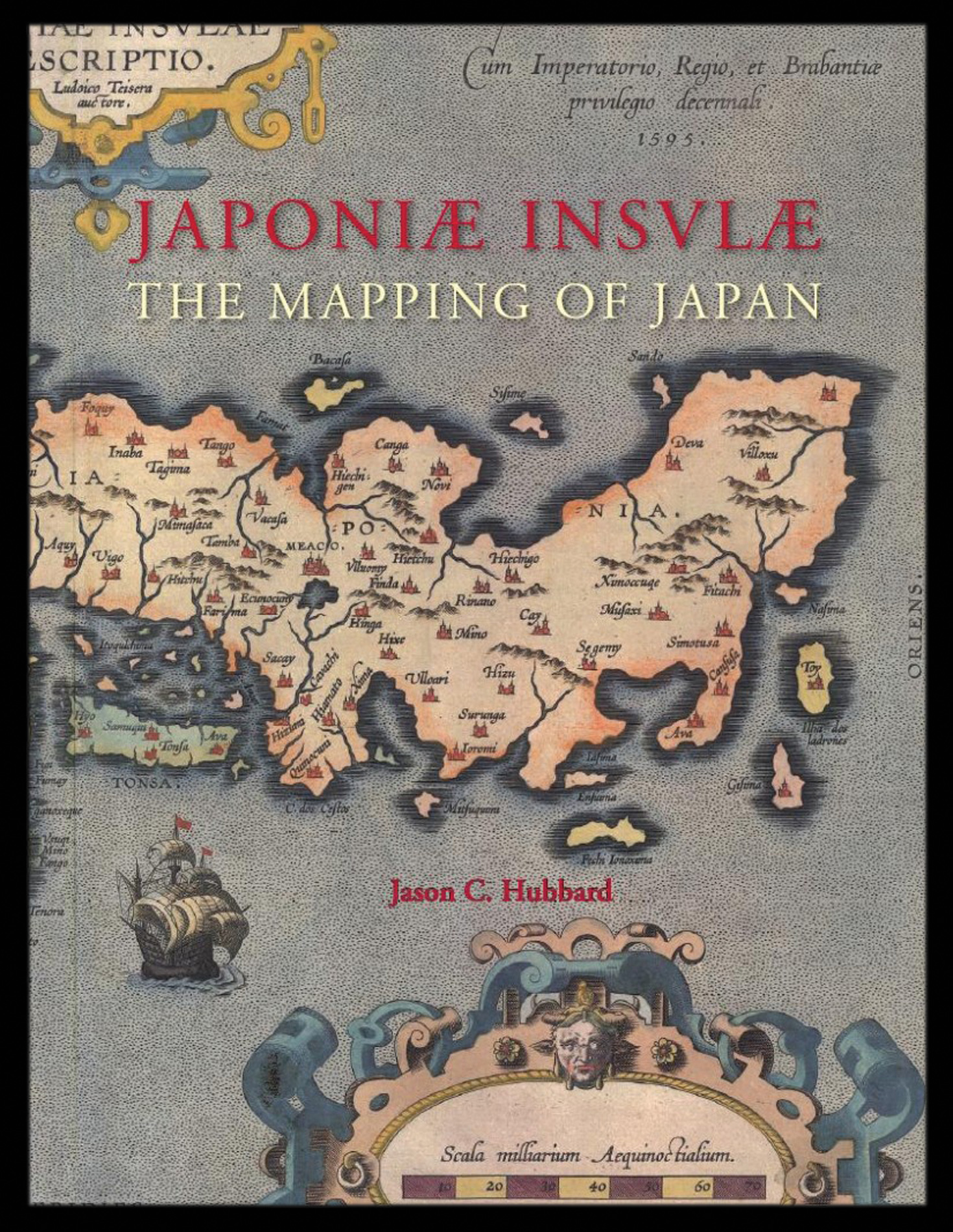 Hubbard's cartobibliography of Japan
1 × £159
Hubbard's cartobibliography of Japan
1 × £159![AUDINET, P[hilip] after COOPER, B. West View of Temple Bar](https://omega.crouchrarebooks.com/wp-content/uploads/2025/03/12369_1H.jpg) Temple Bar
1 × £450
Temple Bar
1 × £450