Large map of Sri Lanka detailing British and Kandyan possessions at the end of the first Kandyan War.
The British, fearing that French control of the Netherlands would result in their controlling the strategically important port of Trincolmanee, occupied Dutch possessions in Sri Lanka in 1795. Initially the British encountered little resistance to their occupation and they soon controlled most of the Dutch territory, which covered the whole of the low-lying Sri L...
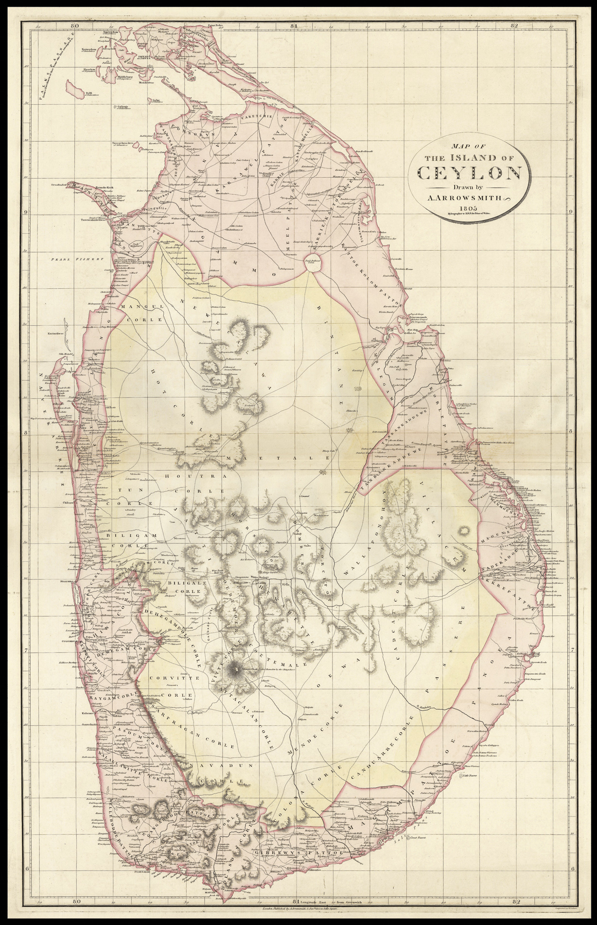
Large map of Sri Lanka detailing British and Kandyan possessions at the end of the first Kandyan War.
The British, fearing that French control of the Netherlands would result in their controlling the strategically important port of Trincolmanee, occupied Dutch possessions in Sri Lanka in 1795. Initially the British encountered little resistance to their occupation and they soon controlled most of the Dutch territory, which covered the whole of the low-lying Sri Lankan coast. British possession would later be enshrined at the Treaty of Amiens of 1802.
The interior of the island was controlled by the Kingdom of Kandy, which had lived in uneasy and sometimes violent peace with the previous colonial incumbents – the Dutch and the Portuguese before them - for the past 200 years. This uneasiness continued and, in 1803, the first Kandyan War broke out when the British marched into Kandyan territory. Although they successfully occupied the capital Senkadagala (Kandy), resistance was stronger than expected and the army, weakened by disease, was resoundingly defeated. The war would continue for another two years with neither side gaining the decisive victory, and it would not be until 1815 - when the British were invited in to overthrow the Sri Vikrama Rajasingha - that they would gain control of central Sri Lanka.
Aaron Arrowsmith (1750-1823) was the finest cartographer of his generation. Although he received little formal education it is believed that he was taught some mathematical instruction by William Emerson, an author of several books on the application of mathematics to the area of cartography. Around 1770, Arrowsmith moved to London to seek employment. It is believed that he worked for William Faden before joining John Cary Sr. in the early 1780s. There he provided the measurements for John Cary's early publication detailing the roads from London to Falmouth, his first signed work. Arrowsmith set up on his own in 1790 and over the next thirty years produced some of the most beautiful and elegant maps of the era.
Rare. We are only able to trace two institutional examples of the map: those of the Bodleian and the British Library.