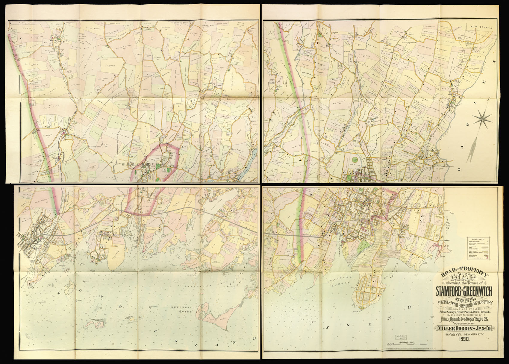
Road and Property Map showing the Towns of Stanford And Greenwich Conn.
together with the surrounding territory compiled from actual surveys, private plans, and official records, by and under the direction of Miller Robbins Jr. & Forsey Breou C. E.
Published by Miller Robbins Jr. & Co., 36 Vesey St.,
1890
Lithograph map, fine original hand-colour, dissected and mounted on linen, in four sections, a few minor tears to old folds, each section folding onto red calf board, rubbed.
Very detailed huge wall map in four sections of Greenwich and Stamford, Connecticut, with surrounding towns. Names of the owners of various properties shown. Various tones of outline and shading color. Key for stores and dwellings, barns and stables, gas mains, water mains, sewer, steam railroad, horsecar railroad, public roads, private and proposed roads, churches, schools, cemeteries, factories and public buildings. Water depth indicated for Long Island Sound.
...
Very detailed huge wall map in four sections of Greenwich and Stamford, Connecticut, with surrounding towns. Names of the owners of various properties shown. Various tones of outline and shading color. Key for stores and dwellings, barns and stables, gas mains, water mains, sewer, steam railroad, horsecar railroad, public roads, private and proposed roads, churches, schools, cemeteries, factories and public buildings. Water depth indicated for Long Island Sound.