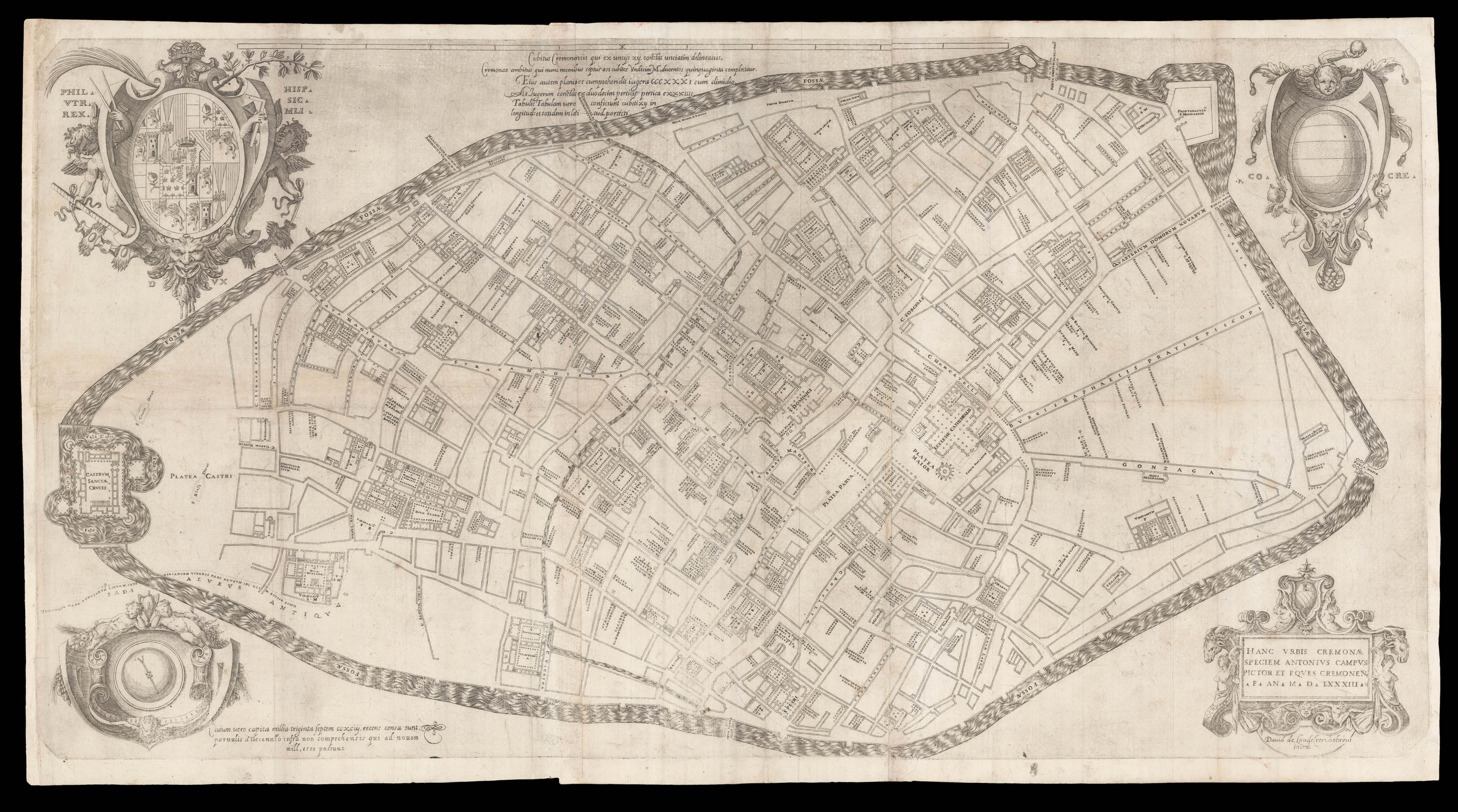
Antonio Campi (1525-1587) was a painter, architect and surveyor from Cremona. He is recorded as making a map of the Territory of Cremona in 1571, later used as a source by Abraham Ortelius; he later made a second map of the region, published in 1583, and in 1585 published his 'Cremona fedelissima Citta et nobilissima colonia de Romani rappresentata in disegno con suo contado...', which contained a map of the area. In parallel, Campi published this large plan of Cremona, eng...
Antonio Campi (1525-1587) was a painter, architect and surveyor from Cremona. He is recorded as making a map of the Territory of Cremona in 1571, later used as a source by Abraham Ortelius; he later made a second map of the region, published in 1583, and in 1585 published his 'Cremona fedelissima Citta et nobilissima colonia de Romani rappresentata in disegno con suo contado...', which contained a map of the area. In parallel, Campi published this large plan of Cremona, engraved by David de Laude, who proudly proclaimed himself a Jew.
The plan represents the urban centre during a period of economic prosperity: The Treaty of Noyon, signed in 1513, assigned Cremona to Spain and the new rulers had implemented their control by 1524. During the period of Spanish rule, the city underwent general building improvements and expansion. Campi's plan clearly shows an intricate network of roads lined with buildings, important constructions set in their own squares, and the city walls, a key defensive feature for a city located between the Duchies of Milan and Venice.
![D'APRES DE MANNEVILLETTE, Jean-Baptiste Le Neptune Oriental, dédié au Roi [with] Supplement](https://omega.crouchrarebooks.com/wp-content/uploads/2025/03/15135_1H.jpg) The greatly enlarged second edition of this rare French Sea Atlas with four maps of the Arabian Peninsula
The greatly enlarged second edition of this rare French Sea Atlas with four maps of the Arabian Peninsula