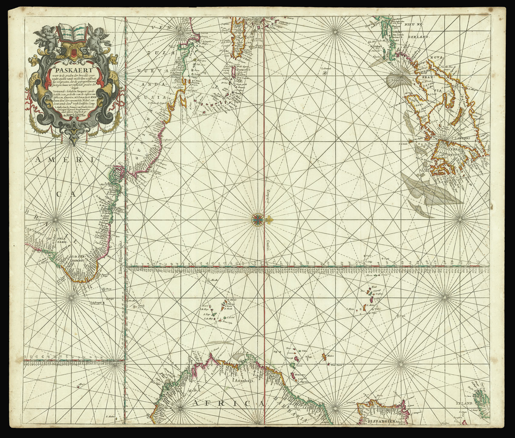
Paskaert waer in de graden der breedde over weder zyden vande middellyn wassende soo vergrooten
dat die geproportioneert syn tegen hunne nevenstaende graden der lengde. Vertonende (behalven Europaes zuydelyckste) een gedeelte van de custen van Africa en America, in 't Octroy by de H.M.H. Staten Genl. der vereenichde Nederl. verleent aende Genle. West-Indische Comp.
A chart of the Atlantic, oriented to the west, from van Keulen's 'Zee-Atlas'.
Johannes van Keulen (1654-1715) was a Dutch maritime publisher. He established a bookselling and instrument making business in Amsterdam in 1678, and by 1680 he had obtained a privilege from Holland and West Friesland to print pilot guides and sea atlases. His first major production was the atlas 'Nieuwe Lichtende Zee-Fakkel', illustrated by Jan Luyken and with maps by Claes Jansz Voogh...
A chart of the Atlantic, oriented to the west, from van Keulen's 'Zee-Atlas'.
Johannes van Keulen (1654-1715) was a Dutch maritime publisher. He established a bookselling and instrument making business in Amsterdam in 1678, and by 1680 he had obtained a privilege from Holland and West Friesland to print pilot guides and sea atlases. His first major production was the atlas 'Nieuwe Lichtende Zee-Fakkel', illustrated by Jan Luyken and with maps by Claes Jansz Vooght. Five volumes were published between 1681 and 1684. Van Keulen also produced a 'Zee-Atlas'. Van Keulen chose an advantageous time to enter his profession, as many of the great early seventeenth century mapmakers were closing down or at the end of their careers, and therefore putting their stock and copperplates on the market.