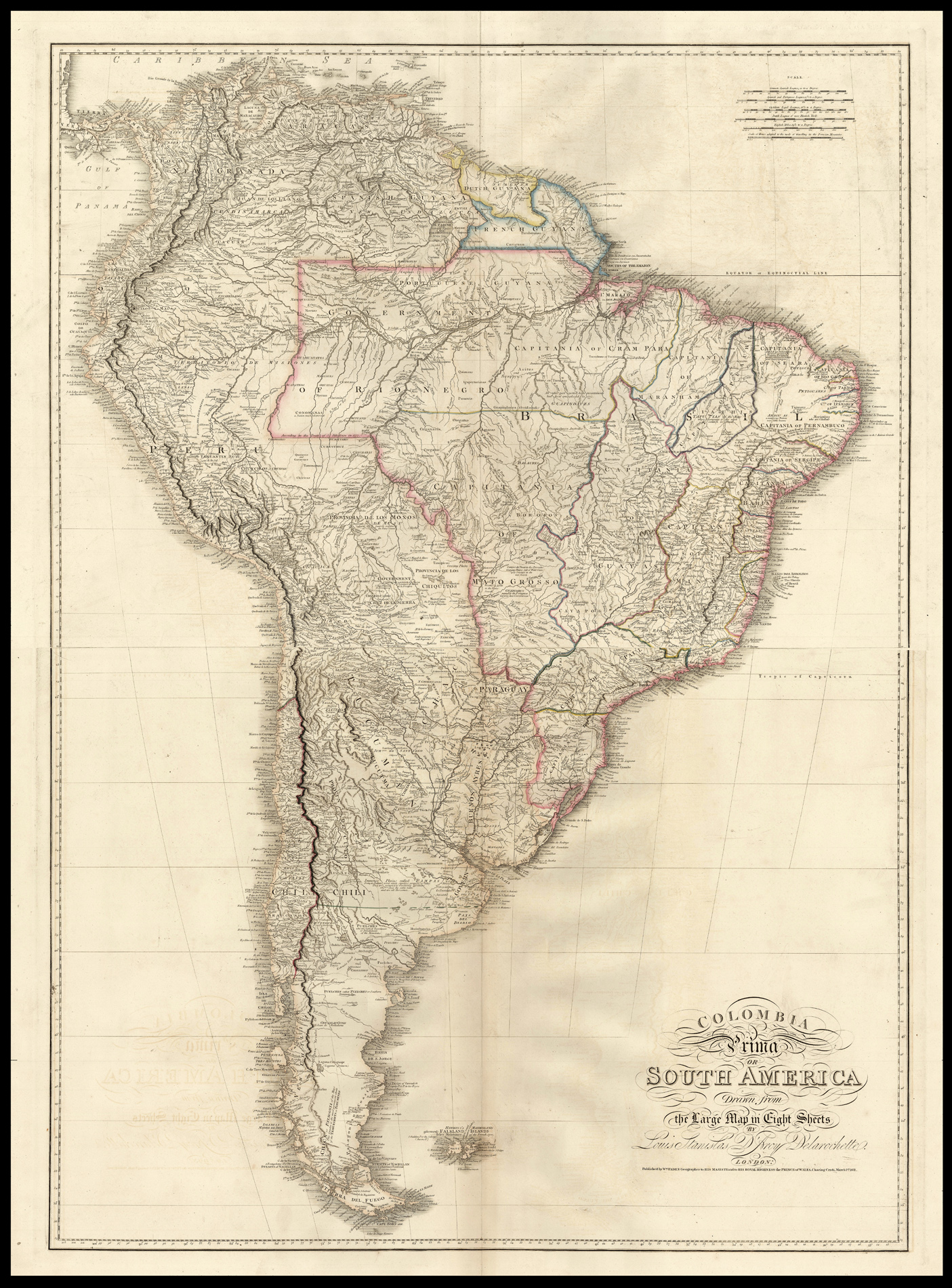
Large and detailed map of South America published at the beginning of the continent's struggle for independence from Spanish and Portuguese rule.
The map is a reduction of Louis Stanislas D'Arcy Delarochette's large map of the continent on eight sheets. Delarochette (1731-1802) was a cartographer and engraver working in London, who produced maps for both the Bowles family and William Faden. This particular map would run through several editions throughout the nin...
Large and detailed map of South America published at the beginning of the continent's struggle for independence from Spanish and Portuguese rule.
The map is a reduction of Louis Stanislas D'Arcy Delarochette's large map of the continent on eight sheets. Delarochette (1731-1802) was a cartographer and engraver working in London, who produced maps for both the Bowles family and William Faden. This particular map would run through several editions throughout the nineteenth century, first bearing Faden's imprint and later that of his successor James Wyld.
William Faden (1750-1836) began his career in cartography after taking over the business of Thomas Jefferys, a highly respected British mapmaker. Initially publishing under the name Faden and Jefferys, he followed his predecessor by specialising in maps of North America, resulting in the publication of a collection of them in the 'North American Atlas' in 1777. Twice honoured by the Royal Society for his work, he became Geographer to the King in 1783, and was chosen in 1801 to create and print the first of the Ordnance survey maps.