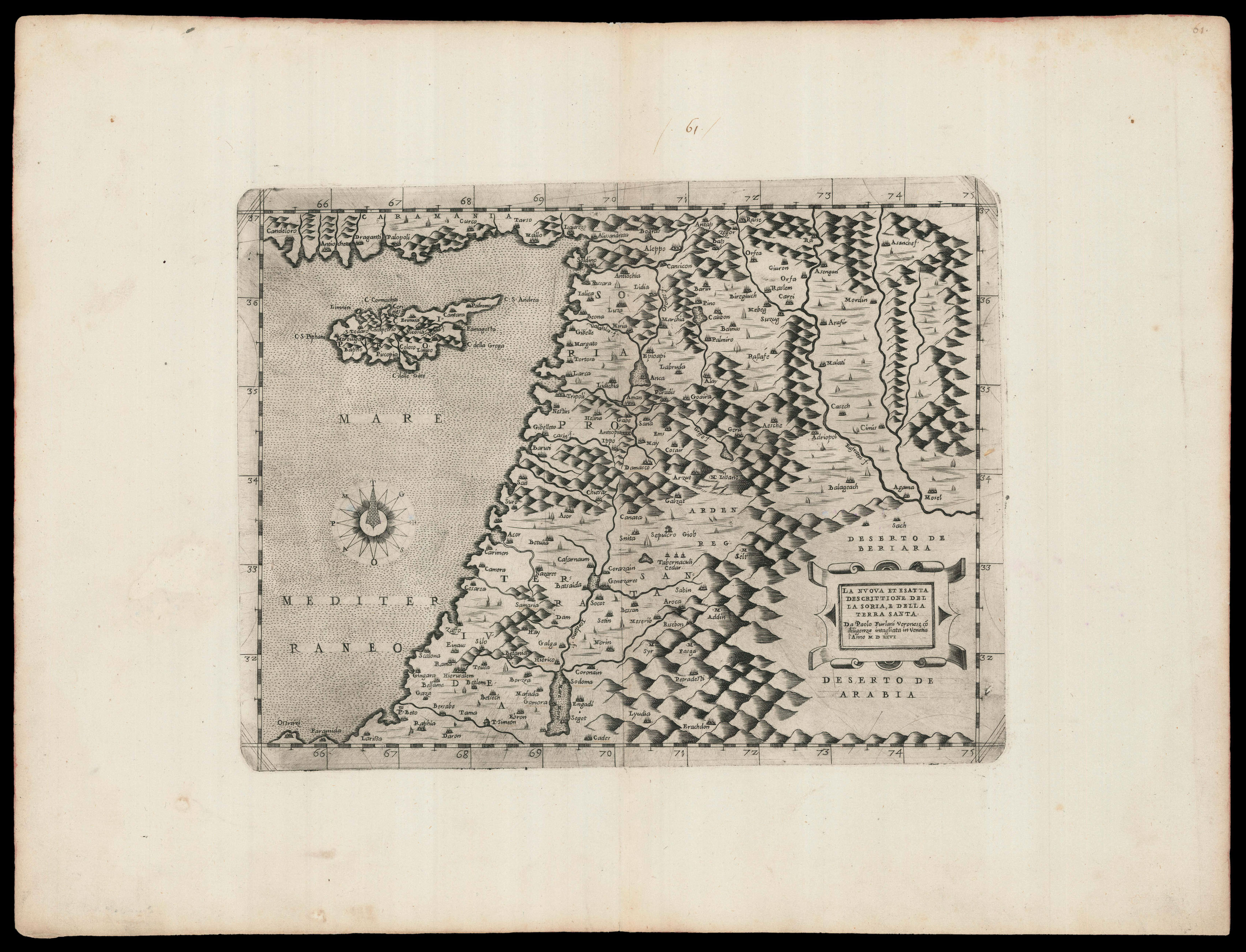
Printed from a possible discarded first issue plate, with the date in the title cartouche in Roman numerals, rather than Arabic, and with the line break after 'esatta' in the title.
An unusual map showing the coast of the Holy Land with Cyprus, and the Levant coast to the south of the Dead Sea, engraved and published by Paolo Forlani. The map is based on Martin Waldseemüller's cartography in the 1513 edition of Ptolemy's 'Geographia': Forlani probably saw Giorda...
Printed from a possible discarded first issue plate, with the date in the title cartouche in Roman numerals, rather than Arabic, and with the line break after 'esatta' in the title.
An unusual map showing the coast of the Holy Land with Cyprus, and the Levant coast to the south of the Dead Sea, engraved and published by Paolo Forlani. The map is based on Martin Waldseemüller's cartography in the 1513 edition of Ptolemy's 'Geographia': Forlani probably saw Giordano Ziletti's edition published in Venice in 1561, enlarged it and added the decorative title cartouche and the wind rose.
The variant with Arabic numerals appears in two states, the second published by Donato Bertelli.
There are institutional examples in the Danish National Library, Leiden University Library, National Library of Israel and the Bibliothèque nationale de France.