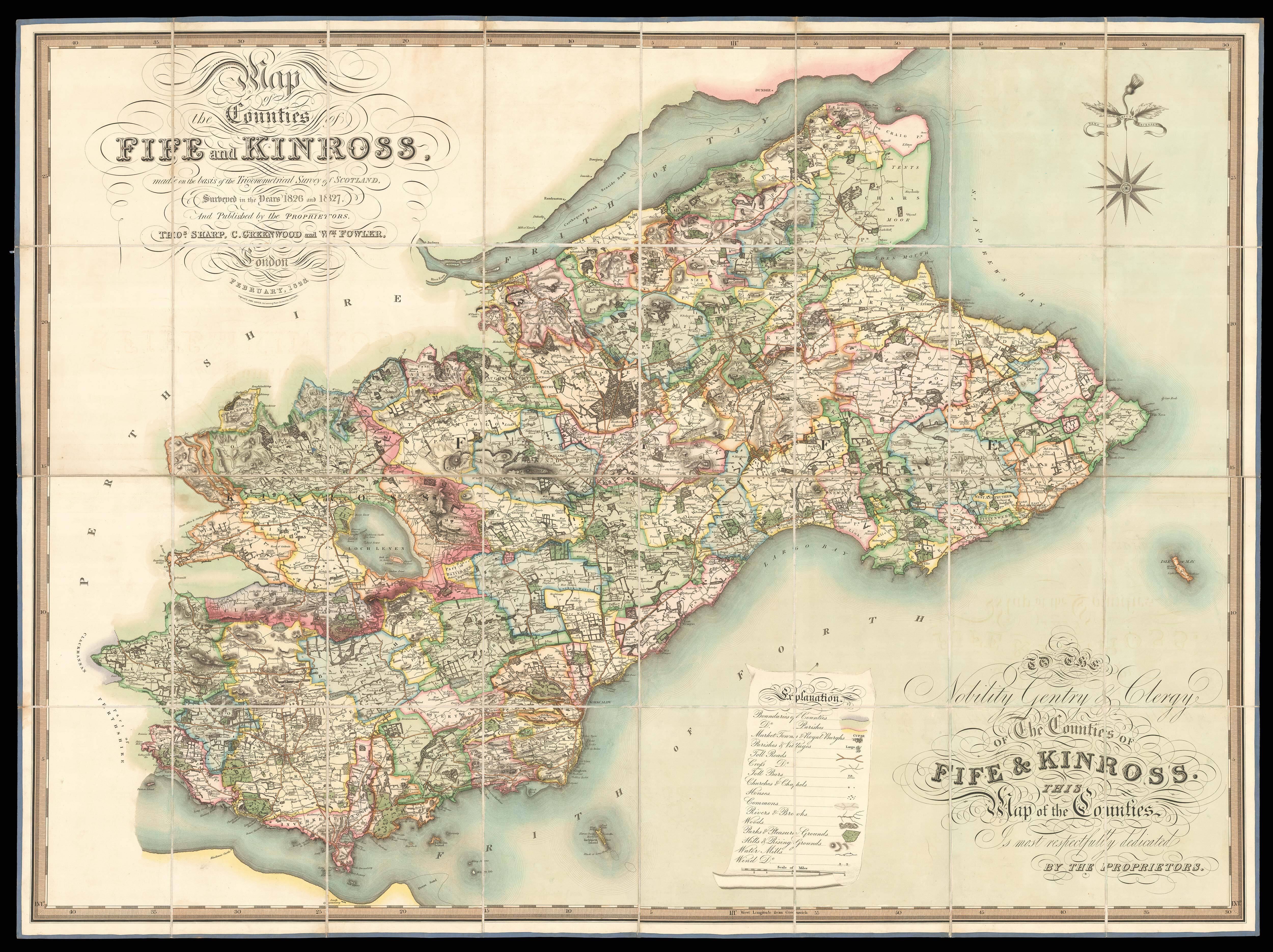
made on the basis of the Trigonometrical Survey of Scotland, Surveyed in the Years 1826 and 1827, And Published by the Proprietors. Thomas Sharp, C. Greenwood and Wm. Fowler. To the Nobility, Gentry, & Clergy of the Counties of Fife & Kinross This Map of the Counties Is most respectfully dedicated by the Proprietors.
GREENWOOD, Christopher; FOWLER, William; SHARP, Thomas
London,
Thomas Sharp, Christopher Greenwood, William Fowler,
February, 1828.
Engraved large-scale map, hand-coloured, dissected and mounted on linen, edged in blue silk, some silk edging lacking, some fraying at edges, folding into original calf pull-off slipcase lettered in gilt, rubbed.
The maps by Christopher and John Greenwood set new standards for large-scale surveys. From a technical point of view the Greenwoods' productions exceeded the high standards set in the previous century though without the decoration and charming title-pieces that typified large scale maps of that period.
The Greenwoods started in 1817 with Lancashire and Yorkshire and by 1831 they had covered 34 counties. Their maps were masterpieces of surveying and engraving tech...
The maps by Christopher and John Greenwood set new standards for large-scale surveys. From a technical point of view the Greenwoods' productions exceeded the high standards set in the previous century though without the decoration and charming title-pieces that typified large scale maps of that period.
The Greenwoods started in 1817 with Lancashire and Yorkshire and by 1831 they had covered 34 counties. Their maps were masterpieces of surveying and engraving techniques, and in view of the speed at which they were completed, their accuracy is remarkable. They mark the boundaries of the counties, hundreds and parishes, churches and chapels, castles and quarries, farmhouses and gentlemen's seats, heaths and common land, woods, parliamentary representatives and distances between towns. The price of 3 guineas each compares with the first edition Ordnance Survey sheets of 7s 6d, though the latter did not relate to complete counties.
The present map is one of only four Scottish counties that Greenwood published. All four maps were published in conjunction with Thomas Sharp and William Fowler, and took as their base the Trigonometrical Survey of Scotland. The first surveys of Scottish lands began in 1809 until around 1822. The survey would later be continued and amended in 1834.