One of the most detailed surveys of the southern Arabian coast carried out in the nineteenth century.
The survey was the work of by Captain Haines, Lieutenant Grieve, and Lieutenant Careless, who were in the employ of the Indian Navy.
In 1837, Captain Haines persuaded the sultan of Lahej to sell Aden, to the East India Company, despite the opposition of his son, who tried to kidnap Haines to thwart the sale. Haines returned to India, but because there ...
One of the most detailed surveys of the southern Arabian coast carried out in the nineteenth century.
The survey was the work of by Captain Haines, Lieutenant Grieve, and Lieutenant Careless, who were in the employ of the Indian Navy.
In 1837, Captain Haines persuaded the sultan of Lahej to sell Aden, to the East India Company, despite the opposition of his son, who tried to kidnap Haines to thwart the sale. Haines returned to India, but because there was a fear that Mehmet Ali Pasha, governor of Egypt, might seize Aden, Haines returned with 700 troops and successfully stormed the town on 19 January 1839. Haines was appointed political agent, and administered Aden from 1839 to 1854, being promoted captain in 1841.
Aden would become a strategically important port along the trade route from England to India. From their base at Aden the British began to steadily grapple with the problem of piracy that had been plaguing much of British shipping. In order to achieve this they required the most up-to-date hydrographic information, hence the significant increase in the charting of the region by the likes of Haines, Sanders, Grieve, Carless, and Moresby. In fact by the middle of the eighteenth century whole of the Arabian Peninsula had been surveyed.
The Indian Navy was the naval arm of the East India Company. It had been established by the Company as early as 1612 when it protected the their nascent commercial interests. In 1686 with most of the English commerce moving to Bombay the navy was renamed 'The Bombay Marine'. A name that it would keep for the next 144 years, until in 1830, it was renamed the 'Her Majesty's Indian Navy'. This title would, however, not be so long lived and in 1858, when the EIC was relieved of its administration of India the navy was brought under the control of the British State.
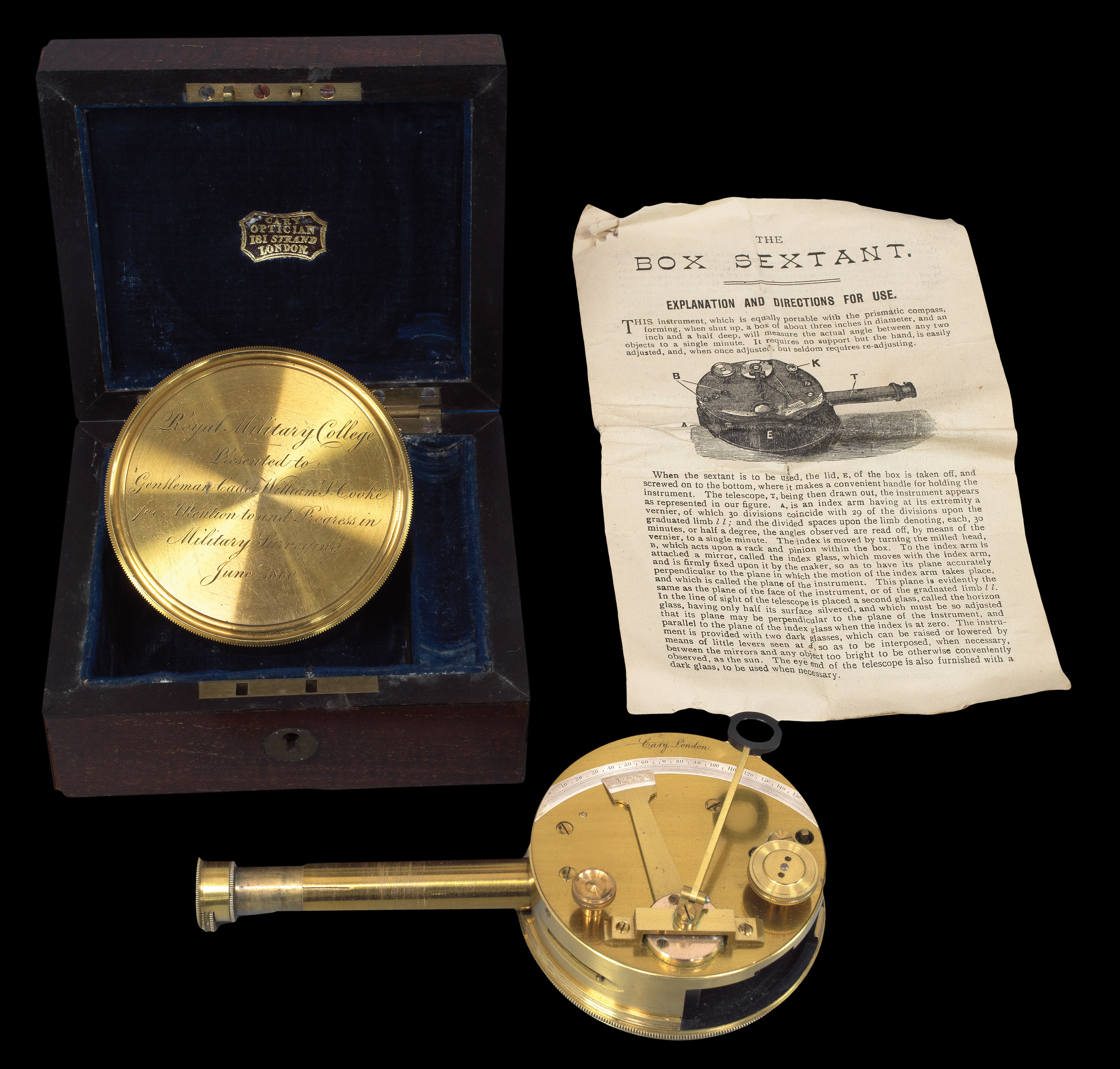 Rare Pocket Sextant
1 × £1,500
Rare Pocket Sextant
1 × £1,500![[MAPSELLER] [Porcelain figure of a mapseller]](https://omega.crouchrarebooks.com/wp-content/uploads/2025/03/17626_1H.jpg) The Meissen Mapseller
1 × £2,000
The Meissen Mapseller
1 × £2,000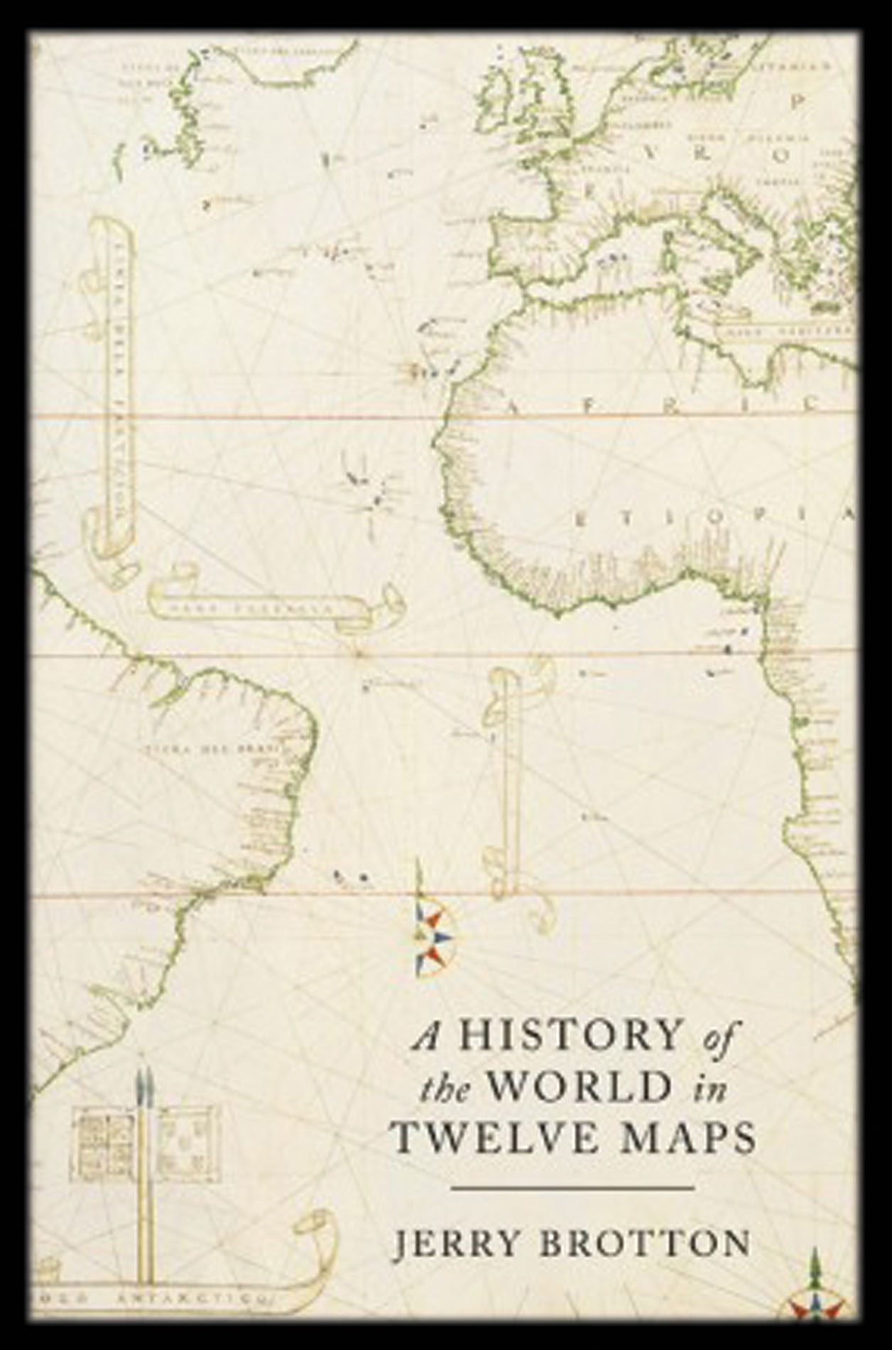 A History of the World in Twelve Maps
1 × £30
A History of the World in Twelve Maps
1 × £30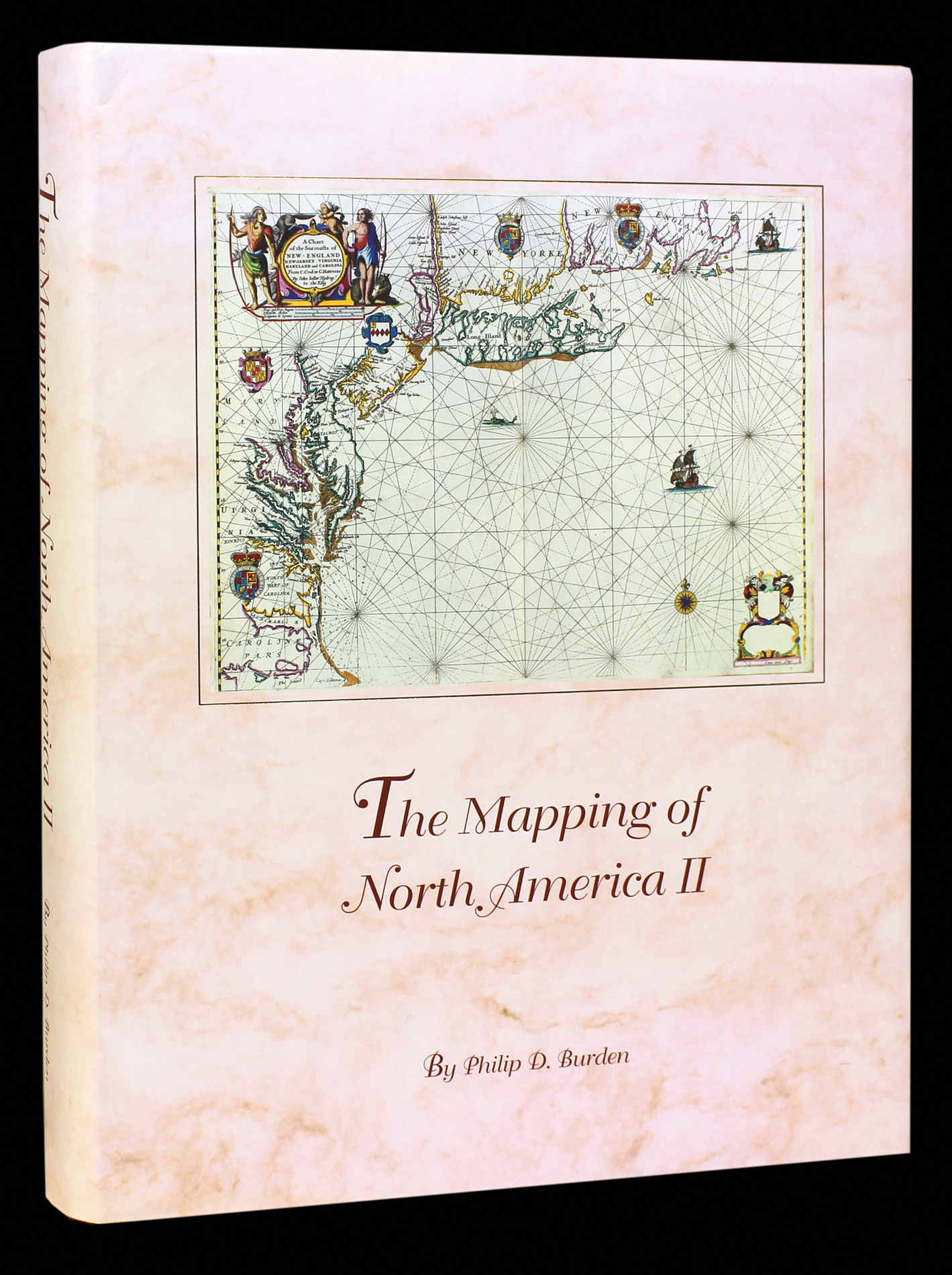 The book documents the cartographic record of the discovery of North America from 1671 to 1700
1 × £250
The book documents the cartographic record of the discovery of North America from 1671 to 1700
1 × £250


![HAINES, Captain [Stafford Bettesworth]; Lieutenant CARLESS; and Lieutenant A. M. GRIEVE Chart of the Gulf of Aden on Mercator's Projection](https://omega.crouchrarebooks.com/wp-content/uploads/2025/03/16481_1H.jpg)