shewing the British Territories, Subdivided into Collectorates and including British Burmah with the Position and Boundary of Each Native State Chiefly compiled from Trigonometrical Surveys, executed by Order of the Government of India By John Walker, Geographer to the India Office.
Large engraved wall map, fine original hand-colour, dissected and mounted on linen, in four sections, inset map of southern Burma, housed within brown cloth slipcase with publisher's label of Edward Stanford pasted on.
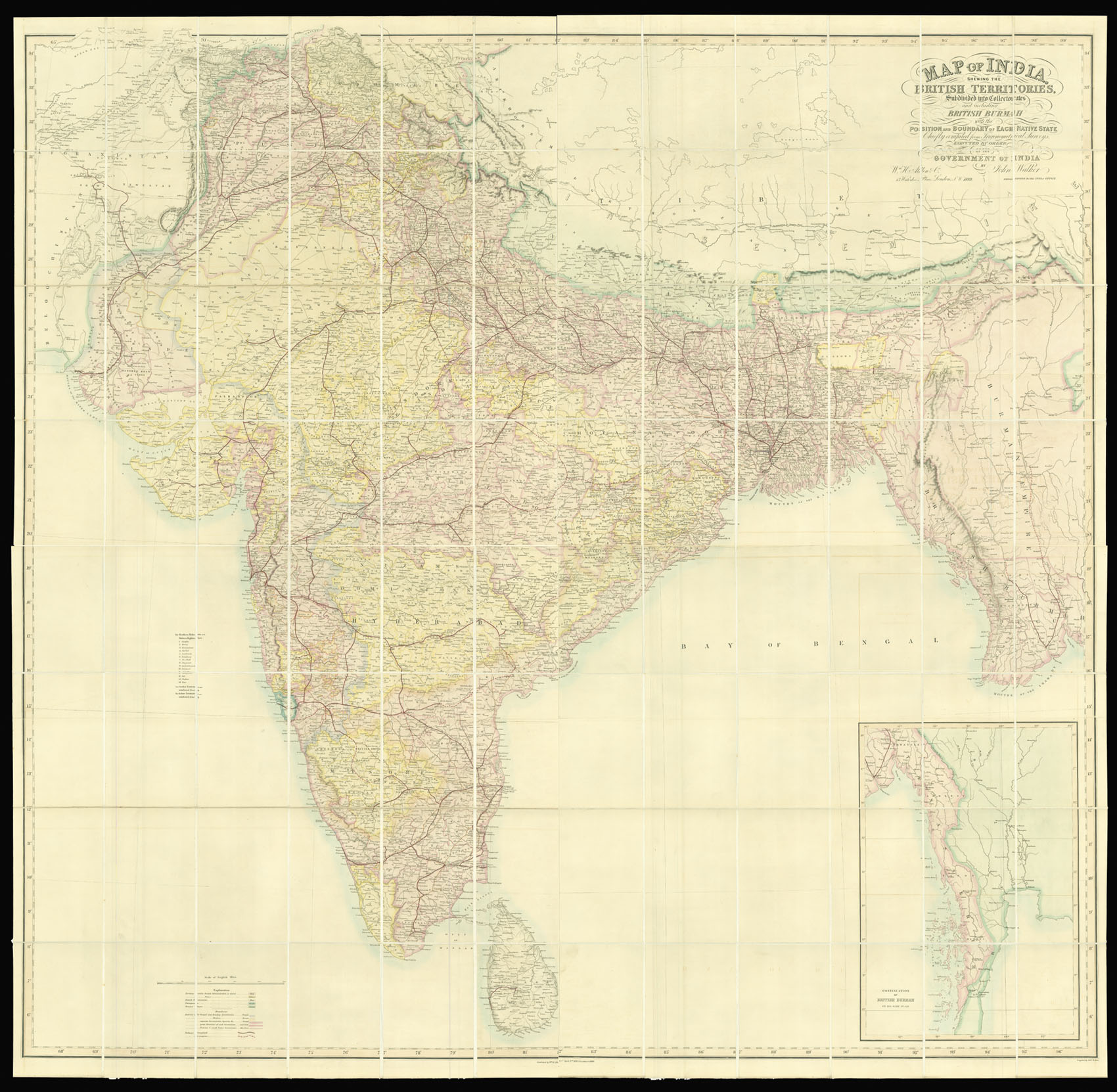
Superbly detailed wall map of India during the days of the British Raj.
The map stretches from Afghanistan in the west to Burma in the east and from the Punjab in the north to Sri Lanka in the south. The map shows the vast scale of the British Raj, its network of client states, together with extensive network of railway lines. British colonies are coloured red, independent states yellow, French possessions blue, Portuguese green, and frontier states light green. ...
Superbly detailed wall map of India during the days of the British Raj.
The map stretches from Afghanistan in the west to Burma in the east and from the Punjab in the north to Sri Lanka in the south. The map shows the vast scale of the British Raj, its network of client states, together with extensive network of railway lines. British colonies are coloured red, independent states yellow, French possessions blue, Portuguese green, and frontier states light green. Boundaries between the Bengal and Bombay Presidencies are marked in purple, Bengal and Madras Presidencies brown, separate government agencies broad red line, divisions of government narrow red line, and small native governments thin red line. Complete railways are marked in red, with those under construction with a dotted red line.
The map was drawn and engraved by John Walker (fl.1813-1873) mapmaker, engraver, lithographer, draughtsman, publisher, and cartographer to the East India Company and subsequently the India Office.