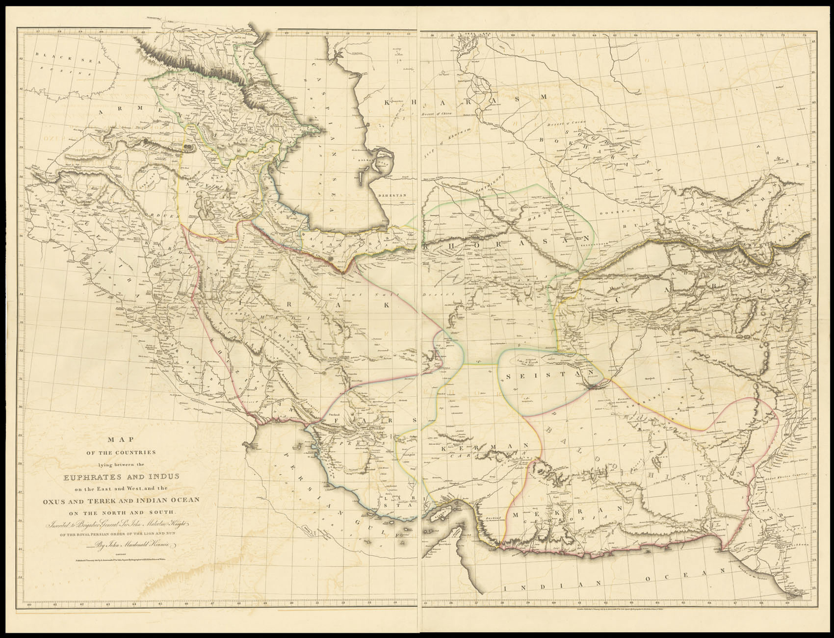
Map of the Countries lying between the Euphrates and Indus on the East and West,
and the Oxus and Terek and Indian Ocean on the North and South. Inscribed to Brigadier General Sir John Malcolm Knight of the Royal Persian Order of the Lion and Sun By John Macdonald Kinneir.
The map is inscribed by John Macdonald Kinneir to Brigadier General Sir John Malcolm. Sir John Malcolm (1769-1833) spent the majority of his career in India in the employ of the East India Company. Whilst in India he gained a keen interest in the Persian Empire that would lead him to undertake several envoys to Persia under the auspices of the East India Company. In Persia, Malcolm not only successfully introduced ...
Large and detailed map of Iran and its environs.
The map is inscribed by John Macdonald Kinneir to Brigadier General Sir John Malcolm. Sir John Malcolm (1769-1833) spent the majority of his career in India in the employ of the East India Company. Whilst in India he gained a keen interest in the Persian Empire that would lead him to undertake several envoys to Persia under the auspices of the East India Company. In Persia, Malcolm not only successfully introduced the potato, but also took with him several men to conduct research into the country. One such was Kinneir, who in 1813, produced a 'Geographical Memoir of the Persian Empire', which described in detail the routes between the major towns. The present map was intended to accompany that work.
The major reason for his research was Britain's increasing concern over Russia gaining power within the region, and whom they feared might invade India. This battle for influence in the area would continue throughout the nineteenth century and become known as 'The Great Game'.
Aaron Arrowsmith (1750-1823) was the finest cartographer of his generation. Although he received little formal education it is believed that he was taught some mathematical instruction by William Emerson, an author of several books on the application of mathematics to the area of cartography. Around 1770, Arrowsmith moved to London to seek employment. It is believed that he worked for William Faden before joining John Cary Sr. in the early 1780s. There he provided the measurements for John Cary's early publication detailing the roads from London to Falmouth, his first signed work. Arrowsmith set up on his own in 1790 and over the next thirty years produced some of the most beautiful and elegant maps of the era.