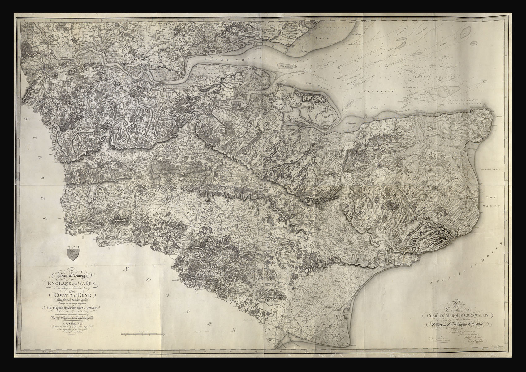
Mudge's map of Kent was the first Ordnance Survey map to be published, and is often known as the 'Mudge Map'. The survey was initiated in response to fears of invasion by the newly republican French.
Colonel William Mudge (1762-1820) began his career as a lieutenant in the Royal Artillery, and was appointed to the Ordnance Survey in 1791, becoming Superintendent in 1798. In the same year, he was elected to the Royal Academy.
...
Mudge's map of Kent was the first Ordnance Survey map to be published, and is often known as the 'Mudge Map'. The survey was initiated in response to fears of invasion by the newly republican French.
Colonel William Mudge (1762-1820) began his career as a lieutenant in the Royal Artillery, and was appointed to the Ordnance Survey in 1791, becoming Superintendent in 1798. In the same year, he was elected to the Royal Academy.