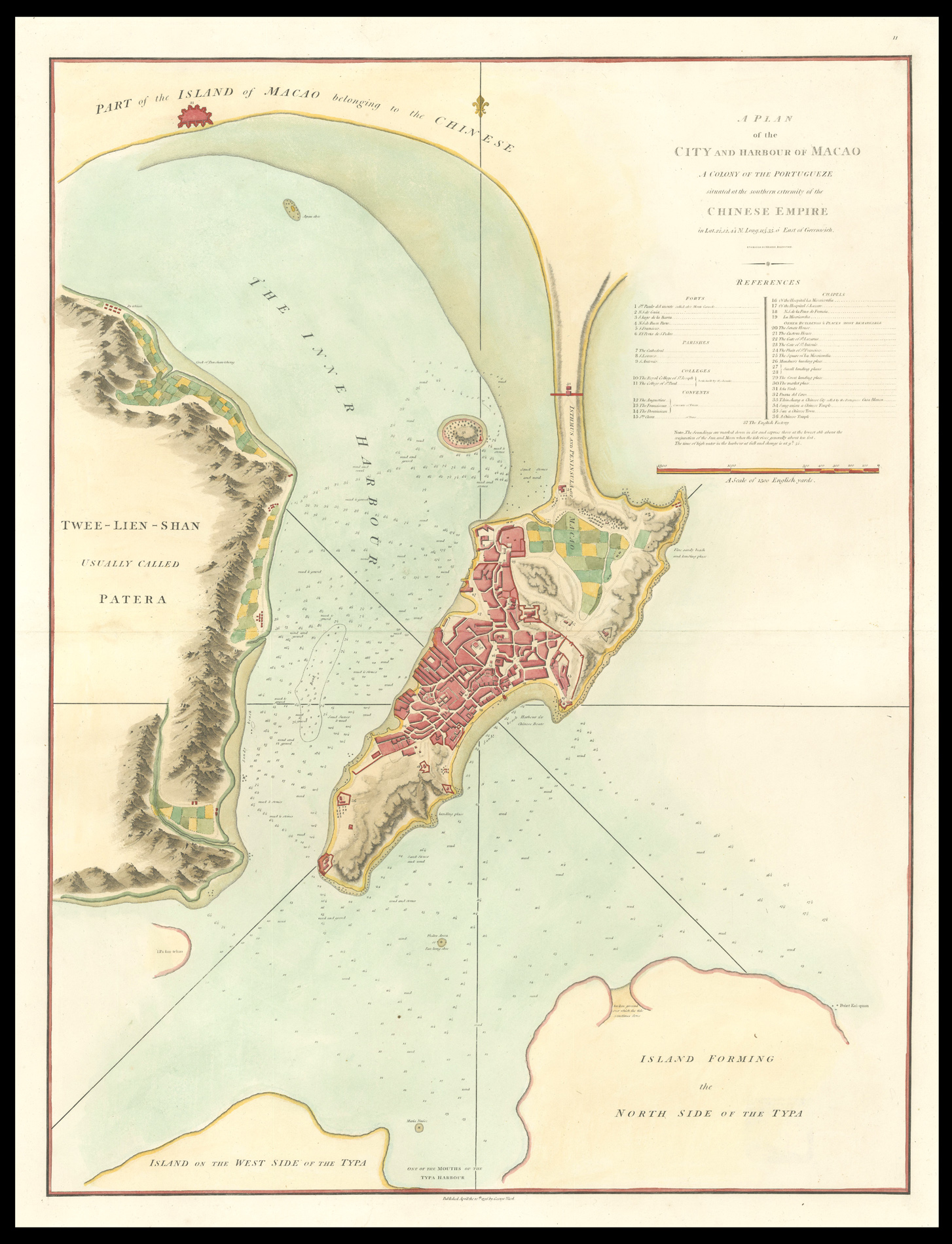
The plan was published in George Staunton's 'An Authentic Account of an Embassy from the King of Great Britain to the Emperor of China', a work which recorded Britain's first official embassy to China, headed by Lord Macartney, in 1792. The plan is upon a scale of 1000 yards to 3.5 inches, and not only shows the city in great detail but also gives information on soundings and seabed notation. Beneath the title is a 37-point key listing forts, parishes, colleges, convents, c...
The plan was published in George Staunton's 'An Authentic Account of an Embassy from the King of Great Britain to the Emperor of China', a work which recorded Britain's first official embassy to China, headed by Lord Macartney, in 1792. The plan is upon a scale of 1000 yards to 3.5 inches, and not only shows the city in great detail but also gives information on soundings and seabed notation. Beneath the title is a 37-point key listing forts, parishes, colleges, convents, chapels, and other buildings and places 'most remarkable'. Among the more remarkable buildings are Sang-miau a Chinese Temple, the English Factory, and the Island of Isla Verde.