Deliniantur in hac tabula, Orae maritimae Abexiae, freti Mecani al Maris Rubri Arabiae, ormi, Persiae, Supra Sindam usq, Fluminis Indi, Cambaiae Indiae & Malabaris, Insulae Ceylon, Choromandeliae, & Orixae, fluuij Gangis & Regni Bengale…
A map of Asia and the Indian Ocean, from the Middle East to India.
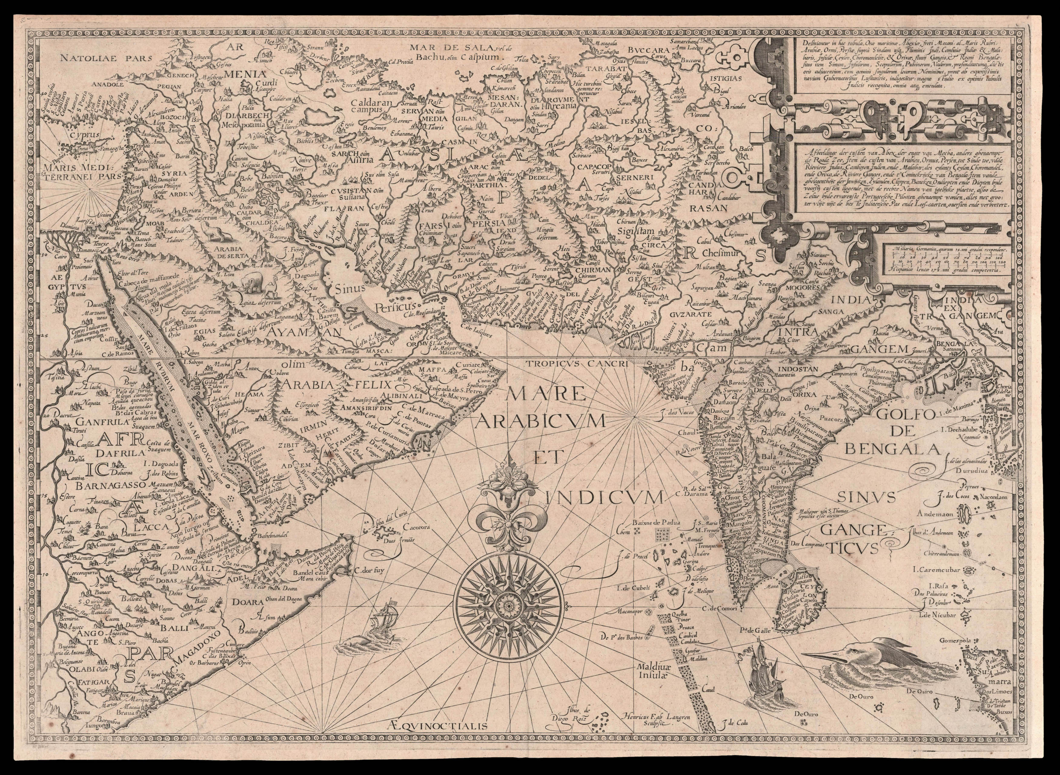
From the first book of Jan Huygen van Linschoten's 'Itinerario', the first printed work to include precise sailing instructions for the East Indies. It allowed Dutch merchants to circumvent the Portuguese stranglehold on trade to the East. It was of such economic utility that "it was given to each ship sailing from Holland to India" and soon became "the navigator's vade mecum for the Eastern seas...
A map of Asia and the Indian Ocean, from the Middle East to India.
From the first book of Jan Huygen van Linschoten's 'Itinerario', the first printed work to include precise sailing instructions for the East Indies. It allowed Dutch merchants to circumvent the Portuguese stranglehold on trade to the East. It was of such economic utility that "it was given to each ship sailing from Holland to India" and soon became "the navigator's vade mecum for the Eastern seas" (Penrose).
Jan Huyghen van Linschoten (1563–1611) left the Netherlands for Spain in 1576 and secured passage to India in 1583 as secretary to Dominican Vicente da Fonseca, the newly-appointed Portuguese Archbishop of Goa, which gave him access to secret information, including the East Indies portolan charts guarded for over a century. With an impressive disregard for the trust placed in him, Linschoten began to copy these maps meticulously. On his return to the Netherlands, he wrote an account of his travels in 1595 with prints based on his own drawings and maps incorporating the information stolen from the Portuguese.
The first book is especially valuable for its eyewitness account of India, as one of the few Renaissance works on the East to be illustrated from life. Linschoten's description of Goa is "one of the most original and reliable narratives prepared during the sixteenth century on life at the hub of Portugal's Eastern empire and still is regarded as one of the best sources for Goa's history at the peak of its glory". The maps in the first book of the 'Itinerario' were engraved by Henricus van Langren, mainly using Portuguese maps owned by Cornelis Claesz, the original publisher of the 'Itinerario'. They were mostly drawn by de Lasso, and originally acquired by the Houtman brothers between 1592-93, during their secret mission to Portugal at the suggestion of Petrus Plancius, the first official hydrographer of the VOC.
bibliography:
bibliography:
Church 252; JCB (3) II:271; Klooster, 'Dutch in the Americas', p. 8 & Catalogue Item 5; Palau 138584; LOC European Americana 638/67; David E. Parry, 'The Cartography Of The East Indian Islands', pp. 84–85; Lach, 'Asia In The Making Of Europe', Volume 1, pp.198–204 & 482–489; Sabin 41373; Shirley 187; Tiele 686–88.